Dārchulā elevation
Dārchulā (Western Region), Nepal elevation is 1923 meters and Dārchulā elevation in feet is 6309 ft above sea level [src 1]. Dārchulā is a populated place (feature code) with elevation that is 964 meters (3163 ft) bigger than average city elevation in Nepal.
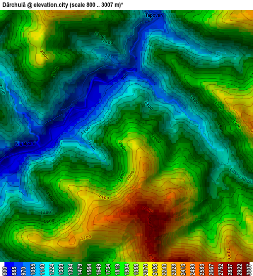
Below is the Elevation map of Dārchulā, which displays elevation range with different colors. Scale of the first map is from 800 to 3007 m (2625 to 9865 ft) with average elevation of 1635.6 meters (=5366 ft) [note 1]
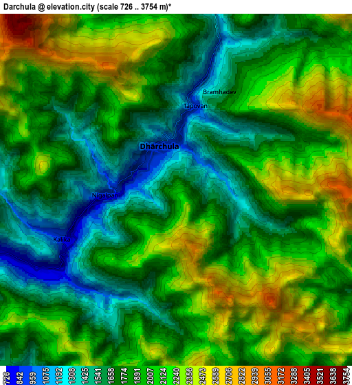
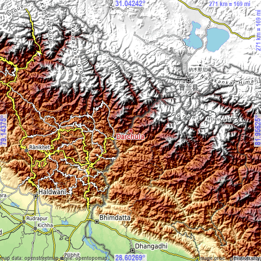
These maps also provides idea of topography and contour of this city, they are displayed at different zoom levels. More info about maps, scale and edge coordinates you can find below images.
| \ | Map #1 | Map #2 | Topo.Map |
| Scale [m] | 800..3007 m | 726..3754 m | × |
| Scale [ft] | 2625..9865 ft | 2382..12316 ft | × |
| Average | 1635.6 m = 5366 ft | 1933.7 m = 6344 ft | × |
| Width | 8.48 km = 5.3 mi | 16.96 km = 10.5 mi | 271.3 km = 168.6 mi |
| Height | 8.48 km = 5.3 mi | 16.96 km = 10.5 mi | 271.3 km = 168.6 mi |
| ↑Max Latitude | 29.868116° | 29.906216° | 31.04242° |
| Latitude at center | 29.83° | 29.83° | 29.83° |
| ↓Min Latitude | 29.79187° | 29.753725° | 28.60269° |
| ← Min Longitude | 80.506055° | 80.462109° | 79.14375° |
| Longitude center | 80.55° | 80.55° | 80.55° |
| →Max Longitude | 80.593945° | 80.637891° | 81.95625° |
Nearby cities:
Cities around Dārchulā sort by population:
• Dhangaḍhi̇̄ elevation 176 m
125.6 km,  178°
178°
• Mahendranagar 199 m
102.8 km,  200°
200°
• Gulariyā 141 m
196.5 km,  156°
156°
• Ṭikāpur 168 m
154.9 km, 159°
• Birendranagar 736 m
172.4 km,  142°
142°
• Dipayal 565 m
73.7 km,  149°
149°
• Dailekh 1307 m
157 km,  134°
134°
• Dadeldhurā 1814 m
59.2 km, 177°
• Jumla 2354 m
169.7 km,  111°
111°
• Surkhet 874 m
188.5 km, 140°
• Bardiyā 151 m
187.1 km, 155°
• Achhām 1284 m
113.1 km, 140°
Multilingual:
 En español:
Dārchulā elevación 1923 m.
 En France:
Dārchulā élévation 1923 m.
 Auf Deutsch:
Dārchulā höhe über dem Meeresspiegel ist 1923 m.

Sources and notes:
- [note 1] Map square and city borders are not equal. Map elevation data is calculated only from area inside that square.
- [src 1] Elevation data from geonames database provided with same terms of usage.
- [src 2] The elevation map of Dārchulā is generated using elevation data from NASA's 3 arcsec (90m) resolution SRTM data.
- [src 3] Base (background) map © OpenStreetMap contributors tiles are generated by Geofabrik and OpenTopoMap.
Copyright & License:
This Dārchulā Elevation Map is licensed under CC BY-SA. You may reuse any part from this page, if you give a proper credit by linking to this URL:
 More info on terms of use page.