Binji elevation
Binji (Sokoto), Nigeria elevation is 250 meters and Binji elevation in feet is 820 ft above sea level [src 1]. Binji is a seat of a second-order administrative division (feature code) with elevation that is 47 meters (154 ft) smaller than average city elevation in Nigeria.
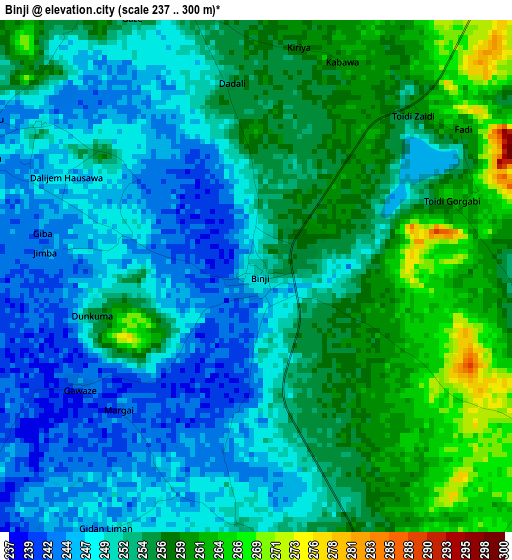
Below is the Elevation map of Binji, which displays elevation range with different colors. Scale of the first map is from 237 to 300 m (778 to 984 ft) with average elevation of 252.8 meters (=829 ft) [note 1]
These maps also provides idea of topography and contour of this city, they are displayed at different zoom levels. More info about maps, scale and edge coordinates you can find below images.
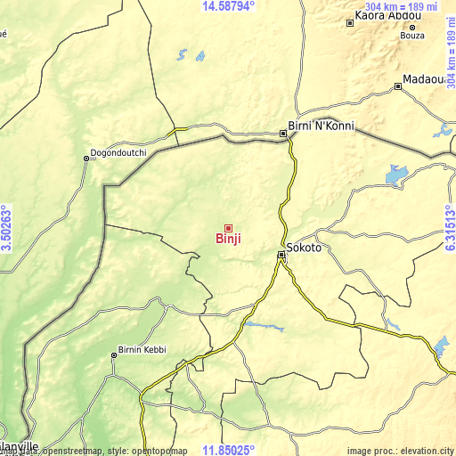
| \ | Map #1 | Map #2 | Topo.Map |
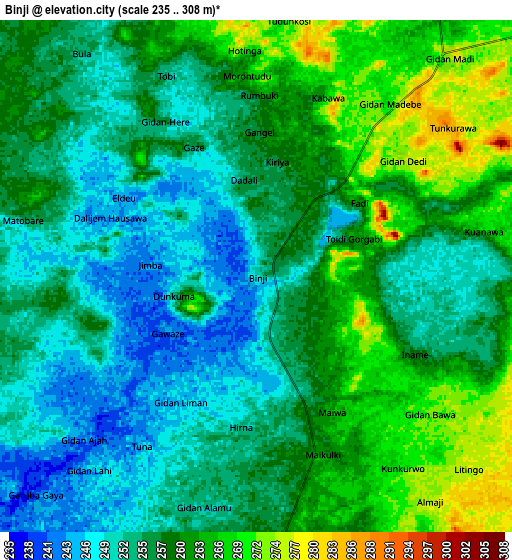
| Scale [m] | 237..300 m | 235..308 m | × |
| Scale [ft] | 778..984 ft | 771..1010 ft | × |
| Average | 252.8 m = 829 ft | 257.5 m = 845 ft | × |
| Width | 9.51 km = 5.9 mi | 19.03 km = 11.8 mi | 304.4 km = 189.1 mi |
| Height | 9.51 km = 5.9 mi | 19.03 km = 11.8 mi | 304.4 km = 189.1 mi |
| ↑Max Latitude | 13.265716° | 13.308485° | 14.58794° |
| Latitude at center | 13.22294° | 13.22294° | 13.22294° |
| ↓Min Latitude | 13.180156° | 13.137365° | 11.85025° |
| ← Min Longitude | 4.864935° | 4.820989° | 3.50263° |
| Longitude center | 4.90888° | 4.90888° | 4.90888° |
| →Max Longitude | 4.952825° | 4.996771° | 6.31513° |
Nearby cities:
Cities around Binji sort by population:
• Sokoto elevation 296 m
40.3 km,  116°
116°
• Gwadabawa 270 m
38.7 km,  67°
67°
• Wurno 273 m
56.2 km,  82°
82°
• Dange 344 m
62.7 km,  130°
130°
• Yabo 292 m
56.8 km,  168°
168°
• Augie 237 m
49.9 km,  222°
222°
• Bodinga 302 m
49.6 km,  148°
148°
• Kware 283 m
38.7 km,  90°
90°
• Balle 240 m
36.9 km,  318°
318°
• Wamako 257 m
30.1 km,  135°
135°
• Silame 259 m
21.5 km,  198°
198°
• Gidan Madi 276 m
10.8 km,  41°
41°
Multilingual:
 En español:
Binji elevación 250 m.
 En France:
Binji élévation 250 m.


Sources and notes:
- [note 1] Map square and city borders are not equal. Map elevation data is calculated only from area inside that square.
- [src 1] Elevation data from geonames database provided with same terms of usage.
- [src 2] The elevation map of Binji is generated using elevation data from NASA's 3 arcsec (90m) resolution SRTM data.
- [src 3] Base (background) map © OpenStreetMap contributors tiles are generated by Geofabrik and OpenTopoMap.
Copyright & License:
This Binji Elevation Map is licensed under CC BY-SA. You may reuse any part from this page, if you give a proper credit by linking to this URL:
 More info on terms of use page.