Dange elevation
Dange (Sokoto, Dange-Shuni), Nigeria elevation is 344 meters and Dange elevation in feet is 1129 ft above sea level [src 1]. Dange is a seat of a second-order administrative division (feature code) with elevation that is 47 meters (154 ft) bigger than average city elevation in Nigeria.
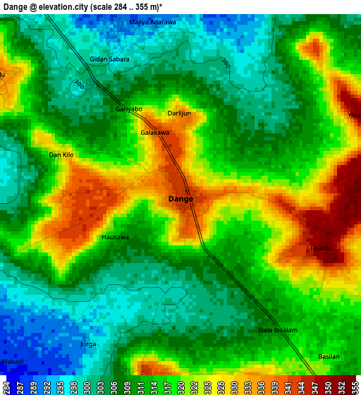
Below is the Elevation map of Dange, which displays elevation range with different colors. Scale of the first map is from 284 to 355 m (932 to 1165 ft) with average elevation of 313.8 meters (=1030 ft) [note 1]
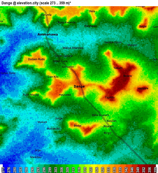
These maps also provides idea of topography and contour of this city, they are displayed at different zoom levels. More info about maps, scale and edge coordinates you can find below images.
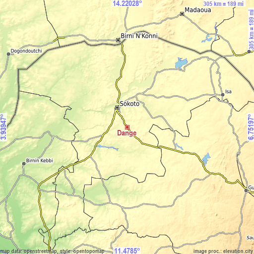
| \ | Map #1 | Map #2 | Topo.Map |
| Scale [m] | 284..355 m | 273..359 m | × |
| Scale [ft] | 932..1165 ft | 896..1178 ft | × |
| Average | 313.8 m = 1030 ft | 304.3 m = 998 ft | × |
| Width | 9.53 km = 5.9 mi | 19.06 km = 11.8 mi | 304.9 km = 189.5 mi |
| Height | 9.53 km = 5.9 mi | 19.06 km = 11.8 mi | 304.9 km = 189.5 mi |
| ↑Max Latitude | 12.895971° | 12.938804° | 14.22028° |
| Latitude at center | 12.85313° | 12.85313° | 12.85313° |
| ↓Min Latitude | 12.810282° | 12.767427° | 11.4785° |
| ← Min Longitude | 5.301775° | 5.257829° | 3.93947° |
| Longitude center | 5.34572° | 5.34572° | 5.34572° |
| →Max Longitude | 5.389665° | 5.433611° | 6.75197° |
Nearby cities:
Cities around Dange sort by population:
• Sokoto elevation 296 m
25.8 km,  334°
334°
• Gwadabawa 270 m
57.4 km,  348°
348°
• Gandi 278 m
44.8 km,  74°
74°
• Wurno 273 m
49.4 km,  9°
9°
• Rabah 265 m
34.7 km,  30°
30°
• Silame 259 m
58 km,  290°
290°
• Shagari 279 m
45.8 km,  236°
236°
• Kware 283 m
41.7 km, 348°
• Yabo 292 m
38.9 km,  248°
248°
• Tureta 274 m
36 km,  143°
143°
• Wamako 257 m
32.8 km,  307°
307°
• Bodinga 302 m
21.2 km,  267°
267°
Multilingual:
 En español:
Dange elevación 344 m.
 En France:
Dange élévation 344 m.


Sources and notes:
- [note 1] Map square and city borders are not equal. Map elevation data is calculated only from area inside that square.
- [src 1] Elevation data from geonames database provided with same terms of usage.
- [src 2] The elevation map of Dange is generated using elevation data from NASA's 3 arcsec (90m) resolution SRTM data.
- [src 3] Base (background) map © OpenStreetMap contributors tiles are generated by Geofabrik and OpenTopoMap.
Copyright & License:
This Dange Elevation Map is licensed under CC BY-SA. You may reuse any part from this page, if you give a proper credit by linking to this URL:
 More info on terms of use page.