Gulma elevation
Gulma (Kebbi, Argungu), Nigeria elevation is 214 meters and Gulma elevation in feet is 702 ft above sea level [src 1]. Gulma is a populated place (feature code) with elevation that is 83 meters (272 ft) smaller than average city elevation in Nigeria.
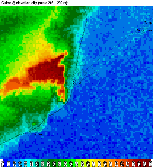
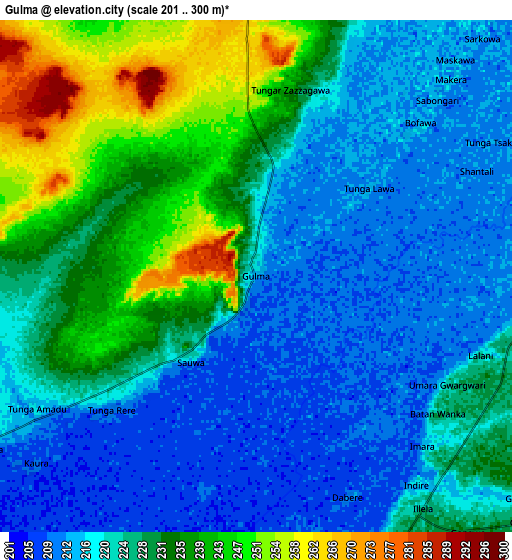
Below is the Elevation map of Gulma, which displays elevation range with different colors. Scale of the first map is from 203 to 290 m (666 to 951 ft) with average elevation of 223.1 meters (=732 ft) [note 1]
These maps also provides idea of topography and contour of this city, they are displayed at different zoom levels. More info about maps, scale and edge coordinates you can find below images.
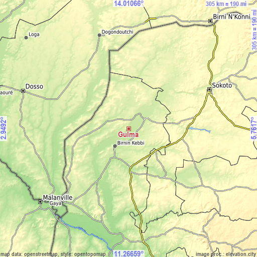
| \ | Map #1 | Map #2 | Topo.Map |
| Scale [m] | 203..290 m | 201..300 m | × |
| Scale [ft] | 666..951 ft | 659..984 ft | × |
| Average | 223.1 m = 732 ft | 225.3 m = 739 ft | × |
| Width | 9.54 km = 5.9 mi | 19.07 km = 11.8 mi | 305.1 km = 189.6 mi |
| Height | 9.54 km = 5.9 mi | 19.07 km = 11.8 mi | 305.1 km = 189.6 mi |
| ↑Max Latitude | 12.685186° | 12.728055° | 14.01066° |
| Latitude at center | 12.64231° | 12.64231° | 12.64231° |
| ↓Min Latitude | 12.599427° | 12.556536° | 11.26659° |
| ← Min Longitude | 4.311505° | 4.267559° | 2.9492° |
| Longitude center | 4.35545° | 4.35545° | 4.35545° |
| →Max Longitude | 4.399395° | 4.443341° | 5.7617° |
Nearby cities:
Cities around Gulma sort by population:
• Birnin Kebbi elevation 234 m
27.1 km,  219°
219°
• Jega 242 m
46.7 km,  176°
176°
• Argungu 228 m
21.6 km,  58°
58°
• Tambuwal 261 m
41.1 km,  129°
129°
• Kangiwa 237 m
59.1 km,  260°
260°
• Gwandu 249 m
34.9 km,  116°
116°
• Maiyama 256 m
62.3 km, 178°
• Shagari 279 m
69.2 km,  91°
91°
• Silame 259 m
69.1 km,  50°
50°
• Aliero 256 m
41.3 km,  162°
162°
• Kalgo 204 m
38.9 km,  205°
205°
• Augie 237 m
38.2 km,  43°
43°
Multilingual:
 En español:
Gulma elevación 214 m.
 En France:
Gulma élévation 214 m.


Sources and notes:
- [note 1] Map square and city borders are not equal. Map elevation data is calculated only from area inside that square.
- [src 1] Elevation data from geonames database provided with same terms of usage.
- [src 2] The elevation map of Gulma is generated using elevation data from NASA's 3 arcsec (90m) resolution SRTM data.
- [src 3] Base (background) map © OpenStreetMap contributors tiles are generated by Geofabrik and OpenTopoMap.
Copyright & License:
This Gulma Elevation Map is licensed under CC BY-SA. You may reuse any part from this page, if you give a proper credit by linking to this URL:
 More info on terms of use page.