Tambuwal elevation
Tambuwal (Sokoto), Nigeria elevation is 261 meters and Tambuwal elevation in feet is 856 ft above sea level [src 1]. Tambuwal is a seat of a second-order administrative division (feature code) with elevation that is 36 meters (118 ft) smaller than average city elevation in Nigeria.
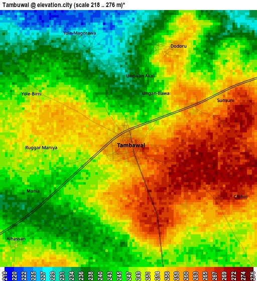
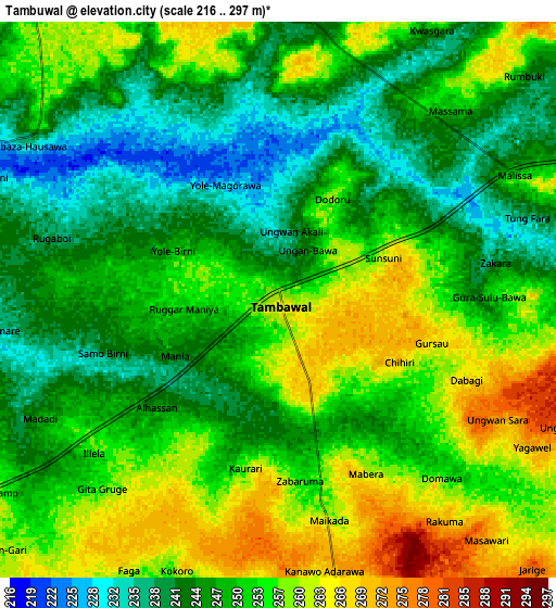
Below is the Elevation map of Tambuwal, which displays elevation range with different colors. Scale of the first map is from 218 to 276 m (715 to 906 ft) with average elevation of 249.4 meters (=818 ft) [note 1]
These maps also provides idea of topography and contour of this city, they are displayed at different zoom levels. More info about maps, scale and edge coordinates you can find below images.
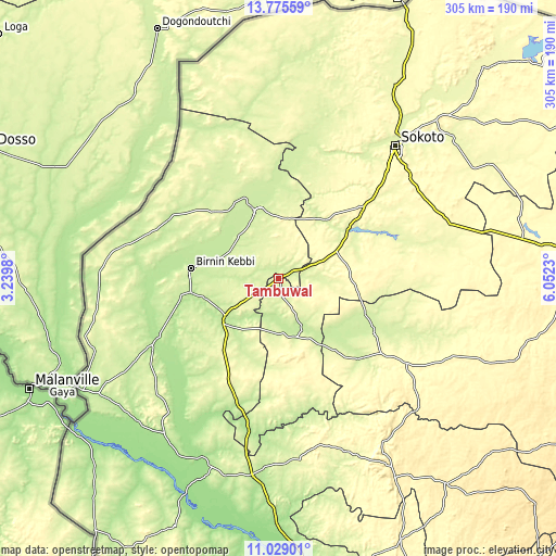
| \ | Map #1 | Map #2 | Topo.Map |
| Scale [m] | 218..276 m | 216..297 m | × |
| Scale [ft] | 715..906 ft | 709..974 ft | × |
| Average | 249.4 m = 818 ft | 250.7 m = 823 ft | × |
| Width | 9.54 km = 5.9 mi | 19.09 km = 11.9 mi | 305.4 km = 189.8 mi |
| Height | 9.54 km = 5.9 mi | 19.09 km = 11.9 mi | 305.4 km = 189.8 mi |
| ↑Max Latitude | 12.448836° | 12.491744° | 13.77559° |
| Latitude at center | 12.40592° | 12.40592° | 12.40592° |
| ↓Min Latitude | 12.362997° | 12.320067° | 11.02901° |
| ← Min Longitude | 4.602105° | 4.558159° | 3.2398° |
| Longitude center | 4.64605° | 4.64605° | 4.64605° |
| →Max Longitude | 4.689995° | 4.733941° | 6.0523° |
Nearby cities:
Cities around Tambuwal sort by population:
• Birnin Kebbi elevation 234 m
49 km,  276°
276°
• Jega 242 m
35.3 km,  234°
234°
• Argungu 228 m
39.9 km,  340°
340°
• Gwandu 249 m
10.7 km,  358°
358°
• Maiyama 256 m
46.9 km,  219°
219°
• Gulma 214 m
41.1 km,  309°
309°
• Augie 237 m
54.1 km,  354°
354°
• Yabo 292 m
53.2 km,  48°
48°
• Kalgo 204 m
49.2 km,  259°
259°
• Shagari 279 m
45 km,  56°
56°
• Kebbe 221 m
32.3 km,  162°
162°
• Aliero 256 m
23 km,  235°
235°
Multilingual:
 En español:
Tambuwal elevación 261 m.
 En France:
Tambuwal élévation 261 m.
 Auf Deutsch:
Tambuwal höhe über dem Meeresspiegel ist 261 m.

Sources and notes:
- [note 1] Map square and city borders are not equal. Map elevation data is calculated only from area inside that square.
- [src 1] Elevation data from geonames database provided with same terms of usage.
- [src 2] The elevation map of Tambuwal is generated using elevation data from NASA's 3 arcsec (90m) resolution SRTM data.
- [src 3] Base (background) map © OpenStreetMap contributors tiles are generated by Geofabrik and OpenTopoMap.
Copyright & License:
This Tambuwal Elevation Map is licensed under CC BY-SA. You may reuse any part from this page, if you give a proper credit by linking to this URL:
 More info on terms of use page.