Holma elevation
Holma (Adamawa, Maiha), Nigeria elevation is 570 meters and Holma elevation in feet is 1870 ft above sea level [src 1]. Holma is a populated place (feature code) with elevation that is 273 meters (896 ft) bigger than average city elevation in Nigeria.
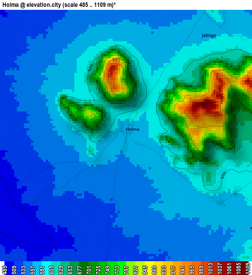
Below is the Elevation map of Holma, which displays elevation range with different colors. Scale of the first map is from 485 to 1109 m (1591 to 3638 ft) with average elevation of 591.1 meters (=1939 ft) [note 1]
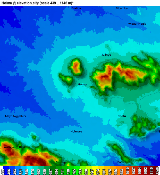
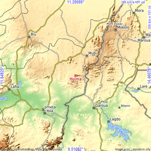
These maps also provides idea of topography and contour of this city, they are displayed at different zoom levels. More info about maps, scale and edge coordinates you can find below images.
| \ | Map #1 | Map #2 | Topo.Map |
| Scale [m] | 485..1109 m | 439..1146 m | × |
| Scale [ft] | 1591..3638 ft | 1440..3760 ft | × |
| Average | 591.1 m = 1939 ft | 572 m = 1877 ft | × |
| Width | 9.63 km = 6 mi | 19.25 km = 12 mi | 308 km = 191.4 mi |
| Height | 9.63 km = 6 mi | 19.25 km = 12 mi | 308.1 km = 191.4 mi |
| ↑Max Latitude | 9.941918° | 9.985201° | 11.28089° |
| Latitude at center | 9.89863° | 9.89863° | 9.89863° |
| ↓Min Latitude | 9.855336° | 9.812036° | 8.51052° |
| ← Min Longitude | 13.010555° | 12.966609° | 11.64825° |
| Longitude center | 13.0545° | 13.0545° | 13.0545° |
| →Max Longitude | 13.098445° | 13.142391° | 14.46075° |
Nearby cities:
Cities around Holma sort by population:
• Jimeta elevation 172 m
94.9 km,  223°
223°
• Mubi 582 m
47.3 km,  29°
29°
• Gombi 597 m
45.9 km,  310°
310°
• Uba 496 m
64.5 km,  16°
16°
• Michika 528 m
88.2 km, 24°
• Fufore 174 m
87.4 km,  210°
210°
• Askira 467 m
85.1 km,  349°
349°
• Girei 248 m
81.4 km, 223°
• Song 307 m
47.9 km,  260°
260°
• Hong 539 m
39.7 km,  339°
339°
• Gella 812 m
39.4 km,  43°
43°
• Maiha 605 m
20.8 km,  58°
58°
Multilingual:
 En español:
Holma elevación 570 m.
 En France:
Holma élévation 570 m.


Sources and notes:
- [note 1] Map square and city borders are not equal. Map elevation data is calculated only from area inside that square.
- [src 1] Elevation data from geonames database provided with same terms of usage.
- [src 2] The elevation map of Holma is generated using elevation data from NASA's 3 arcsec (90m) resolution SRTM data.
- [src 3] Base (background) map © OpenStreetMap contributors tiles are generated by Geofabrik and OpenTopoMap.
Copyright & License:
This Holma Elevation Map is licensed under CC BY-SA. You may reuse any part from this page, if you give a proper credit by linking to this URL:
 More info on terms of use page.