Igabi elevation
Igabi (Kaduna), Nigeria elevation is 673 meters and Igabi elevation in feet is 2208 ft above sea level [src 1]. Igabi is a populated place (feature code) with elevation that is 376 meters (1234 ft) bigger than average city elevation in Nigeria.
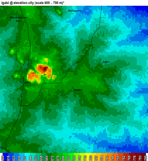
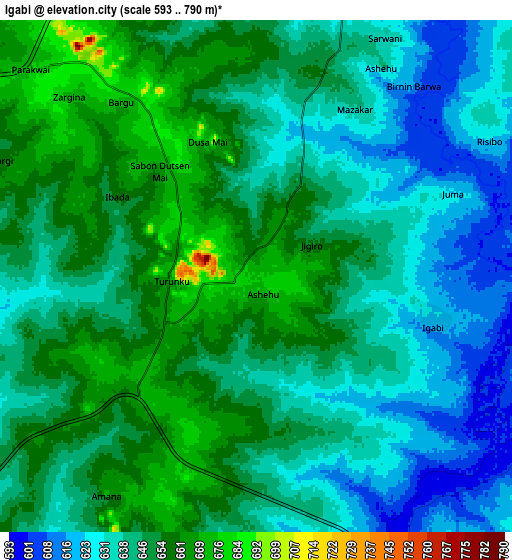
Below is the Elevation map of Igabi, which displays elevation range with different colors. Scale of the first map is from 609 to 790 m (1998 to 2592 ft) with average elevation of 656.2 meters (=2153 ft) [note 1]
These maps also provides idea of topography and contour of this city, they are displayed at different zoom levels. More info about maps, scale and edge coordinates you can find below images.
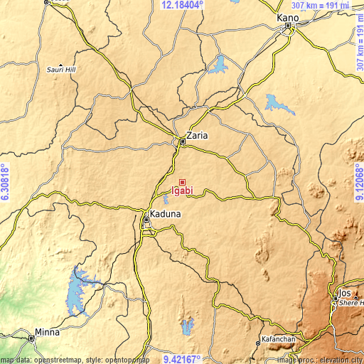
| \ | Map #1 | Map #2 | Topo.Map |
| Scale [m] | 609..790 m | 593..790 m | × |
| Scale [ft] | 1998..2592 ft | 1946..2592 ft | × |
| Average | 656.2 m = 2153 ft | 644.3 m = 2114 ft | × |
| Width | 9.6 km = 6 mi | 19.2 km = 11.9 mi | 307.1 km = 190.8 mi |
| Height | 9.6 km = 6 mi | 19.2 km = 11.9 mi | 307.2 km = 190.9 mi |
| ↑Max Latitude | 10.849193° | 10.89235° | 12.18404° |
| Latitude at center | 10.80603° | 10.80603° | 10.80603° |
| ↓Min Latitude | 10.762861° | 10.719686° | 9.42167° |
| ← Min Longitude | 7.670485° | 7.626539° | 6.30818° |
| Longitude center | 7.71443° | 7.71443° | 7.71443° |
| →Max Longitude | 7.758375° | 7.802321° | 9.12068° |
Nearby cities:
Cities around Igabi sort by population:
• Kaduna elevation 626 m
43.3 km,  224°
224°
• Zaria 644 m
34 km,  1°
1°
• Dutsen Wai 694 m
53.1 km,  84°
84°
• Soba 683 m
42.2 km,  62°
62°
• Kajuru 686 m
53.8 km,  183°
183°
• Kujama 663 m
39.6 km,  192°
192°
• Danja 681 m
65.7 km,  345°
345°
• Hunkuyi 653 m
51.7 km, 352°
• Giwa 680 m
63.6 km,  332°
332°
• Kauru 649 m
54.1 km,  118°
118°
• Makera 604 m
49.9 km, 221°
• Maigana 658 m
34.7 km,  44°
44°
Multilingual:
 En español:
Igabi elevación 673 m.
 En France:
Igabi élévation 673 m.


Sources and notes:
- [note 1] Map square and city borders are not equal. Map elevation data is calculated only from area inside that square.
- [src 1] Elevation data from geonames database provided with same terms of usage.
- [src 2] The elevation map of Igabi is generated using elevation data from NASA's 3 arcsec (90m) resolution SRTM data.
- [src 3] Base (background) map © OpenStreetMap contributors tiles are generated by Geofabrik and OpenTopoMap.
Copyright & License:
This Igabi Elevation Map is licensed under CC BY-SA. You may reuse any part from this page, if you give a proper credit by linking to this URL:
 More info on terms of use page.