Oguta elevation
Oguta (Imo), Nigeria elevation is 26 meters and Oguta elevation in feet is 85 ft above sea level [src 1]. Oguta is a seat of a second-order administrative division (feature code) with elevation that is 271 meters (889 ft) smaller than average city elevation in Nigeria.
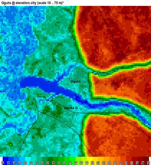
Below is the Elevation map of Oguta, which displays elevation range with different colors. Scale of the first map is from 10 to 75 m (33 to 246 ft) with average elevation of 38.7 meters (=127 ft) [note 1]
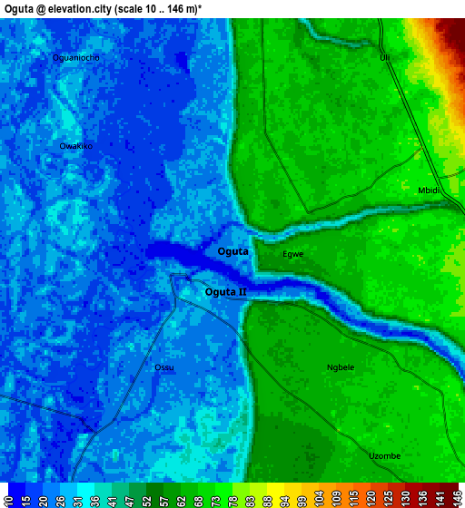
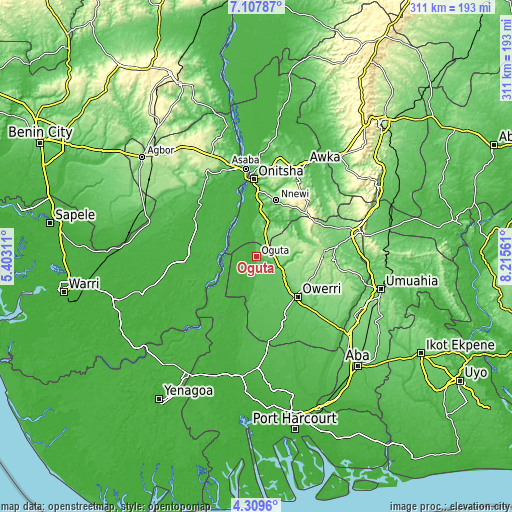
These maps also provides idea of topography and contour of this city, they are displayed at different zoom levels. More info about maps, scale and edge coordinates you can find below images.
| \ | Map #1 | Map #2 | Topo.Map |
| Scale [m] | 10..75 m | 10..146 m | × |
| Scale [ft] | 33..246 ft | 33..479 ft | × |
| Average | 38.7 m = 127 ft | 44 m = 144 ft | × |
| Width | 9.72 km = 6 mi | 19.45 km = 12.1 mi | 311.1 km = 193.3 mi |
| Height | 9.72 km = 6 mi | 19.45 km = 12.1 mi | 311.2 km = 193.4 mi |
| ↑Max Latitude | 5.754166° | 5.797888° | 7.10787° |
| Latitude at center | 5.71044° | 5.71044° | 5.71044° |
| ↓Min Latitude | 5.666711° | 5.622979° | 4.3096° |
| ← Min Longitude | 6.765415° | 6.721469° | 5.40311° |
| Longitude center | 6.80936° | 6.80936° | 6.80936° |
| →Max Longitude | 6.853305° | 6.897251° | 8.21561° |
Nearby cities:
Cities around Oguta sort by population:
• Ihiala elevation 146 m
17 km,  19°
19°
• Ozubulu 135 m
27.9 km,  9°
9°
• Uruobo-Okija 86 m
21.4 km, 10°
• Orlu 173 m
26.7 km,  69°
69°
• Orodo 138 m
26.9 km,  112°
112°
• Ukpor 130 m
29 km,  27°
27°
• Nwaorieubi 115 m
27 km,  121°
121°
• Nnenasa 156 m
22.7 km,  83°
83°
• Egbema 20 m
19.2 km,  196°
196°
• Awo-Idemili 158 m
18.9 km,  46°
46°
• Umumma 136 m
16 km, 71°
• Mgbidi 72 m
9.1 km, 74°
Multilingual:
 En español:
Oguta elevación 26 m.
 En France:
Oguta élévation 26 m.


Sources and notes:
- [note 1] Map square and city borders are not equal. Map elevation data is calculated only from area inside that square.
- [src 1] Elevation data from geonames database provided with same terms of usage.
- [src 2] The elevation map of Oguta is generated using elevation data from NASA's 3 arcsec (90m) resolution SRTM data.
- [src 3] Base (background) map © OpenStreetMap contributors tiles are generated by Geofabrik and OpenTopoMap.
Copyright & License:
This Oguta Elevation Map is licensed under CC BY-SA. You may reuse any part from this page, if you give a proper credit by linking to this URL:
 More info on terms of use page.