Oyan elevation
Oyan (Osun, Odo Otin), Nigeria elevation is 422 meters and Oyan elevation in feet is 1385 ft above sea level [src 1]. Oyan is a populated place (feature code) with elevation that is 125 meters (410 ft) bigger than average city elevation in Nigeria.
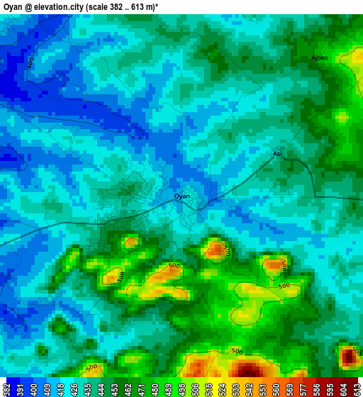
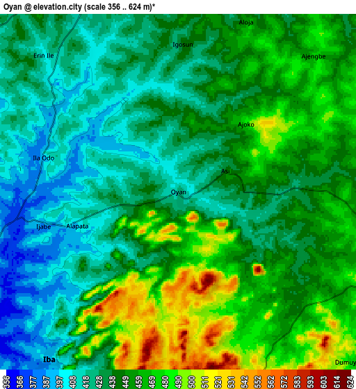
Below is the Elevation map of Oyan, which displays elevation range with different colors. Scale of the first map is from 382 to 613 m (1253 to 2011 ft) with average elevation of 440 meters (=1444 ft) [note 1]
These maps also provides idea of topography and contour of this city, they are displayed at different zoom levels. More info about maps, scale and edge coordinates you can find below images.
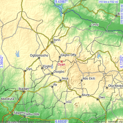
| \ | Map #1 | Map #2 | Topo.Map |
| Scale [m] | 382..613 m | 356..624 m | × |
| Scale [ft] | 1253..2011 ft | 1168..2047 ft | × |
| Average | 440 m = 1444 ft | 445.2 m = 1461 ft | × |
| Width | 9.68 km = 6 mi | 19.35 km = 12 mi | 309.6 km = 192.4 mi |
| Height | 9.68 km = 6 mi | 19.35 km = 12 mi | 309.6 km = 192.4 mi |
| ↑Max Latitude | 8.09351° | 8.137015° | 9.43987° |
| Latitude at center | 8.05° | 8.05° | 8.05° |
| ↓Min Latitude | 8.006485° | 7.962966° | 6.65535° |
| ← Min Longitude | 4.722725° | 4.678779° | 3.36042° |
| Longitude center | 4.76667° | 4.76667° | 4.76667° |
| →Max Longitude | 4.810615° | 4.854561° | 6.17292° |
Nearby cities:
Cities around Oyan sort by population:
• Ila Orangun elevation 493 m
15.6 km,  103°
103°
• Ikirun 379 m
18.8 km,  215°
215°
• Offa 419 m
12.1 km,  335°
335°
• Oke Mesi 514 m
30.8 km,  147°
147°
• Otan Ayegbaju 484 m
11.6 km,  168°
168°
• Oke Ila 540 m
26.3 km,  114°
114°
• Ajasse Ipo 402 m
21.1 km,  15°
15°
• Owu-Isin 434 m
37.9 km,  47°
47°
• Ibokun 425 m
29.5 km,  187°
187°
• Iragbiji 417 m
18.4 km,  208°
208°
• Ilemona 411 m
13.4 km,  299°
299°
• Okuku 393 m
11 km,  251°
251°
Multilingual:
 En español:
Oyan elevación 422 m.
 En France:
Oyan élévation 422 m.


Sources and notes:
- [note 1] Map square and city borders are not equal. Map elevation data is calculated only from area inside that square.
- [src 1] Elevation data from geonames database provided with same terms of usage.
- [src 2] The elevation map of Oyan is generated using elevation data from NASA's 3 arcsec (90m) resolution SRTM data.
- [src 3] Base (background) map © OpenStreetMap contributors tiles are generated by Geofabrik and OpenTopoMap.
Copyright & License:
This Oyan Elevation Map is licensed under CC BY-SA. You may reuse any part from this page, if you give a proper credit by linking to this URL:
 More info on terms of use page.