Suya elevation
Suya (Kwara, Baruten), Nigeria elevation is 439 meters and Suya elevation in feet is 1440 ft above sea level [src 1]. Suya is a populated place (feature code) with elevation that is 142 meters (466 ft) bigger than average city elevation in Nigeria.
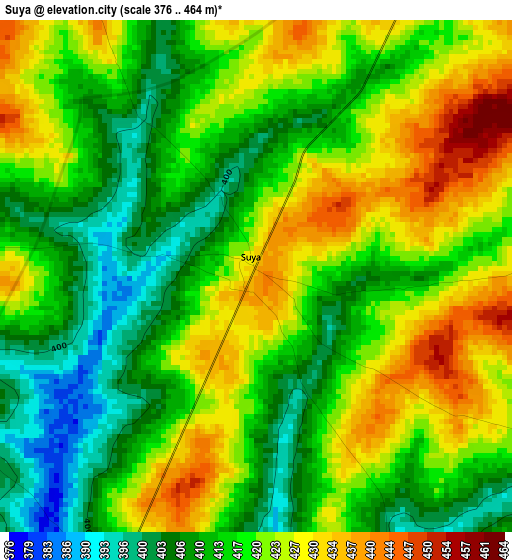
Below is the Elevation map of Suya, which displays elevation range with different colors. Scale of the first map is from 376 to 464 m (1234 to 1522 ft) with average elevation of 418 meters (=1371 ft) [note 1]
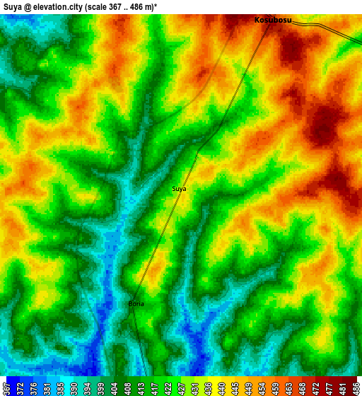
These maps also provides idea of topography and contour of this city, they are displayed at different zoom levels. More info about maps, scale and edge coordinates you can find below images.
| \ | Map #1 | Map #2 | Topo.Map |
| Scale [m] | 376..464 m | 367..486 m | × |
| Scale [ft] | 1234..1522 ft | 1204..1594 ft | × |
| Average | 418 m = 1371 ft | 424.2 m = 1392 ft | × |
| Width | 9.64 km = 6 mi | 19.28 km = 12 mi | 308.4 km = 191.6 mi |
| Height | 9.64 km = 6 mi | 19.28 km = 12 mi | 308.5 km = 191.7 mi |
| ↑Max Latitude | 9.510014° | 9.553353° | 10.85084° |
| Latitude at center | 9.46667° | 9.46667° | 9.46667° |
| ↓Min Latitude | 9.42332° | 9.379965° | 8.0769° |
| ← Min Longitude | 3.139385° | 3.095439° | 1.77708° |
| Longitude center | 3.18333° | 3.18333° | 3.18333° |
| →Max Longitude | 3.227275° | 3.271221° | 4.58958° |
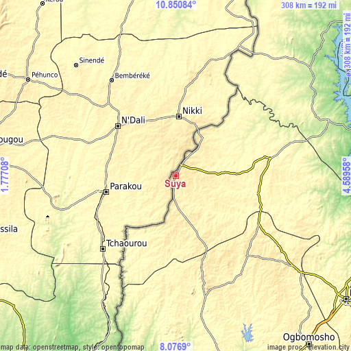
Nearby cities:
Cities around Suya sort by population:
• Saki elevation 472 m
91.8 km,  165°
165°
• Kisi 371 m
84.9 km,  120°
120°
• Igboho 405 m
94 km,  138°
138°
• Okuta 405 m
27.8 km,  180°
180°
• Kaiama 325 m
84.5 km,  79°
79°
• Babana 291 m
127.5 km,  32°
32°
• Yashikera 416 m
40.9 km,  35°
35°
• Ago Are 317 m
110.5 km, 166°
• Gwasero 355 m
34.8 km,  86°
86°
• Tede 397 m
105.3 km,  164°
164°
• Ago-Amodu 356 m
105 km,  153°
153°
• Kosubosu 469 m
10.6 km, 27°
Multilingual:
 En español:
Suya elevación 439 m.
 En France:
Suya élévation 439 m.


Sources and notes:
- [note 1] Map square and city borders are not equal. Map elevation data is calculated only from area inside that square.
- [src 1] Elevation data from geonames database provided with same terms of usage.
- [src 2] The elevation map of Suya is generated using elevation data from NASA's 3 arcsec (90m) resolution SRTM data.
- [src 3] Base (background) map © OpenStreetMap contributors tiles are generated by Geofabrik and OpenTopoMap.
Copyright & License:
This Suya Elevation Map is licensed under CC BY-SA. You may reuse any part from this page, if you give a proper credit by linking to this URL:
 More info on terms of use page.