Umuahia elevation
Umuahia (Abia, Umuahia North), Nigeria elevation is 148 meters and Umuahia elevation in feet is 486 ft above sea level [src 1]. Umuahia is a seat of a first-order administrative division (feature code) with elevation that is 149 meters (489 ft) smaller than average city elevation in Nigeria.
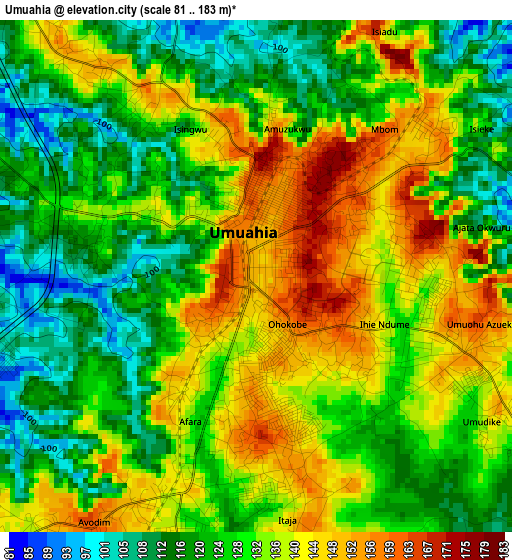
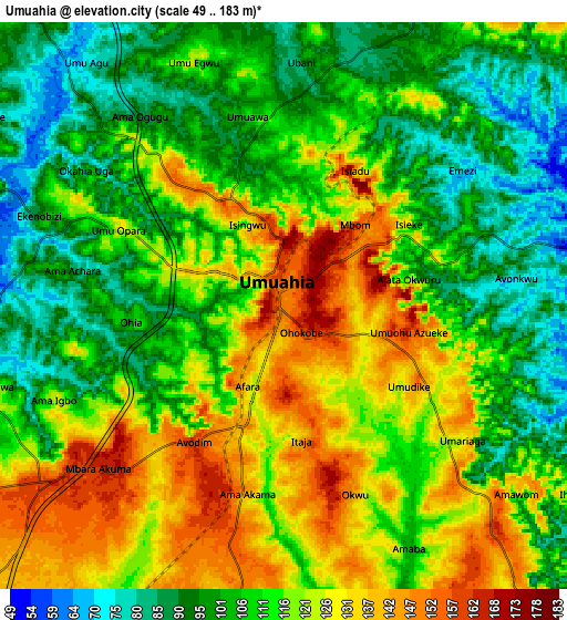
Below is the Elevation map of Umuahia, which displays elevation range with different colors. Scale of the first map is from 81 to 183 m (266 to 600 ft) with average elevation of 130.7 meters (=429 ft) [note 1]
These maps also provides idea of topography and contour of this city, they are displayed at different zoom levels. More info about maps, scale and edge coordinates you can find below images.
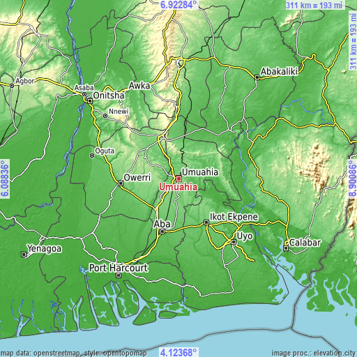
| \ | Map #1 | Map #2 | Topo.Map |
| Scale [m] | 81..183 m | 49..183 m | × |
| Scale [ft] | 266..600 ft | 161..600 ft | × |
| Average | 130.7 m = 429 ft | 113.2 m = 371 ft | × |
| Width | 9.73 km = 6 mi | 19.45 km = 12.1 mi | 311.2 km = 193.4 mi |
| Height | 9.73 km = 6 mi | 19.45 km = 12.1 mi | 311.3 km = 193.4 mi |
| ↑Max Latitude | 5.56865° | 5.612386° | 6.92284° |
| Latitude at center | 5.52491° | 5.52491° | 5.52491° |
| ↓Min Latitude | 5.481167° | 5.437421° | 4.12368° |
| ← Min Longitude | 7.450665° | 7.406719° | 6.08836° |
| Longitude center | 7.49461° | 7.49461° | 7.49461° |
| →Max Longitude | 7.538555° | 7.582501° | 8.90086° |
Nearby cities:
Cities around Umuahia sort by population:
• Bende elevation 123 m
15.8 km,  76°
76°
• Odoro Ikpe 121 m
34 km,  123°
123°
• Umuelemai 147 m
33.2 km,  303°
303°
• Omoba 98 m
32.9 km,  197°
197°
• Nto Edino 75 m
31.1 km,  163°
163°
• Aboh 139 m
25.3 km,  257°
257°
• Afor-Oru 137 m
25.1 km,  274°
274°
• Mbalano 223 m
23.3 km,  2°
2°
• Okpuala-Ngwa 118 m
22.1 km,  212°
212°
• Itu 141 m
19.4 km,  249°
249°
• Isinweke 171 m
19.2 km, 303°
• Isiala Oboro 141 m
15.5 km,  148°
148°
Multilingual:
 En español:
Umuahia elevación 148 m.
 En France:
Umuahia élévation 148 m.


Sources and notes:
- [note 1] Map square and city borders are not equal. Map elevation data is calculated only from area inside that square.
- [src 1] Elevation data from geonames database provided with same terms of usage.
- [src 2] The elevation map of Umuahia is generated using elevation data from NASA's 3 arcsec (90m) resolution SRTM data.
- [src 3] Base (background) map © OpenStreetMap contributors tiles are generated by Geofabrik and OpenTopoMap.
Copyright & License:
This Umuahia Elevation Map is licensed under CC BY-SA. You may reuse any part from this page, if you give a proper credit by linking to this URL:
 More info on terms of use page.