Tequisistlán Primero elevation
Tequisistlán Primero (State of Mexico), Mexico elevation is 2238 meters and Tequisistlán Primero elevation in feet is 7343 ft above sea level [src 1]. Tequisistlán Primero is a populated place (feature code) with elevation that is 924 meters (3031 ft) bigger than average city elevation in Mexico.
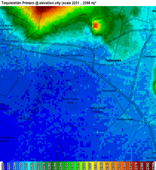
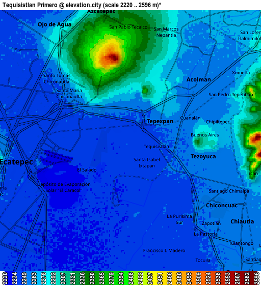
Below is the Elevation map of Tequisistlán Primero, which displays elevation range with different colors. Scale of the first map is from 2231 to 2398 m (7320 to 7867 ft) with average elevation of 2253.8 meters (=7394 ft) [note 1]
These maps also provides idea of topography and contour of this city, they are displayed at different zoom levels. More info about maps, scale and edge coordinates you can find below images.
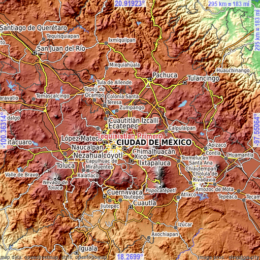
| \ | Map #1 | Map #2 | Topo.Map |
| Scale [m] | 2231..2398 m | 2220..2596 m | × |
| Scale [ft] | 7320..7867 ft | 7283..8517 ft | × |
| Average | 2253.8 m = 7394 ft | 2264 m = 7428 ft | × |
| Width | 9.21 km = 5.7 mi | 18.41 km = 11.4 mi | 294.6 km = 183.1 mi |
| Height | 9.21 km = 5.7 mi | 18.41 km = 11.4 mi | 294.6 km = 183.1 mi |
| ↑Max Latitude | 19.641414° | 19.682797° | 20.91923° |
| Latitude at center | 19.60002° | 19.60002° | 19.60002° |
| ↓Min Latitude | 19.558616° | 19.517201° | 18.2699° |
| ← Min Longitude | -99.000835° | -99.044781° | -100.36314° |
| Longitude center | -98.95689° | -98.95689° | -98.95689° |
| →Max Longitude | -98.912945° | -98.868999° | -97.55064° |
Nearby cities:
Cities around Tequisistlán Primero sort by population:
• Tepexpan elevation 2260 m
2.6 km,  54°
54°
• Tezoyuca 2276 m
4.9 km,  99°
99°
• San Cristóbal Nexquipayac 2250 m
3.5 km,  128°
128°
• Tequisistlán 2246 m
1.7 km, 103°
• Granjas Ampliación Santa Rosa 2238 m
1.3 km,  231°
231°
• Santa Catarina 2273 m
5.2 km,  38°
38°
• Nueva Santa Rosa 2241 m
1.1 km,  196°
196°
• Santa Isabel Ixtapan 2244 m
1.8 km,  144°
144°
• Colonia el Salado 2234 m
4 km,  243°
243°
• Prados de San Juan 2385 m
4.8 km,  336°
336°
• Ampliación Tezoyuca 2251 m
4.4 km,  119°
119°
• La Concepción 2284 m
6 km,  88°
88°
Multilingual:
 En español:
Tequisistlán Primero elevación 2238 m.
 En France:
Tequisistlán Primero élévation 2238 m.
 Auf Deutsch:
Tequisistlán Primero höhe über dem Meeresspiegel ist 2238 m.
 На русском:
Tequisistlán Primero высота над уровнем моря 2238 м
Sources and notes:
- [note 1] Map square and city borders are not equal. Map elevation data is calculated only from area inside that square.
- [src 1] Elevation data from geonames database provided with same terms of usage.
- [src 2] The elevation map of Tequisistlán Primero is generated using elevation data from NASA's 3 arcsec (90m) resolution SRTM data.
- [src 3] Base (background) map © OpenStreetMap contributors tiles are generated by Geofabrik and OpenTopoMap.
Copyright & License:
This Tequisistlán Primero Elevation Map is licensed under CC BY-SA. You may reuse any part from this page, if you give a proper credit by linking to this URL:
 More info on terms of use page.