Bella Vista del Río elevation
Bella Vista del Río (Querétaro, Cadereyta de Montes), Mexico elevation is 1875 meters and Bella Vista del Río elevation in feet is 6152 ft above sea level [src 1]. Bella Vista del Río is a populated place (feature code) with elevation that is 561 meters (1841 ft) bigger than average city elevation in Mexico.
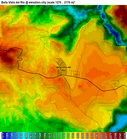
Below is the Elevation map of Bella Vista del Río, which displays elevation range with different colors. Scale of the first map is from 1270 to 2176 m (4167 to 7139 ft) with average elevation of 1815.7 meters (=5957 ft) [note 1]
These maps also provides idea of topography and contour of this city, they are displayed at different zoom levels. More info about maps, scale and edge coordinates you can find below images.
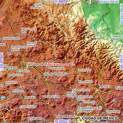
| \ | Map #1 | Topo.Map |
| Scale [m] | 1270..2176 m | × |
| Scale [ft] | 4167..7139 ft | × |
| Average | 1815.7 m = 5957 ft | × |
| Width | 9.14 km = 5.7 mi | 292.5 km = 181.8 mi |
| Height | 9.14 km = 5.7 mi | 292.5 km = 181.8 mi |
| ↑Max Latitude | 20.731106° | 21.99975° |
| Latitude at center | 20.69° | 20.69° |
| ↓Min Latitude | 20.648883° | 19.36884° |
| ← Min Longitude | -99.615335° | -100.97764° |
| Longitude center | -99.57139° | -99.57139° |
| →Max Longitude | -99.527445° | -98.16514° |
Nearby cities:
Cities around Bella Vista del Río sort by population:
• Zimapan elevation 1779 m
20.4 km,  74°
74°
• Tecozautla 1708 m
18.6 km,  200°
200°
• El Palmar 2027 m
14.1 km,  271°
271°
• Vizarrón 2063 m
22.1 km,  315°
315°
• Pañhé 1733 m
22.8 km,  214°
214°
• Gandhó 1695 m
20.1 km,  216°
216°
• Bomanxotha 1772 m
21.8 km, 207°
• Boyé 2086 m
17.5 km, 266°
• San Javier 2207 m
16.7 km,  294°
294°
• Villa Guerrero 2108 m
19.7 km, 272°
• La Esquina 1729 m
21.3 km, 221°
• Álvaro Obregón 1749 m
20.7 km,  84°
84°
Multilingual:
 En español:
Bella Vista del Río elevación 1875 m.
 En France:
Bella Vista del Río élévation 1875 m.
 Auf Deutsch:
Bella Vista del Río höhe über dem Meeresspiegel ist 1875 m.
 На русском:
Bella Vista del Río высота над уровнем моря 1875 м
Sources and notes:
- [note 1] Map square and city borders are not equal. Map elevation data is calculated only from area inside that square.
- [src 1] Elevation data from geonames database provided with same terms of usage.
- [src 2] The elevation map of Bella Vista del Río is generated using elevation data from NASA's 3 arcsec (90m) resolution SRTM data.
- [src 3] Base (background) map © OpenStreetMap contributors tiles are generated by Geofabrik and OpenTopoMap.
Copyright & License:
This Bella Vista del Río Elevation Map is licensed under CC BY-SA. You may reuse any part from this page, if you give a proper credit by linking to this URL:
 More info on terms of use page.