C-41 (Licenciado Carlos A. Madrazo) elevation
C-41 (Licenciado Carlos A. Madrazo) (Tabasco, Huimanguillo), Mexico elevation is 29 meters and C-41 (Licenciado Carlos A. Madrazo) elevation in feet is 95 ft above sea level [src 1]. C-41 (Licenciado Carlos A. Madrazo) is a populated place (feature code) with elevation that is 1285 meters (4216 ft) smaller than average city elevation in Mexico.
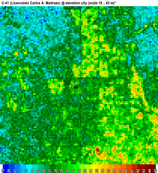
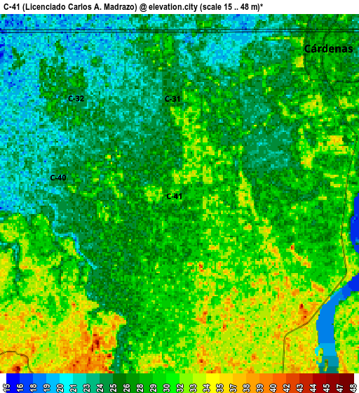
Below is the Elevation map of C-41 (Licenciado Carlos A. Madrazo), which displays elevation range with different colors. Scale of the first map is from 19 to 43 m (62 to 141 ft) with average elevation of 27.8 meters (=91 ft) [note 1]
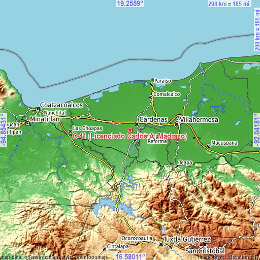
These maps also provides idea of topography and contour of this city, they are displayed at different zoom levels. More info about maps, scale and edge coordinates you can find below images.
| \ | Map #1 | Map #2 | Topo.Map |
| Scale [m] | 19..43 m | 15..48 m | × |
| Scale [ft] | 62..141 ft | 49..157 ft | × |
| Average | 27.8 m = 91 ft | 27.8 m = 91 ft | × |
| Width | 9.3 km = 5.8 mi | 18.6 km = 11.6 mi | 297.5 km = 184.9 mi |
| Height | 9.3 km = 5.8 mi | 18.6 km = 11.6 mi | 297.5 km = 184.9 mi |
| ↑Max Latitude | 17.964868° | 18.006666° | 19.2559° |
| Latitude at center | 17.92306° | 17.92306° | 17.92306° |
| ↓Min Latitude | 17.881242° | 17.839415° | 16.58011° |
| ← Min Longitude | -93.492005° | -93.535951° | -94.85431° |
| Longitude center | -93.44806° | -93.44806° | -93.44806° |
| →Max Longitude | -93.404115° | -93.360169° | -92.04181° |
Nearby cities:
Cities around C-41 (Licenciado Carlos A. Madrazo) sort by population:
• Cárdenas elevation 26 m
11.6 km,  41°
41°
• Huimanguillo 37 m
11.7 km,  147°
147°
• C-32 (Licenciado Francisco Trujillo Gurría) 23 m
7.6 km,  311°
311°
• Libertad 36 m
10.4 km,  162°
162°
• Ocuapan 41 m
8.8 km,  210°
210°
• Poblado C-33 20 de Noviembre 18 m
13.3 km,  291°
291°
• Tecominoacán 28 m
12.2 km,  269°
269°
• Mecatepec 33 m
8.9 km,  245°
245°
• Arroyo Hondo Abejonal 26 m
7.2 km,  33°
33°
• La Península 28 m
9.4 km,  76°
76°
• Benito Juárez (La Playita) 31 m
8.9 km, 83°
• El Dorado 33 m
9.6 km,  117°
117°
Multilingual:
 En español:
C-41 (Licenciado Carlos A. Madrazo) elevación 29 m.
 En France:
C-41 (Licenciado Carlos A. Madrazo) élévation 29 m.
 Auf Deutsch:
C-41 (Licenciado Carlos A. Madrazo) höhe über dem Meeresspiegel ist 29 m.
 На русском:
C-41 (Licenciado Carlos A. Madrazo) высота над уровнем моря 29 м
Sources and notes:
- [note 1] Map square and city borders are not equal. Map elevation data is calculated only from area inside that square.
- [src 1] Elevation data from geonames database provided with same terms of usage.
- [src 2] The elevation map of C-41 (Licenciado Carlos A. Madrazo) is generated using elevation data from NASA's 3 arcsec (90m) resolution SRTM data.
- [src 3] Base (background) map © OpenStreetMap contributors tiles are generated by Geofabrik and OpenTopoMap.
Copyright & License:
This C-41 (Licenciado Carlos A. Madrazo) Elevation Map is licensed under CC BY-SA. You may reuse any part from this page, if you give a proper credit by linking to this URL:
 More info on terms of use page.