Huimanguillo elevation
Huimanguillo (Tabasco), Mexico elevation is 37 meters and Huimanguillo elevation in feet is 121 ft above sea level [src 1]. Huimanguillo is a seat of a second-order administrative division (feature code) with elevation that is 1277 meters (4190 ft) smaller than average city elevation in Mexico.
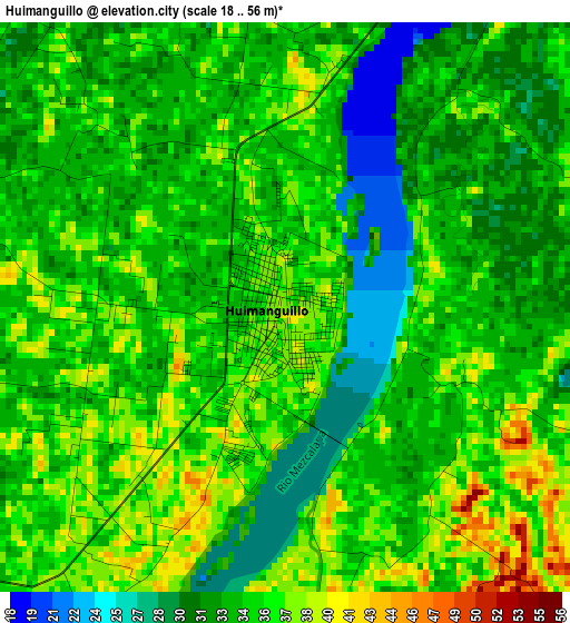
Below is the Elevation map of Huimanguillo, which displays elevation range with different colors. Scale of the first map is from 18 to 56 m (59 to 184 ft) with average elevation of 34.3 meters (=113 ft) [note 1]
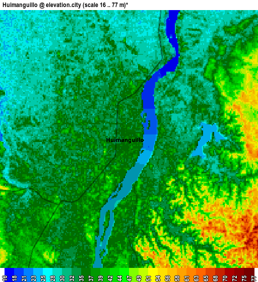
These maps also provides idea of topography and contour of this city, they are displayed at different zoom levels. More info about maps, scale and edge coordinates you can find below images.
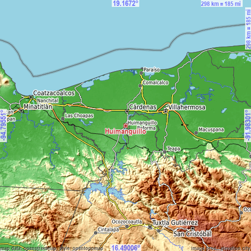
| \ | Map #1 | Map #2 | Topo.Map |
| Scale [m] | 18..56 m | 16..77 m | × |
| Scale [ft] | 59..184 ft | 52..253 ft | × |
| Average | 34.3 m = 113 ft | 36.4 m = 119 ft | × |
| Width | 9.3 km = 5.8 mi | 18.61 km = 11.6 mi | 297.7 km = 185 mi |
| Height | 9.3 km = 5.8 mi | 18.61 km = 11.6 mi | 297.7 km = 185 mi |
| ↑Max Latitude | 17.875489° | 17.917308° | 19.1672° |
| Latitude at center | 17.83366° | 17.83366° | 17.83366° |
| ↓Min Latitude | 17.791821° | 17.749973° | 16.49006° |
| ← Min Longitude | -93.433205° | -93.477151° | -94.79551° |
| Longitude center | -93.38926° | -93.38926° | -93.38926° |
| →Max Longitude | -93.345315° | -93.301369° | -91.98301° |
Nearby cities:
Cities around Huimanguillo sort by population:
• Cárdenas elevation 26 m
18.7 km,  4°
4°
• C-32 (Licenciado Francisco Trujillo Gurría) 23 m
19.1 km,  321°
321°
• C-41 (Licenciado Carlos A. Madrazo) 29 m
11.7 km,  327°
327°
• Libertad 36 m
3.1 km,  269°
269°
• Ocuapan 41 m
10.9 km,  282°
282°
• Mecatepec 33 m
15.7 km,  293°
293°
• Arroyo Hondo Abejonal 26 m
16.1 km,  352°
352°
• Habanero 1ra. Sección (Venustiano Carranza) 25 m
16.3 km,  23°
23°
• La Península 28 m
12.6 km,  13°
13°
• Benito Juárez (La Playita) 31 m
11.3 km, 13°
• Rafael Pascacio Gamboa 29 m
15.9 km,  53°
53°
• El Dorado 33 m
6 km, 22°
Multilingual:
 En español:
Huimanguillo elevación 37 m.
 En France:
Huimanguillo élévation 37 m.
 Auf Deutsch:
Huimanguillo höhe über dem Meeresspiegel ist 37 m.

Sources and notes:
- [note 1] Map square and city borders are not equal. Map elevation data is calculated only from area inside that square.
- [src 1] Elevation data from geonames database provided with same terms of usage.
- [src 2] The elevation map of Huimanguillo is generated using elevation data from NASA's 3 arcsec (90m) resolution SRTM data.
- [src 3] Base (background) map © OpenStreetMap contributors tiles are generated by Geofabrik and OpenTopoMap.
Copyright & License:
This Huimanguillo Elevation Map is licensed under CC BY-SA. You may reuse any part from this page, if you give a proper credit by linking to this URL:
 More info on terms of use page.