Héctor Caballero elevation
Héctor Caballero (Nuevo León, Juárez), Mexico elevation is 429 meters and Héctor Caballero elevation in feet is 1407 ft above sea level [src 1]. Héctor Caballero is a populated place (feature code) with elevation that is 885 meters (2904 ft) smaller than average city elevation in Mexico.
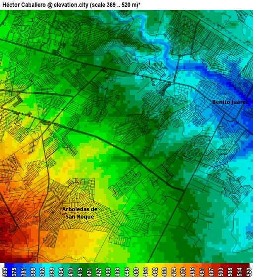
Below is the Elevation map of Héctor Caballero, which displays elevation range with different colors. Scale of the first map is from 369 to 520 m (1211 to 1706 ft) with average elevation of 427.5 meters (=1403 ft) [note 1]
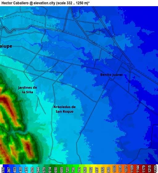
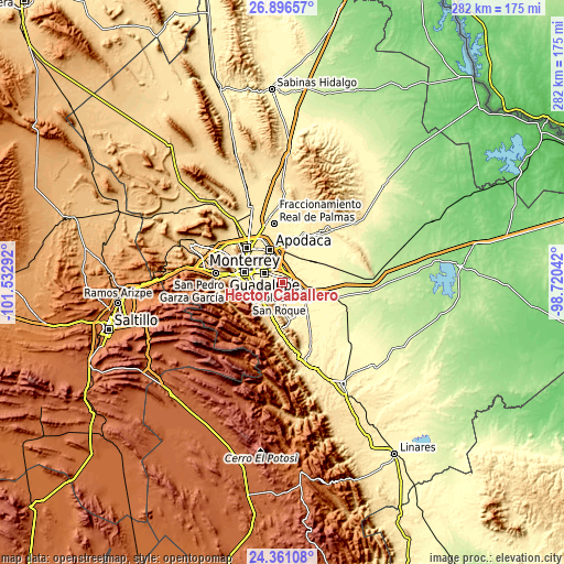
These maps also provides idea of topography and contour of this city, they are displayed at different zoom levels. More info about maps, scale and edge coordinates you can find below images.
| \ | Map #1 | Map #2 | Topo.Map |
| Scale [m] | 369..520 m | 332..1250 m | × |
| Scale [ft] | 1211..1706 ft | 1089..4101 ft | × |
| Average | 427.5 m = 1403 ft | 456.5 m = 1498 ft | × |
| Width | 8.81 km = 5.5 mi | 17.62 km = 10.9 mi | 281.9 km = 175.2 mi |
| Height | 8.81 km = 5.5 mi | 17.62 km = 10.9 mi | 281.9 km = 175.2 mi |
| ↑Max Latitude | 25.675173° | 25.714773° | 26.89657° |
| Latitude at center | 25.63556° | 25.63556° | 25.63556° |
| ↓Min Latitude | 25.595934° | 25.556295° | 24.36108° |
| ← Min Longitude | -100.170615° | -100.214561° | -101.53292° |
| Longitude center | -100.12667° | -100.12667° | -100.12667° |
| →Max Longitude | -100.082725° | -100.038779° | -98.72042° |
Nearby cities:
Cities around Héctor Caballero sort by population:
• Ciudad Benito Juárez elevation 388 m
3.4 km,  67°
67°
• Jardines de la Silla (Jardines) 512 m
6.2 km,  263°
263°
• Misión San Pablo 399 m
11.7 km,  351°
351°
• Monte Kristal 457 m
3.2 km,  250°
250°
• Loma la Paz 402 m
8.4 km, 354°
• Valle de Vaquerías 444 m
2.1 km, 260°
• Fraccionamiento Misión de San Javier 405 m
12.5 km, 348°
• San Antonio 374 m
6.8 km,  87°
87°
• Bosques de San Pedro 525 m
6.5 km,  234°
234°
• Paseo de San Javier 394 m
11.6 km,  356°
356°
• Lomas de San Martín 385 m
12.4 km,  3°
3°
• Valle de Juárez 455 m
3.2 km,  274°
274°
Multilingual:
 En español:
Héctor Caballero elevación 429 m.
 En France:
Héctor Caballero élévation 429 m.
 Auf Deutsch:
Héctor Caballero höhe über dem Meeresspiegel ist 429 m.

Sources and notes:
- [note 1] Map square and city borders are not equal. Map elevation data is calculated only from area inside that square.
- [src 1] Elevation data from geonames database provided with same terms of usage.
- [src 2] The elevation map of Héctor Caballero is generated using elevation data from NASA's 3 arcsec (90m) resolution SRTM data.
- [src 3] Base (background) map © OpenStreetMap contributors tiles are generated by Geofabrik and OpenTopoMap.
Copyright & License:
This Héctor Caballero Elevation Map is licensed under CC BY-SA. You may reuse any part from this page, if you give a proper credit by linking to this URL:
 More info on terms of use page.