San Antonio del Coyote elevation
San Antonio del Coyote (Coahuila, Matamoros), Mexico elevation is 1118 meters and San Antonio del Coyote elevation in feet is 3668 ft above sea level [src 1]. San Antonio del Coyote is a populated place (feature code) with elevation that is 196 meters (643 ft) smaller than average city elevation in Mexico.
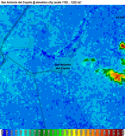
Below is the Elevation map of San Antonio del Coyote, which displays elevation range with different colors. Scale of the first map is from 1102 to 1222 m (3615 to 4009 ft) with average elevation of 1115.7 meters (=3660 ft) [note 1]
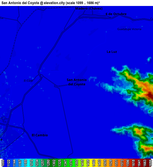
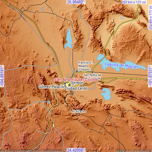
These maps also provides idea of topography and contour of this city, they are displayed at different zoom levels. More info about maps, scale and edge coordinates you can find below images.
| \ | Map #1 | Map #2 | Topo.Map |
| Scale [m] | 1102..1222 m | 1099..1686 m | × |
| Scale [ft] | 3615..4009 ft | 3606..5531 ft | × |
| Average | 1115.7 m = 3660 ft | 1129.1 m = 3704 ft | × |
| Width | 8.81 km = 5.5 mi | 17.61 km = 10.9 mi | 281.8 km = 175.1 mi |
| Height | 8.81 km = 5.5 mi | 17.61 km = 10.9 mi | 281.8 km = 175.1 mi |
| ↑Max Latitude | 25.734033° | 25.773614° | 26.95482° |
| Latitude at center | 25.69444° | 25.69444° | 25.69444° |
| ↓Min Latitude | 25.654833° | 25.615214° | 24.42058° |
| ← Min Longitude | -103.329505° | -103.373451° | -104.69181° |
| Longitude center | -103.28556° | -103.28556° | -103.28556° |
| →Max Longitude | -103.241615° | -103.197669° | -101.87931° |
Nearby cities:
Cities around San Antonio del Coyote sort by population:
• Coyote elevation 1117 m
0.2 km,  61°
61°
• La Luz 1114 m
5.4 km,  48°
48°
• Hormiguero 1118 m
5.7 km,  258°
258°
• Purísima 1118 m
4 km,  246°
246°
• Solima 1114 m
3.7 km,  164°
164°
• Nuevo León 1117 m
2.8 km,  341°
341°
• Veinte de Noviembre 1118 m
4.8 km,  293°
293°
• Granada 1112 m
6.2 km, 162°
• Santa Ana del Pilar 1118 m
2.8 km,  305°
305°
• Jaboncillo 1114 m
6.3 km,  18°
18°
• Compuertas 1114 m
6.1 km, 343°
• El Cuije 1120 m
5.6 km,  272°
272°
Multilingual:
 En español:
San Antonio del Coyote elevación 1118 m.
 En France:
San Antonio del Coyote élévation 1118 m.
 Auf Deutsch:
San Antonio del Coyote höhe über dem Meeresspiegel ist 1118 m.
 На русском:
San Antonio del Coyote высота над уровнем моря 1118 м
Sources and notes:
- [note 1] Map square and city borders are not equal. Map elevation data is calculated only from area inside that square.
- [src 1] Elevation data from geonames database provided with same terms of usage.
- [src 2] The elevation map of San Antonio del Coyote is generated using elevation data from NASA's 3 arcsec (90m) resolution SRTM data.
- [src 3] Base (background) map © OpenStreetMap contributors tiles are generated by Geofabrik and OpenTopoMap.
Copyright & License:
This San Antonio del Coyote Elevation Map is licensed under CC BY-SA. You may reuse any part from this page, if you give a proper credit by linking to this URL:
 More info on terms of use page.