Los Olvera elevation
Los Olvera (Querétaro, Corregidora), Mexico elevation is 1870 meters and Los Olvera elevation in feet is 6135 ft above sea level [src 1]. Los Olvera is a populated place (feature code) with elevation that is 556 meters (1824 ft) bigger than average city elevation in Mexico.
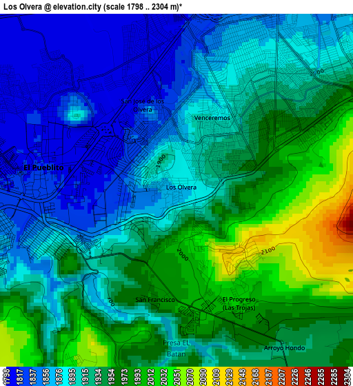
Below is the Elevation map of Los Olvera, which displays elevation range with different colors. Scale of the first map is from 1798 to 2304 m (5899 to 7559 ft) with average elevation of 1920.4 meters (=6301 ft) [note 1]
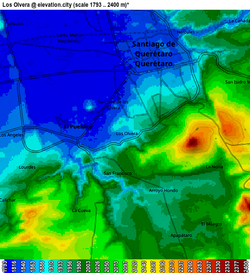
These maps also provides idea of topography and contour of this city, they are displayed at different zoom levels. More info about maps, scale and edge coordinates you can find below images.
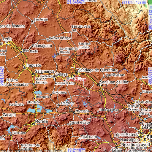
| \ | Map #1 | Map #2 | Topo.Map |
| Scale [m] | 1798..2304 m | 1793..2400 m | × |
| Scale [ft] | 5899..7559 ft | 5883..7874 ft | × |
| Average | 1920.4 m = 6301 ft | 1950.1 m = 6398 ft | × |
| Width | 9.15 km = 5.7 mi | 18.3 km = 11.4 mi | 292.8 km = 181.9 mi |
| Height | 9.15 km = 5.7 mi | 18.3 km = 11.4 mi | 292.8 km = 181.9 mi |
| ↑Max Latitude | 20.575488° | 20.616624° | 21.84547° |
| Latitude at center | 20.53434° | 20.53434° | 20.53434° |
| ↓Min Latitude | 20.493181° | 20.452012° | 19.21187° |
| ← Min Longitude | -100.451895° | -100.495841° | -101.8142° |
| Longitude center | -100.40795° | -100.40795° | -100.40795° |
| →Max Longitude | -100.364005° | -100.320059° | -99.0017° |
Nearby cities:
Cities around Los Olvera sort by population:
• Santiago de Querétaro elevation 1826 m
6.3 km,  19°
19°
• El Pueblito 1815 m
3.2 km,  281°
281°
• San Jose de los Olvera 1857 m
2.2 km,  340°
340°
• Venceremos 1896 m
2.1 km,  29°
29°
• Santa María Magdalena 1803 m
8.1 km,  329°
329°
• La Negreta 1845 m
4.5 km,  258°
258°
• Colonia los Ángeles 1857 m
8.4 km,  270°
270°
• Joaquín Herrera 2033 m
6.5 km,  209°
209°
• La Noria 2004 m
6.9 km,  110°
110°
• El Milagro 1993 m
9.1 km,  137°
137°
• Lourdes 1956 m
7.5 km,  251°
251°
• Apapátaro 1967 m
8.4 km,  150°
150°
Multilingual:
 En español:
Los Olvera elevación 1870 m.
 En France:
Los Olvera élévation 1870 m.
 Auf Deutsch:
Los Olvera höhe über dem Meeresspiegel ist 1870 m.

Sources and notes:
- [note 1] Map square and city borders are not equal. Map elevation data is calculated only from area inside that square.
- [src 1] Elevation data from geonames database provided with same terms of usage.
- [src 2] The elevation map of Los Olvera is generated using elevation data from NASA's 3 arcsec (90m) resolution SRTM data.
- [src 3] Base (background) map © OpenStreetMap contributors tiles are generated by Geofabrik and OpenTopoMap.
Copyright & License:
This Los Olvera Elevation Map is licensed under CC BY-SA. You may reuse any part from this page, if you give a proper credit by linking to this URL:
 More info on terms of use page.