El Sabino elevation
El Sabino (Guanajuato, Salvatierra), Mexico elevation is 1755 meters and El Sabino elevation in feet is 5758 ft above sea level [src 1]. El Sabino is a populated place (feature code) with elevation that is 441 meters (1447 ft) bigger than average city elevation in Mexico.
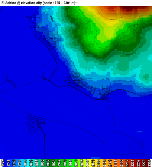
Below is the Elevation map of El Sabino, which displays elevation range with different colors. Scale of the first map is from 1725 to 2301 m (5659 to 7549 ft) with average elevation of 1795.1 meters (=5889 ft) [note 1]
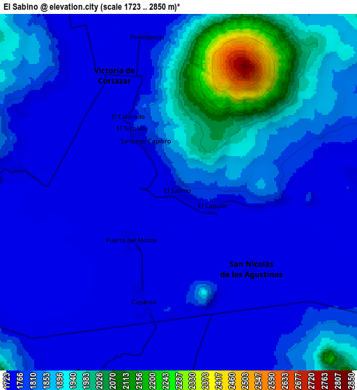
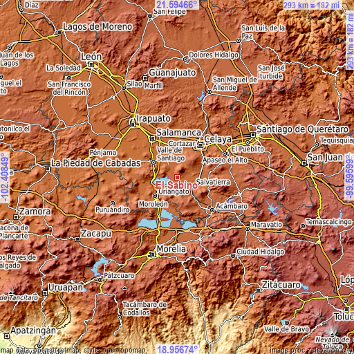
These maps also provides idea of topography and contour of this city, they are displayed at different zoom levels. More info about maps, scale and edge coordinates you can find below images.
| \ | Map #1 | Map #2 | Topo.Map |
| Scale [m] | 1725..2301 m | 1723..2850 m | × |
| Scale [ft] | 5659..7549 ft | 5653..9350 ft | × |
| Average | 1795.1 m = 5889 ft | 1816.8 m = 5961 ft | × |
| Width | 9.17 km = 5.7 mi | 18.33 km = 11.4 mi | 293.3 km = 182.2 mi |
| Height | 9.17 km = 5.7 mi | 18.33 km = 11.4 mi | 293.3 km = 182.2 mi |
| ↑Max Latitude | 20.322525° | 20.36373° | 21.59466° |
| Latitude at center | 20.28131° | 20.28131° | 20.28131° |
| ↓Min Latitude | 20.240084° | 20.198847° | 18.95674° |
| ← Min Longitude | -101.046185° | -101.090131° | -102.40849° |
| Longitude center | -101.00224° | -101.00224° | -101.00224° |
| →Max Longitude | -100.958295° | -100.914349° | -99.59599° |
Nearby cities:
Cities around El Sabino sort by population:
• San Nicolás de los Agustinos elevation 1746 m
5.4 km,  136°
136°
• San Pedro de los Naranjos 1762 m
9 km,  131°
131°
• Victoria de Cortazar 1729 m
6.7 km,  332°
332°
• Maravatío del Encinal 1747 m
9.4 km,  153°
153°
• Santiago Capitiro 1760 m
3 km, 327°
• Cupareo 1735 m
6.1 km,  195°
195°
• Santo Tomás Huatzindeo 1790 m
10.8 km, 127°
• Loma de Zempoala 1741 m
8.2 km,  278°
278°
• La Luz 1746 m
8.9 km,  84°
84°
• El Capulín 1752 m
1.9 km,  110°
110°
• Providencia 1737 m
8.3 km,  347°
347°
• Puerta del Monte 1733 m
3.5 km,  224°
224°
Multilingual:
 En español:
El Sabino elevación 1755 m.
 En France:
El Sabino élévation 1755 m.
 Auf Deutsch:
El Sabino höhe über dem Meeresspiegel ist 1755 m.

Sources and notes:
- [note 1] Map square and city borders are not equal. Map elevation data is calculated only from area inside that square.
- [src 1] Elevation data from geonames database provided with same terms of usage.
- [src 2] The elevation map of El Sabino is generated using elevation data from NASA's 3 arcsec (90m) resolution SRTM data.
- [src 3] Base (background) map © OpenStreetMap contributors tiles are generated by Geofabrik and OpenTopoMap.
Copyright & License:
This El Sabino Elevation Map is licensed under CC BY-SA. You may reuse any part from this page, if you give a proper credit by linking to this URL:
 More info on terms of use page.