Urireo elevation
Urireo (Guanajuato, Salvatierra), Mexico elevation is 1796 meters and Urireo elevation in feet is 5892 ft above sea level [src 1]. Urireo is a populated place (feature code) with elevation that is 482 meters (1581 ft) bigger than average city elevation in Mexico.
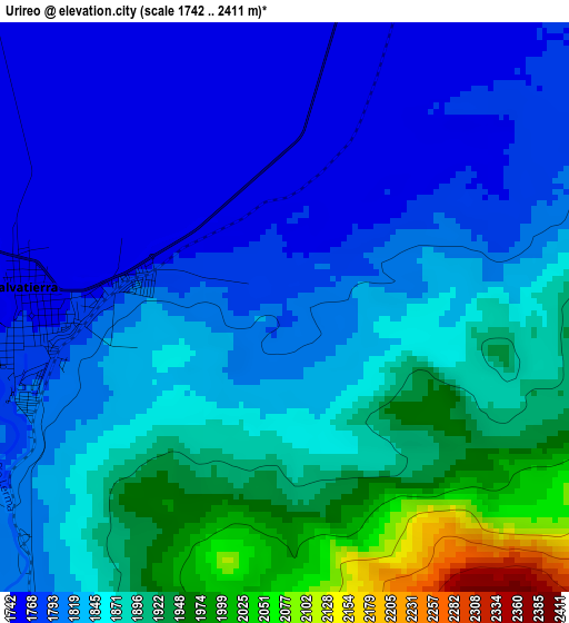
Below is the Elevation map of Urireo, which displays elevation range with different colors. Scale of the first map is from 1742 to 2411 m (5715 to 7910 ft) with average elevation of 1844.9 meters (=6053 ft) [note 1]
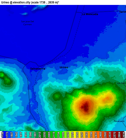
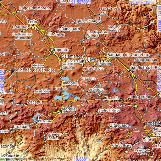
These maps also provides idea of topography and contour of this city, they are displayed at different zoom levels. More info about maps, scale and edge coordinates you can find below images.
| \ | Map #1 | Map #2 | Topo.Map |
| Scale [m] | 1742..2411 m | 1738..2639 m | × |
| Scale [ft] | 5715..7910 ft | 5702..8658 ft | × |
| Average | 1844.9 m = 6053 ft | 1873.2 m = 6146 ft | × |
| Width | 9.17 km = 5.7 mi | 18.34 km = 11.4 mi | 293.4 km = 182.3 mi |
| Height | 9.17 km = 5.7 mi | 18.34 km = 11.4 mi | 293.5 km = 182.4 mi |
| ↑Max Latitude | 20.254373° | 20.295596° | 21.52709° |
| Latitude at center | 20.21314° | 20.21314° | 20.21314° |
| ↓Min Latitude | 20.171896° | 20.13064° | 18.888° |
| ← Min Longitude | -100.885825° | -100.929771° | -102.24813° |
| Longitude center | -100.84188° | -100.84188° | -100.84188° |
| →Max Longitude | -100.797935° | -100.753989° | -99.43563° |
Nearby cities:
Cities around Urireo sort by population:
• Salvatierra elevation 1761 m
4 km,  270°
270°
• La Moncada 1761 m
8.7 km,  26°
26°
• Panales Jamaica (Cañones) 1757 m
9.4 km,  12°
12°
• Santo Tomás Huatzindeo 1790 m
8.3 km,  276°
276°
• Ojo de Agua de Ballesteros 1761 m
2.5 km,  47°
47°
• San Miguel Eménguaro 1808 m
7.1 km,  220°
220°
• Los Fierros 1981 m
8.9 km,  104°
104°
• Galerade Panales 1758 m
9.5 km,  17°
17°
• La Estancia de San José del Carmen 1757 m
9.4 km,  347°
347°
• El Salvador (Ranchito San José del Carmen) 1752 m
9.1 km,  335°
335°
• San Antonio Eménguaro 1809 m
9 km,  205°
205°
• San Nicolás de la Condesa 1804 m
6.7 km,  71°
71°
Multilingual:
 En español:
Urireo, Uriréo elevación 1796 m.
 En France:
Urireo élévation 1796 m.


Sources and notes:
- [note 1] Map square and city borders are not equal. Map elevation data is calculated only from area inside that square.
- [src 1] Elevation data from geonames database provided with same terms of usage.
- [src 2] The elevation map of Urireo is generated using elevation data from NASA's 3 arcsec (90m) resolution SRTM data.
- [src 3] Base (background) map © OpenStreetMap contributors tiles are generated by Geofabrik and OpenTopoMap.
Copyright & License:
This Urireo Elevation Map is licensed under CC BY-SA. You may reuse any part from this page, if you give a proper credit by linking to this URL:
 More info on terms of use page.