Ameca elevation
Ameca (Jalisco), Mexico elevation is 1234 meters and Ameca elevation in feet is 4049 ft above sea level [src 1]. Ameca is a seat of a second-order administrative division (feature code) with elevation that is 80 meters (262 ft) smaller than average city elevation in Mexico.
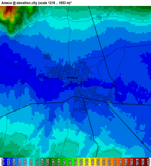
Below is the Elevation map of Ameca, which displays elevation range with different colors. Scale of the first map is from 1216 to 1653 m (3990 to 5423 ft) with average elevation of 1267 meters (=4157 ft) [note 1]
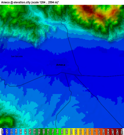
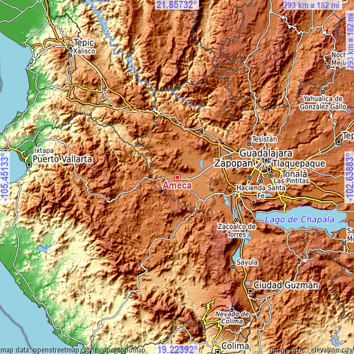
These maps also provides idea of topography and contour of this city, they are displayed at different zoom levels. More info about maps, scale and edge coordinates you can find below images.
| \ | Map #1 | Map #2 | Topo.Map |
| Scale [m] | 1216..1653 m | 1204..2594 m | × |
| Scale [ft] | 3990..5423 ft | 3950..8510 ft | × |
| Average | 1267 m = 4157 ft | 1396 m = 4580 ft | × |
| Width | 9.15 km = 5.7 mi | 18.3 km = 11.4 mi | 292.8 km = 181.9 mi |
| Height | 9.15 km = 5.7 mi | 18.3 km = 11.4 mi | 292.8 km = 181.9 mi |
| ↑Max Latitude | 20.587434° | 20.628568° | 21.85732° |
| Latitude at center | 20.54629° | 20.54629° | 20.54629° |
| ↓Min Latitude | 20.505135° | 20.463968° | 19.22392° |
| ← Min Longitude | -104.089025° | -104.132971° | -105.45133° |
| Longitude center | -104.04508° | -104.04508° | -104.04508° |
| →Max Longitude | -104.001135° | -103.957189° | -102.63883° |
Nearby cities:
Cities around Ameca sort by population:
• Ahualulco de Mercado elevation 1325 m
18.7 km,  23°
23°
• San Martín Hidalgo 1308 m
17.3 km,  135°
135°
• El Salitre 1262 m
19.9 km,  101°
101°
• El Cabezón 1270 m
11.3 km,  119°
119°
• Portes Gil 1307 m
16.7 km,  41°
41°
• Buenavista 1250 m
20.3 km,  83°
83°
• La Vega 1263 m
19.9 km, 78°
• El Carmen 1279 m
18.3 km,  49°
49°
• Santa Cruz de Bárcenas 1407 m
14.3 km, 18°
• Santa Cruz de las Flores 1363 m
19.6 km,  149°
149°
• Punta de la Vega 1275 m
16.1 km,  72°
72°
• Los Pocitos 1247 m
11.3 km, 95°
Multilingual:
 En español:
Ameca elevación 1234 m.
 En France:
Ameca élévation 1234 m.
 Auf Deutsch:
Municipio Ameca höhe über dem Meeresspiegel ist 1234 m.

Sources and notes:
- [note 1] Map square and city borders are not equal. Map elevation data is calculated only from area inside that square.
- [src 1] Elevation data from geonames database provided with same terms of usage.
- [src 2] The elevation map of Ameca is generated using elevation data from NASA's 3 arcsec (90m) resolution SRTM data.
- [src 3] Base (background) map © OpenStreetMap contributors tiles are generated by Geofabrik and OpenTopoMap.
Copyright & License:
This Ameca Elevation Map is licensed under CC BY-SA. You may reuse any part from this page, if you give a proper credit by linking to this URL:
 More info on terms of use page.