Badiraguato elevation
Badiraguato (Sinaloa), Mexico elevation is 208 meters and Badiraguato elevation in feet is 682 ft above sea level [src 1]. Badiraguato is a seat of a second-order administrative division (feature code) with elevation that is 1106 meters (3629 ft) smaller than average city elevation in Mexico.
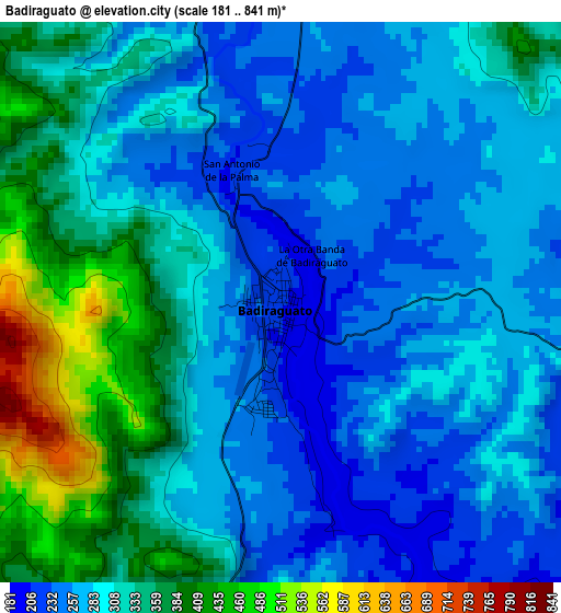
Below is the Elevation map of Badiraguato, which displays elevation range with different colors. Scale of the first map is from 181 to 841 m (594 to 2759 ft) with average elevation of 305.1 meters (=1001 ft) [note 1]
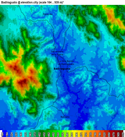
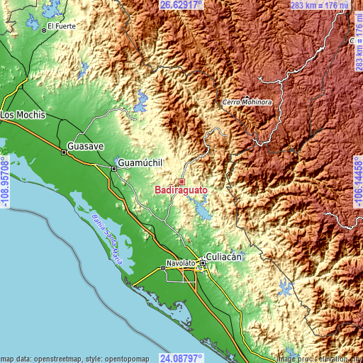
These maps also provides idea of topography and contour of this city, they are displayed at different zoom levels. More info about maps, scale and edge coordinates you can find below images.
| \ | Map #1 | Map #2 | Topo.Map |
| Scale [m] | 181..841 m | 164..939 m | × |
| Scale [ft] | 594..2759 ft | 538..3081 ft | × |
| Average | 305.1 m = 1001 ft | 334.6 m = 1098 ft | × |
| Width | 8.83 km = 5.5 mi | 17.66 km = 11 mi | 282.6 km = 175.6 mi |
| Height | 8.83 km = 5.5 mi | 17.66 km = 11 mi | 282.6 km = 175.6 mi |
| ↑Max Latitude | 25.404952° | 25.444641° | 26.62917° |
| Latitude at center | 25.36525° | 25.36525° | 25.36525° |
| ↓Min Latitude | 25.325535° | 25.285806° | 24.08797° |
| ← Min Longitude | -107.594775° | -107.638721° | -108.95708° |
| Longitude center | -107.55083° | -107.55083° | -107.55083° |
| →Max Longitude | -107.506885° | -107.462939° | -106.14458° |
Nearby cities:
Cities around Badiraguato sort by population:
• Pericos elevation 50 m
35 km,  205°
205°
• Mocorito 86 m
39.3 km,  289°
289°
• El Limón de los Ramos 63 m
50.3 km,  176°
176°
• Colonia Agrícola México (Palmitas) 25 m
48.8 km,  234°
234°
• Jesús María 185 m
32.3 km,  162°
162°
• Estación Chimaneco 22 m
49.9 km,  203°
203°
• Melchor Ocampo 28 m
49.5 km,  224°
224°
• Recoveco 27 m
45 km, 203°
• Higuera de los Vega 181 m
52 km,  308°
308°
• Potrero de los Sánchez (Estación Techa) 43 m
45.2 km, 231°
• La Palmita y Anexos (La Presita) 76 m
51.7 km,  168°
168°
• Cerro Agudo 134 m
48.8 km,  302°
302°
Multilingual:
 En español:
Badiraguato elevación 208 m.
 En France:
Badiraguato élévation 208 m.
 Auf Deutsch:
Badiraguato höhe über dem Meeresspiegel ist 208 m.

Sources and notes:
- [note 1] Map square and city borders are not equal. Map elevation data is calculated only from area inside that square.
- [src 1] Elevation data from geonames database provided with same terms of usage.
- [src 2] The elevation map of Badiraguato is generated using elevation data from NASA's 3 arcsec (90m) resolution SRTM data.
- [src 3] Base (background) map © OpenStreetMap contributors tiles are generated by Geofabrik and OpenTopoMap.
Copyright & License:
This Badiraguato Elevation Map is licensed under CC BY-SA. You may reuse any part from this page, if you give a proper credit by linking to this URL:
 More info on terms of use page.