Pericos elevation
Pericos (Sinaloa, Mocorito), Mexico elevation is 50 meters and Pericos elevation in feet is 164 ft above sea level [src 1]. Pericos is a populated place (feature code) with elevation that is 1264 meters (4147 ft) smaller than average city elevation in Mexico.
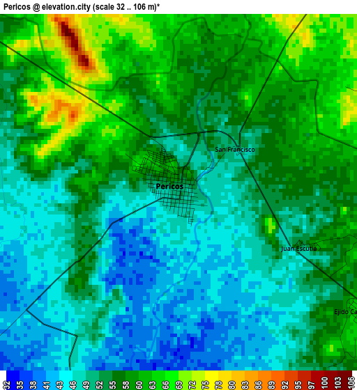
Below is the Elevation map of Pericos, which displays elevation range with different colors. Scale of the first map is from 32 to 106 m (105 to 348 ft) with average elevation of 53.9 meters (=177 ft) [note 1]
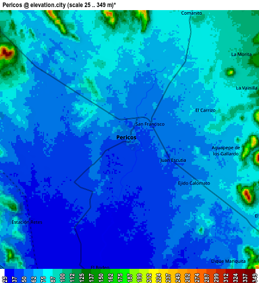
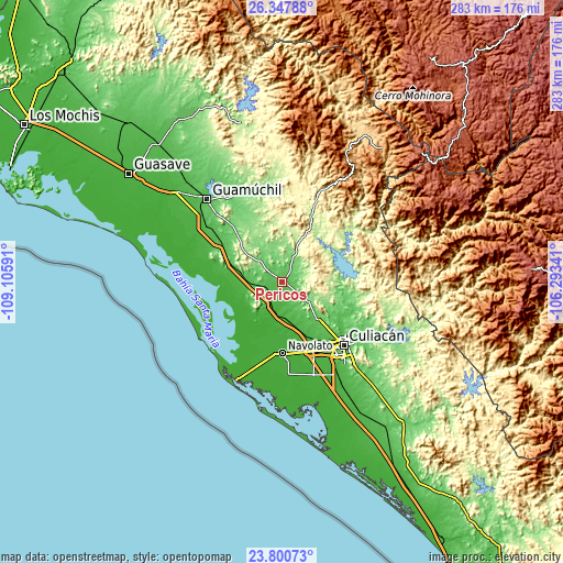
These maps also provides idea of topography and contour of this city, they are displayed at different zoom levels. More info about maps, scale and edge coordinates you can find below images.
| \ | Map #1 | Map #2 | Topo.Map |
| Scale [m] | 32..106 m | 25..349 m | × |
| Scale [ft] | 105..348 ft | 82..1145 ft | × |
| Average | 53.9 m = 177 ft | 65.3 m = 214 ft | × |
| Width | 8.85 km = 5.5 mi | 17.7 km = 11 mi | 283.2 km = 176 mi |
| Height | 8.85 km = 5.5 mi | 17.7 km = 11 mi | 283.2 km = 176 mi |
| ↑Max Latitude | 25.120725° | 25.160508° | 26.34788° |
| Latitude at center | 25.08093° | 25.08093° | 25.08093° |
| ↓Min Latitude | 25.041122° | 25.001301° | 23.80073° |
| ← Min Longitude | -107.743605° | -107.787551° | -109.10591° |
| Longitude center | -107.69966° | -107.69966° | -107.69966° |
| →Max Longitude | -107.655715° | -107.611769° | -106.29341° |
Nearby cities:
Cities around Pericos sort by population:
• General Ángel Flores (La Palma) elevation 17 m
29.4 km,  171°
171°
• Adolfo López Mateos (El Tamarindo) 42 m
21.6 km,  161°
161°
• El Limón de los Ramos 63 m
25.7 km,  136°
136°
• Juan Aldama (El Tigre) 20 m
19.9 km,  217°
217°
• Colonia Agrícola México (Palmitas) 25 m
24.9 km,  277°
277°
• Jesús María 185 m
24.9 km,  87°
87°
• Estación Chimaneco 22 m
14.9 km,  199°
199°
• Melchor Ocampo 28 m
20 km,  259°
259°
• Recoveco 27 m
10.1 km, 196°
• Potrero de los Sánchez (Estación Techa) 43 m
20.5 km, 279°
• La Palmita y Anexos (La Presita) 76 m
31.4 km,  127°
127°
• Estación Rosales 28 m
29.7 km, 156°
Multilingual:
 En español:
Pericos elevación 50 m.
 En France:
Pericos élévation 50 m.


Sources and notes:
- [note 1] Map square and city borders are not equal. Map elevation data is calculated only from area inside that square.
- [src 1] Elevation data from geonames database provided with same terms of usage.
- [src 2] The elevation map of Pericos is generated using elevation data from NASA's 3 arcsec (90m) resolution SRTM data.
- [src 3] Base (background) map © OpenStreetMap contributors tiles are generated by Geofabrik and OpenTopoMap.
Copyright & License:
This Pericos Elevation Map is licensed under CC BY-SA. You may reuse any part from this page, if you give a proper credit by linking to this URL:
 More info on terms of use page.