Buaysiacobe elevation
Buaysiacobe (Sonora, Etchojoa), Mexico elevation is 19 meters and Buaysiacobe elevation in feet is 62 ft above sea level [src 1]. Buaysiacobe is a populated place (feature code) with elevation that is 1295 meters (4249 ft) smaller than average city elevation in Mexico.
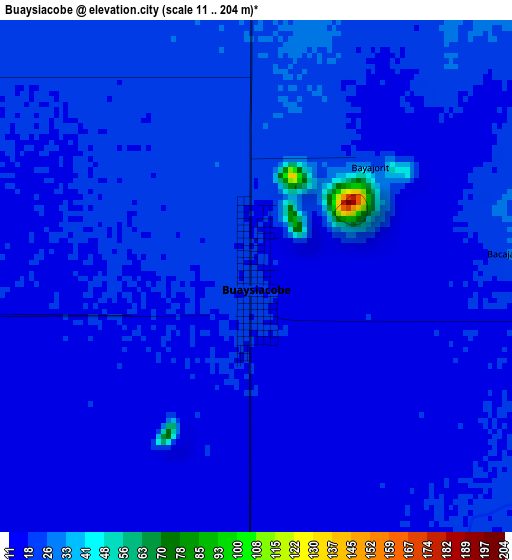
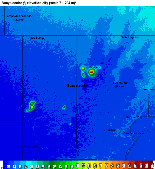
Below is the Elevation map of Buaysiacobe, which displays elevation range with different colors. Scale of the first map is from 11 to 204 m (36 to 669 ft) with average elevation of 19.3 meters (=63 ft) [note 1]
These maps also provides idea of topography and contour of this city, they are displayed at different zoom levels. More info about maps, scale and edge coordinates you can find below images.
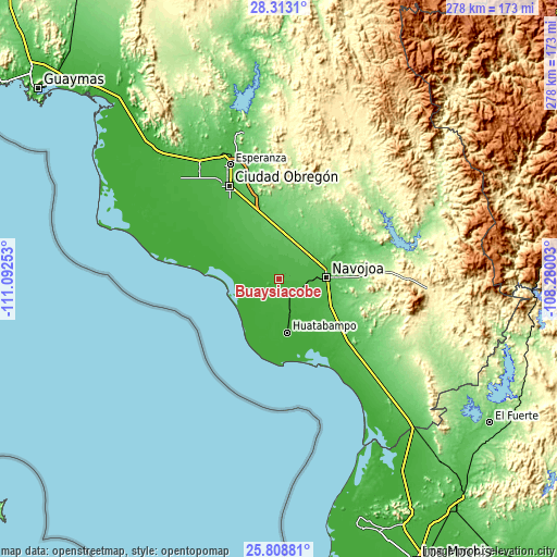
| \ | Map #1 | Map #2 | Topo.Map |
| Scale [m] | 11..204 m | 7..204 m | × |
| Scale [ft] | 36..669 ft | 23..669 ft | × |
| Average | 19.3 m = 63 ft | 20.9 m = 69 ft | × |
| Width | 8.7 km = 5.4 mi | 17.4 km = 10.8 mi | 278.5 km = 173.1 mi |
| Height | 8.7 km = 5.4 mi | 17.4 km = 10.8 mi | 278.5 km = 173.1 mi |
| ↑Max Latitude | 27.107075° | 27.146186° | 28.3131° |
| Latitude at center | 27.06795° | 27.06795° | 27.06795° |
| ↓Min Latitude | 27.028811° | 26.989659° | 25.80881° |
| ← Min Longitude | -109.730225° | -109.774171° | -111.09253° |
| Longitude center | -109.68628° | -109.68628° | -109.68628° |
| →Max Longitude | -109.642335° | -109.598389° | -108.28003° |
Nearby cities:
Cities around Buaysiacobe sort by population:
• Villa Juárez elevation 18 m
16.6 km,  293°
293°
• Etchojoa 18 m
18.4 km,  161°
161°
• Bacobampo 22 m
10.1 km, 161°
• Bacame Nuevo 51 m
13.7 km,  42°
42°
• Basconcobe 16 m
12.7 km,  172°
172°
• El Sahuaral 18 m
15.9 km, 172°
• Chucarit 27 m
10.9 km,  111°
111°
• El Rodeo 22 m
7.3 km,  143°
143°
• San Pedro Río Mayo 23 m
7.5 km,  134°
134°
• Jecopaco 46 m
16.7 km,  330°
330°
• Jitonhueca 31 m
8.1 km,  94°
94°
• El Recodo 33 m
15.8 km, 86°
Multilingual:
 En español:
Buaysiacobe elevación 19 m.
 En France:
Buaysiacobe élévation 19 m.
 Auf Deutsch:
Buaysiacobe höhe über dem Meeresspiegel ist 19 m.

Sources and notes:
- [note 1] Map square and city borders are not equal. Map elevation data is calculated only from area inside that square.
- [src 1] Elevation data from geonames database provided with same terms of usage.
- [src 2] The elevation map of Buaysiacobe is generated using elevation data from NASA's 3 arcsec (90m) resolution SRTM data.
- [src 3] Base (background) map © OpenStreetMap contributors tiles are generated by Geofabrik and OpenTopoMap.
Copyright & License:
This Buaysiacobe Elevation Map is licensed under CC BY-SA. You may reuse any part from this page, if you give a proper credit by linking to this URL:
 More info on terms of use page.