Jecopaco elevation
Jecopaco (Sonora, Benito Juárez), Mexico elevation is 46 meters and Jecopaco elevation in feet is 151 ft above sea level [src 1]. Jecopaco is a populated place (feature code) with elevation that is 1268 meters (4160 ft) smaller than average city elevation in Mexico.
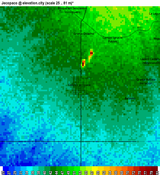
Below is the Elevation map of Jecopaco, which displays elevation range with different colors. Scale of the first map is from 25 to 81 m (82 to 266 ft) with average elevation of 40.5 meters (=133 ft) [note 1]
These maps also provides idea of topography and contour of this city, they are displayed at different zoom levels. More info about maps, scale and edge coordinates you can find below images.
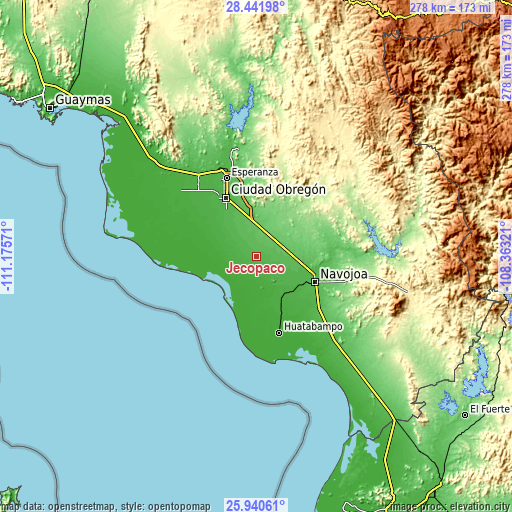
| \ | Map #1 | Topo.Map |
| Scale [m] | 25..81 m | × |
| Scale [ft] | 82..266 ft | × |
| Average | 40.5 m = 133 ft | × |
| Width | 8.69 km = 5.4 mi | 278.1 km = 172.8 mi |
| Height | 8.69 km = 5.4 mi | 278.1 km = 172.8 mi |
| ↑Max Latitude | 27.237389° | 28.44198° |
| Latitude at center | 27.19831° | 27.19831° |
| ↓Min Latitude | 27.159217° | 25.94061° |
| ← Min Longitude | -109.813405° | -111.17571° |
| Longitude center | -109.76946° | -109.76946° |
| →Max Longitude | -109.725515° | -108.36321° |
Nearby cities:
Cities around Jecopaco sort by population:
• Villa Juárez elevation 18 m
10.4 km,  221°
221°
• Marte R. Gómez (Tobarito) 49 m
22.1 km,  328°
328°
• Buaysiacobe 19 m
16.7 km,  150°
150°
• Bacame Nuevo 51 m
18 km,  104°
104°
• Quetchehueca 25 m
19.2 km,  292°
292°
• Paredón Colorado 4 m
21 km,  230°
230°
• Pueblo Mayo 67 m
21.2 km,  88°
88°
• Antonio Rosales 53 m
18.9 km, 334°
• El Paredoncito 4 m
21 km, 222°
• Allende 22 m
13.7 km,  267°
267°
• Jitonhueca 31 m
22.3 km,  133°
133°
• Santa María del Buáraje 57 m
11.9 km,  344°
344°
Multilingual:
 En español:
Jecopaco elevación 46 m.
 En France:
Jecopaco élévation 46 m.


Sources and notes:
- [note 1] Map square and city borders are not equal. Map elevation data is calculated only from area inside that square.
- [src 1] Elevation data from geonames database provided with same terms of usage.
- [src 2] The elevation map of Jecopaco is generated using elevation data from NASA's 3 arcsec (90m) resolution SRTM data.
- [src 3] Base (background) map © OpenStreetMap contributors tiles are generated by Geofabrik and OpenTopoMap.
Copyright & License:
This Jecopaco Elevation Map is licensed under CC BY-SA. You may reuse any part from this page, if you give a proper credit by linking to this URL:
 More info on terms of use page.