Coeneo de la Libertad elevation
Coeneo de la Libertad (Michoacán, Coeneo), Mexico elevation is 2043 meters and Coeneo de la Libertad elevation in feet is 6703 ft above sea level [src 1]. Coeneo de la Libertad is a seat of a second-order administrative division (feature code) with elevation that is 729 meters (2392 ft) bigger than average city elevation in Mexico.
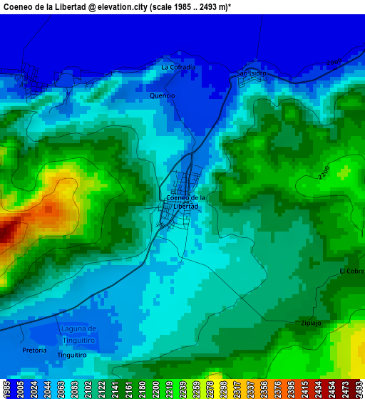
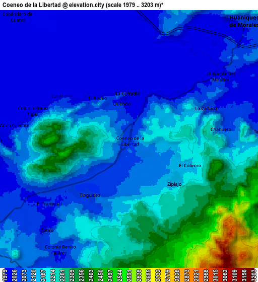
Below is the Elevation map of Coeneo de la Libertad, which displays elevation range with different colors. Scale of the first map is from 1985 to 2493 m (6512 to 8179 ft) with average elevation of 2103.7 meters (=6902 ft) [note 1]
These maps also provides idea of topography and contour of this city, they are displayed at different zoom levels. More info about maps, scale and edge coordinates you can find below images.
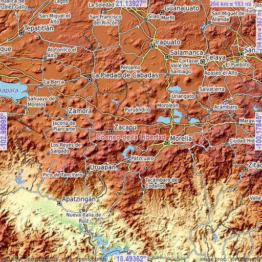
| \ | Map #1 | Map #2 | Topo.Map |
| Scale [m] | 1985..2493 m | 1979..3203 m | × |
| Scale [ft] | 6512..8179 ft | 6493..10509 ft | × |
| Average | 2103.7 m = 6902 ft | 2145.8 m = 7040 ft | × |
| Width | 9.19 km = 5.7 mi | 18.39 km = 11.4 mi | 294.2 km = 182.8 mi |
| Height | 9.19 km = 5.7 mi | 18.39 km = 11.4 mi | 294.2 km = 182.8 mi |
| ↑Max Latitude | 19.863286° | 19.904612° | 21.13927° |
| Latitude at center | 19.82195° | 19.82195° | 19.82195° |
| ↓Min Latitude | 19.780603° | 19.739245° | 18.49362° |
| ← Min Longitude | -101.628645° | -101.672591° | -102.99095° |
| Longitude center | -101.5847° | -101.5847° | -101.5847° |
| →Max Longitude | -101.540755° | -101.496809° | -100.17845° |
Nearby cities:
Cities around Coeneo de la Libertad sort by population:
• Santa Fé de la Laguna elevation 2053 m
16.9 km,  169°
169°
• Tiríndaro 1995 m
17.5 km,  251°
251°
• Huaniqueo de Morales 2049 m
11.8 km,  45°
45°
• Zipiajo 2141 m
4.5 km,  132°
132°
• Cantabria 1986 m
15 km,  277°
277°
• San Jerónimo Purenchecuaro 2065 m
16.1 km,  190°
190°
• Santiago Azajo 2264 m
16.7 km,  219°
219°
• Tarejero 2004 m
13.7 km,  268°
268°
• Comanjá 2083 m
13.9 km,  233°
233°
• Copándaro (Copándaro del Cuatro) 1991 m
11.7 km,  318°
318°
• Teremendo 2166 m
11.7 km,  110°
110°
• Bellas Fuentes 2002 m
9.9 km, 269°
Multilingual:
 En español:
Coeneo de la Libertad elevación 2043 m.
 En France:
Coeneo de la Libertad élévation 2043 m.
 Auf Deutsch:
Coeneo de la Libertad höhe über dem Meeresspiegel ist 2043 m.
 На русском:
Coeneo de la Libertad высота над уровнем моря 2043 м
Sources and notes:
- [note 1] Map square and city borders are not equal. Map elevation data is calculated only from area inside that square.
- [src 1] Elevation data from geonames database provided with same terms of usage.
- [src 2] The elevation map of Coeneo de la Libertad is generated using elevation data from NASA's 3 arcsec (90m) resolution SRTM data.
- [src 3] Base (background) map © OpenStreetMap contributors tiles are generated by Geofabrik and OpenTopoMap.
Copyright & License:
This Coeneo de la Libertad Elevation Map is licensed under CC BY-SA. You may reuse any part from this page, if you give a proper credit by linking to this URL:
 More info on terms of use page.