Franco elevation
Franco (Guanajuato, Silao de la Victoria), Mexico elevation is 1780 meters and Franco elevation in feet is 5840 ft above sea level [src 1]. Franco is a populated place (feature code) with elevation that is 466 meters (1529 ft) bigger than average city elevation in Mexico.
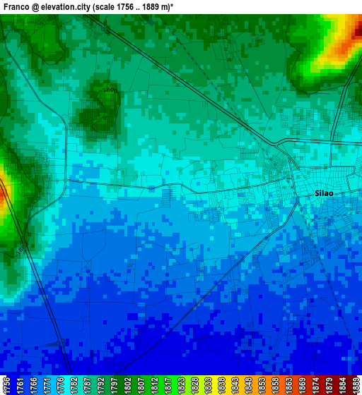
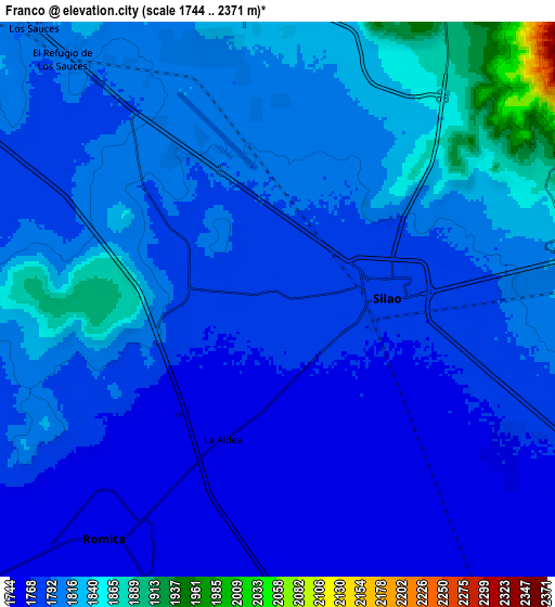
Below is the Elevation map of Franco, which displays elevation range with different colors. Scale of the first map is from 1756 to 1889 m (5761 to 6198 ft) with average elevation of 1780.2 meters (=5841 ft) [note 1]
These maps also provides idea of topography and contour of this city, they are displayed at different zoom levels. More info about maps, scale and edge coordinates you can find below images.
| \ | Map #1 | Map #2 | Topo.Map |
| Scale [m] | 1756..1889 m | 1744..2371 m | × |
| Scale [ft] | 5761..6198 ft | 5722..7779 ft | × |
| Average | 1780.2 m = 5841 ft | 1797.2 m = 5896 ft | × |
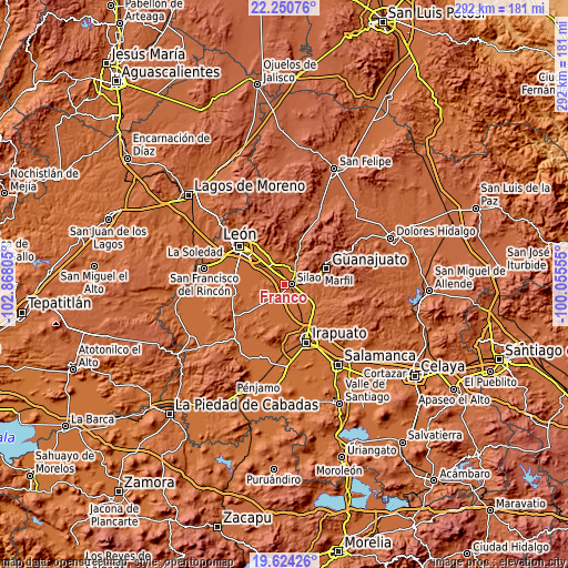
| Width | 9.13 km = 5.7 mi | 18.25 km = 11.3 mi | 292 km = 181.4 mi |
| Height | 9.13 km = 5.7 mi | 18.25 km = 11.3 mi | 292.1 km = 181.5 mi |
| ↑Max Latitude | 20.984306° | 21.025332° | 22.25076° |
| Latitude at center | 20.94327° | 20.94327° | 20.94327° |
| ↓Min Latitude | 20.902222° | 20.861163° | 19.62426° |
| ← Min Longitude | -101.505745° | -101.549691° | -102.86805° |
| Longitude center | -101.4618° | -101.4618° | -101.4618° |
| →Max Longitude | -101.417855° | -101.373909° | -100.05555° |
Nearby cities:
Cities around Franco sort by population:
• Silao elevation 1780 m
3.6 km,  89°
89°
• La Aldea 1760 m
4.9 km,  200°
200°
• El Coecillo 1796 m
3.9 km,  18°
18°
• Colonia Nuevo México 1797 m
5.2 km,  332°
332°
• Bajío de Bonillas 1787 m
3.5 km,  281°
281°
• San Antonio Texas 1798 m
5.5 km, 328°
• Los Medranos 1755 m
7.2 km,  158°
158°
• San Miguel del Arenal 1803 m
5.8 km, 334°
• Monte del Coecillo 1805 m
4.8 km,  34°
34°
• Colonia Francisco Javier Mina 1847 m
6.2 km,  49°
49°
• Colonia Rafael Corrales Ayala 1763 m
7.3 km,  230°
230°
• El Escoplo 1779 m
6.3 km, 234°
Multilingual:
 En español:
Franco elevación 1780 m.
 En France:
Franco élévation 1780 m.


Sources and notes:
- [note 1] Map square and city borders are not equal. Map elevation data is calculated only from area inside that square.
- [src 1] Elevation data from geonames database provided with same terms of usage.
- [src 2] The elevation map of Franco is generated using elevation data from NASA's 3 arcsec (90m) resolution SRTM data.
- [src 3] Base (background) map © OpenStreetMap contributors tiles are generated by Geofabrik and OpenTopoMap.
Copyright & License:
This Franco Elevation Map is licensed under CC BY-SA. You may reuse any part from this page, if you give a proper credit by linking to this URL:
 More info on terms of use page.