General Zuazua elevation
General Zuazua (Nuevo León), Mexico elevation is 363 meters and General Zuazua elevation in feet is 1191 ft above sea level [src 1]. General Zuazua is a seat of a second-order administrative division (feature code) with elevation that is 951 meters (3120 ft) smaller than average city elevation in Mexico.
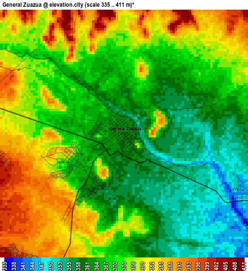
Below is the Elevation map of General Zuazua, which displays elevation range with different colors. Scale of the first map is from 335 to 411 m (1099 to 1348 ft) with average elevation of 370.4 meters (=1215 ft) [note 1]
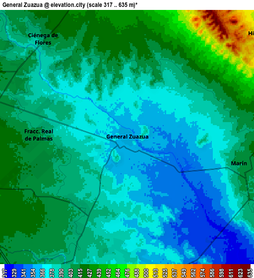
These maps also provides idea of topography and contour of this city, they are displayed at different zoom levels. More info about maps, scale and edge coordinates you can find below images.
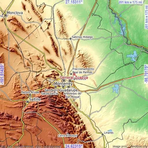
| \ | Map #1 | Map #2 | Topo.Map |
| Scale [m] | 335..411 m | 317..635 m | × |
| Scale [ft] | 1099..1348 ft | 1040..2083 ft | × |
| Average | 370.4 m = 1215 ft | 395.8 m = 1299 ft | × |
| Width | 8.79 km = 5.5 mi | 17.58 km = 10.9 mi | 281.3 km = 174.8 mi |
| Height | 8.79 km = 5.5 mi | 17.58 km = 10.9 mi | 281.3 km = 174.8 mi |
| ↑Max Latitude | 25.934436° | 25.97395° | 27.15311° |
| Latitude at center | 25.89491° | 25.89491° | 25.89491° |
| ↓Min Latitude | 25.85537° | 25.815817° | 24.62315° |
| ← Min Longitude | -100.151945° | -100.195891° | -101.51425° |
| Longitude center | -100.108° | -100.108° | -100.108° |
| →Max Longitude | -100.064055° | -100.020109° | -98.70175° |
Nearby cities:
Cities around General Zuazua sort by population:
• Fraccionamiento Real Palmas elevation 389 m
5.3 km,  281°
281°
• Ciénega de Flores 399 m
8.9 km,  318°
318°
• Real del Sol 409 m
8.8 km,  303°
303°
• Pesquería 334 m
13.4 km,  154°
154°
• Villas de Alcalá 403 m
8.1 km,  286°
286°
• Colinas del Aeropuerto 383 m
8.7 km,  176°
176°
• Hacienda San Pedro 398 m
5.9 km, 291°
• Marín 406 m
8 km,  102°
102°
• Portal de las Salinas 434 m
10.3 km,  340°
340°
• Ladrillera (Entronque Pesquería) 367 m
10.2 km, 176°
• Artemio Treviño 401 m
7.5 km,  207°
207°
• Higueras 496 m
11.8 km,  52°
52°
Multilingual:
 En español:
General Zuazua elevación 363 m.
 En France:
General Zuazua élévation 363 m.
 Auf Deutsch:
General Zuazua höhe über dem Meeresspiegel ist 363 m.

Sources and notes:
- [note 1] Map square and city borders are not equal. Map elevation data is calculated only from area inside that square.
- [src 1] Elevation data from geonames database provided with same terms of usage.
- [src 2] The elevation map of General Zuazua is generated using elevation data from NASA's 3 arcsec (90m) resolution SRTM data.
- [src 3] Base (background) map © OpenStreetMap contributors tiles are generated by Geofabrik and OpenTopoMap.
Copyright & License:
This General Zuazua Elevation Map is licensed under CC BY-SA. You may reuse any part from this page, if you give a proper credit by linking to this URL:
 More info on terms of use page.