La Piedad elevation
La Piedad (Michoacán), Mexico elevation is 1698 meters and La Piedad elevation in feet is 5571 ft above sea level [src 1]. La Piedad is a seat of a second-order administrative division (feature code) with elevation that is 384 meters (1260 ft) bigger than average city elevation in Mexico.
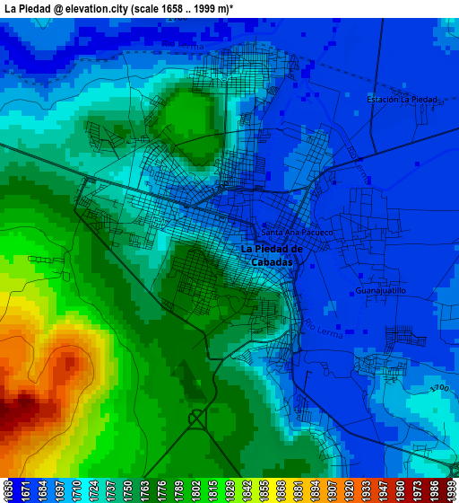
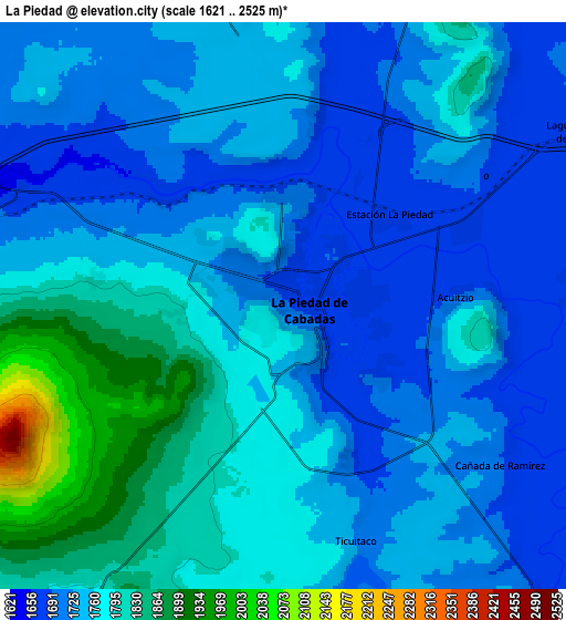
Below is the Elevation map of La Piedad, which displays elevation range with different colors. Scale of the first map is from 1658 to 1999 m (5440 to 6558 ft) with average elevation of 1732.7 meters (=5685 ft) [note 1]
These maps also provides idea of topography and contour of this city, they are displayed at different zoom levels. More info about maps, scale and edge coordinates you can find below images.
| \ | Map #1 | Map #2 | Topo.Map |
| Scale [m] | 1658..1999 m | 1621..2525 m | × |
| Scale [ft] | 5440..6558 ft | 5318..8284 ft | × |
| Average | 1732.7 m = 5685 ft | 1756.9 m = 5764 ft | × |
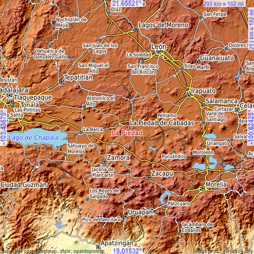
| Width | 9.16 km = 5.7 mi | 18.33 km = 11.4 mi | 293.2 km = 182.2 mi |
| Height | 9.16 km = 5.7 mi | 18.33 km = 11.4 mi | 293.2 km = 182.2 mi |
| ↑Max Latitude | 20.383589° | 20.424777° | 21.65521° |
| Latitude at center | 20.34239° | 20.34239° | 20.34239° |
| ↓Min Latitude | 20.30118° | 20.259959° | 19.01832° |
| ← Min Longitude | -102.074445° | -102.118391° | -103.43675° |
| Longitude center | -102.0305° | -102.0305° | -102.0305° |
| →Max Longitude | -101.986555° | -101.942609° | -100.62425° |
Nearby cities:
Cities around La Piedad sort by population:
• Santa Ana Pacueco elevation 1686 m
1.6 km,  70°
70°
• Numarán 1686 m
12.8 km,  138°
138°
• Laguna Larga de Cortés 1683 m
10.9 km,  59°
59°
• La Estrella 1680 m
12.6 km, 64°
• Las Cañadas 1719 m
7.4 km,  132°
132°
• Los Ocotes 1696 m
10.9 km,  41°
41°
• Río Grande 1678 m
2.6 km,  85°
85°
• El Fuerte 1673 m
5 km,  310°
310°
• Cañada de Ramírez 1703 m
8.7 km, 126°
• Los Guajes 1750 m
14.7 km,  232°
232°
• Estación la Piedad 1681 m
4.4 km,  50°
50°
• Colonia Morelos 1679 m
14 km,  78°
78°
Multilingual:
 En español:
Municipio La Piedad elevación 1698 m.
 En France:
La Piedad élévation 1698 m.
 Auf Deutsch:
La Piedad höhe über dem Meeresspiegel ist 1698 m.

Sources and notes:
- [note 1] Map square and city borders are not equal. Map elevation data is calculated only from area inside that square.
- [src 1] Elevation data from geonames database provided with same terms of usage.
- [src 2] The elevation map of La Piedad is generated using elevation data from NASA's 3 arcsec (90m) resolution SRTM data.
- [src 3] Base (background) map © OpenStreetMap contributors tiles are generated by Geofabrik and OpenTopoMap.
Copyright & License:
This La Piedad Elevation Map is licensed under CC BY-SA. You may reuse any part from this page, if you give a proper credit by linking to this URL:
 More info on terms of use page.