La Trinidad elevation
La Trinidad (Sinaloa, Guasave), Mexico elevation is 36 meters and La Trinidad elevation in feet is 118 ft above sea level [src 1]. La Trinidad is a populated place (feature code) with elevation that is 1278 meters (4193 ft) smaller than average city elevation in Mexico.
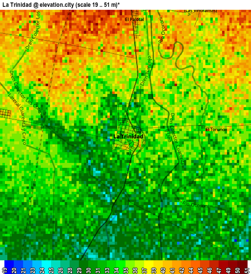
Below is the Elevation map of La Trinidad, which displays elevation range with different colors. Scale of the first map is from 19 to 51 m (62 to 167 ft) with average elevation of 34.8 meters (=114 ft) [note 1]
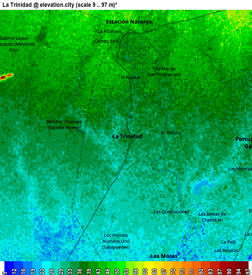
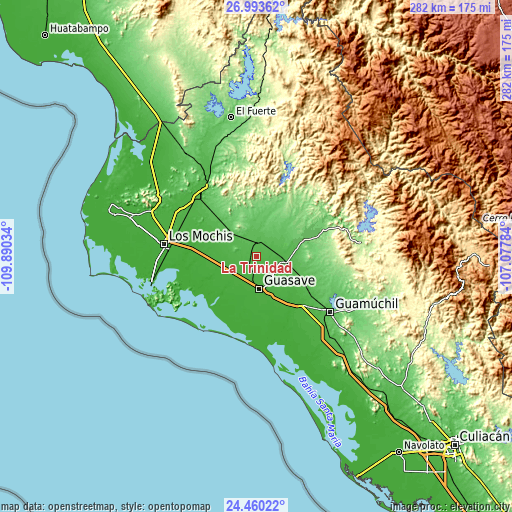
These maps also provides idea of topography and contour of this city, they are displayed at different zoom levels. More info about maps, scale and edge coordinates you can find below images.
| \ | Map #1 | Map #2 | Topo.Map |
| Scale [m] | 19..51 m | 9..97 m | × |
| Scale [ft] | 62..167 ft | 30..318 ft | × |
| Average | 34.8 m = 114 ft | 35.1 m = 115 ft | × |
| Width | 8.8 km = 5.5 mi | 17.61 km = 10.9 mi | 281.7 km = 175 mi |
| Height | 8.8 km = 5.5 mi | 17.61 km = 10.9 mi | 281.7 km = 175 mi |
| ↑Max Latitude | 25.77325° | 25.812817° | 26.99362° |
| Latitude at center | 25.73367° | 25.73367° | 25.73367° |
| ↓Min Latitude | 25.694077° | 25.65447° | 24.46022° |
| ← Min Longitude | -108.528035° | -108.571981° | -109.89034° |
| Longitude center | -108.48409° | -108.48409° | -108.48409° |
| →Max Longitude | -108.440145° | -108.396199° | -107.07784° |
Nearby cities:
Cities around La Trinidad sort by population:
• Naranjo elevation 54 m
8.1 km,  2°
2°
• El Varal (San Sebastián Número Uno) 27 m
11.7 km,  149°
149°
• Gabriel Leyva Velázquez 45 m
10.2 km,  308°
308°
• Alfonso G. Calderón Velarde 43 m
13.2 km,  295°
295°
• Portugués de Gálvez 37 m
8.9 km,  94°
94°
• Las Moras 29 m
8.9 km,  162°
162°
• Orba (Infiernito) 35 m
13.1 km,  112°
112°
• Las Quemazones 36 m
6.2 km, 149°
• El Sabino 29 m
10.7 km,  121°
121°
• La Presita 30 m
10.5 km,  253°
253°
• La Noria 31 m
2.8 km,  195°
195°
• Cruz Blanca 34 m
13.1 km, 120°
Multilingual:
 En español:
La Trinidad elevación 36 m.
 En France:
La Trinidad élévation 36 m.
 Auf Deutsch:
La Trinidad höhe über dem Meeresspiegel ist 36 m.

Sources and notes:
- [note 1] Map square and city borders are not equal. Map elevation data is calculated only from area inside that square.
- [src 1] Elevation data from geonames database provided with same terms of usage.
- [src 2] The elevation map of La Trinidad is generated using elevation data from NASA's 3 arcsec (90m) resolution SRTM data.
- [src 3] Base (background) map © OpenStreetMap contributors tiles are generated by Geofabrik and OpenTopoMap.
Copyright & License:
This La Trinidad Elevation Map is licensed under CC BY-SA. You may reuse any part from this page, if you give a proper credit by linking to this URL:
 More info on terms of use page.