Naranjo elevation
Naranjo (Sinaloa), Mexico elevation is 54 meters and Naranjo elevation in feet is 177 ft above sea level [src 1]. Naranjo is a populated place (feature code) with elevation that is 1260 meters (4134 ft) smaller than average city elevation in Mexico.
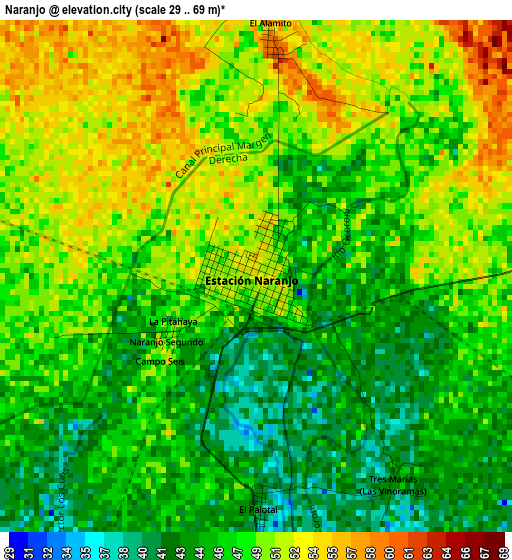
Below is the Elevation map of Naranjo, which displays elevation range with different colors. Scale of the first map is from 29 to 69 m (95 to 226 ft) with average elevation of 47.8 meters (=157 ft) [note 1]
These maps also provides idea of topography and contour of this city, they are displayed at different zoom levels. More info about maps, scale and edge coordinates you can find below images.
| \ | Map #1 | Map #2 | Topo.Map |
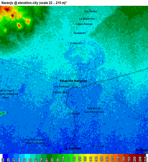
| Scale [m] | 29..69 m | 22..215 m | × |
| Scale [ft] | 95..226 ft | 72..705 ft | × |
| Average | 47.8 m = 157 ft | 52.9 m = 174 ft | × |
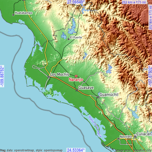
| Width | 8.8 km = 5.5 mi | 17.6 km = 10.9 mi | 281.5 km = 174.9 mi |
| Height | 8.8 km = 5.5 mi | 17.6 km = 10.9 mi | 281.5 km = 174.9 mi |
| ↑Max Latitude | 25.845886° | 25.885429° | 27.06549° |
| Latitude at center | 25.80633° | 25.80633° | 25.80633° |
| ↓Min Latitude | 25.766761° | 25.727178° | 24.53364° |
| ← Min Longitude | -108.525215° | -108.569161° | -109.88752° |
| Longitude center | -108.48127° | -108.48127° | -108.48127° |
| →Max Longitude | -108.437325° | -108.393379° | -107.07502° |
Nearby cities:
Cities around Naranjo sort by population:
• La Trinidad elevation 36 m
8.1 km,  182°
182°
• Genaro Estrada 97 m
16.7 km,  30°
30°
• Bamoa 41 m
17.6 km,  129°
129°
• Gabriel Leyva Velázquez 45 m
8.4 km,  258°
258°
• Alfonso G. Calderón Velarde 43 m
12.3 km, 259°
• Portugués de Gálvez 37 m
12.2 km,  135°
135°
• Las Moras 29 m
16.7 km,  172°
172°
• Las Quemazones 36 m
13.7 km, 167°
• El Sabino 29 m
16.3 km,  147°
147°
• La Presita 30 m
15.2 km,  223°
223°
• Concentración 5 de Febrero 61 m
15.8 km,  290°
290°
• La Noria 31 m
10.9 km,  185°
185°
Multilingual:
 En español:
Estación Naranjo elevación 54 m.
 En France:
Naranjo élévation 54 m.


Sources and notes:
- [note 1] Map square and city borders are not equal. Map elevation data is calculated only from area inside that square.
- [src 1] Elevation data from geonames database provided with same terms of usage.
- [src 2] The elevation map of Naranjo is generated using elevation data from NASA's 3 arcsec (90m) resolution SRTM data.
- [src 3] Base (background) map © OpenStreetMap contributors tiles are generated by Geofabrik and OpenTopoMap.
Copyright & License:
This Naranjo Elevation Map is licensed under CC BY-SA. You may reuse any part from this page, if you give a proper credit by linking to this URL:
 More info on terms of use page.