Mochicahui elevation
Mochicahui (Sinaloa, El Fuerte), Mexico elevation is 23 meters and Mochicahui elevation in feet is 75 ft above sea level [src 1]. Mochicahui is a populated place (feature code) with elevation that is 1291 meters (4236 ft) smaller than average city elevation in Mexico.
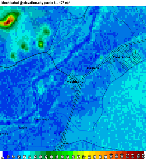
Below is the Elevation map of Mochicahui, which displays elevation range with different colors. Scale of the first map is from 8 to 127 m (26 to 417 ft) with average elevation of 22.3 meters (=73 ft) [note 1]
These maps also provides idea of topography and contour of this city, they are displayed at different zoom levels. More info about maps, scale and edge coordinates you can find below images.
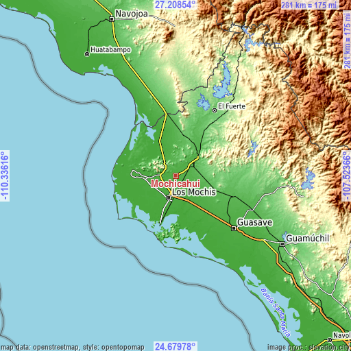
| \ | Map #1 | Map #2 | Topo.Map |
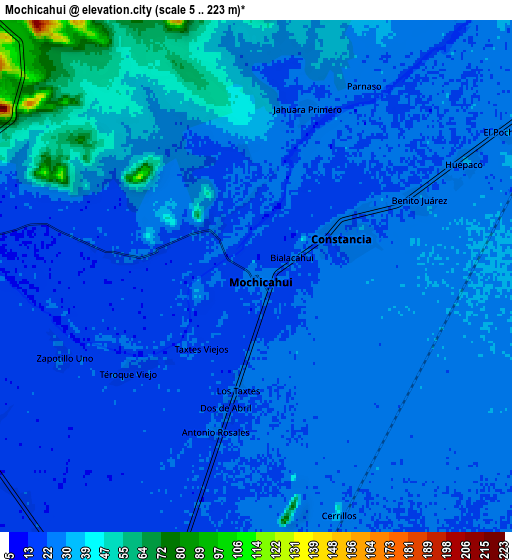
| Scale [m] | 8..127 m | 5..223 m | × |
| Scale [ft] | 26..417 ft | 16..732 ft | × |
| Average | 22.3 m = 73 ft | 27.1 m = 89 ft | × |
| Width | 8.79 km = 5.5 mi | 17.57 km = 10.9 mi | 281.2 km = 174.7 mi |
| Height | 8.79 km = 5.5 mi | 17.57 km = 10.9 mi | 281.2 km = 174.7 mi |
| ↑Max Latitude | 25.990458° | 26.029952° | 27.20854° |
| Latitude at center | 25.95095° | 25.95095° | 25.95095° |
| ↓Min Latitude | 25.911429° | 25.871895° | 24.67978° |
| ← Min Longitude | -108.973855° | -109.017801° | -110.33616° |
| Longitude center | -108.92991° | -108.92991° | -108.92991° |
| →Max Longitude | -108.885965° | -108.842019° | -107.52366° |
Nearby cities:
Cities around Mochicahui sort by population:
• Constancia elevation 26 m
3.3 km,  67°
67°
• San Miguel Zapotitlan 19 m
11.7 km,  268°
268°
• Cerrillos (Campo 35) 48 m
8.6 km,  160°
160°
• Ejido Cinco de Mayo 21 m
11.5 km,  194°
194°
• Benito Juárez (Vinatería) 30 m
6.2 km, 65°
• Taxtes 22 m
3.9 km, 188°
• Dos de Abril 21 m
4.6 km, 193°
• Gabriel Leyva Solano (Zapotillo Dos) 22 m
10.9 km,  226°
226°
• Higueras de los Natoches 19 m
4.8 km,  277°
277°
• Huepaco 25 m
7.9 km,  61°
61°
• El Pochotal 31 m
9.9 km, 60°
• Carricitos 26 m
2.8 km,  357°
357°
Multilingual:
 En español:
Mochicahui elevación 23 m.
 En France:
Mochicahui élévation 23 m.
 Auf Deutsch:
Mochicahui höhe über dem Meeresspiegel ist 23 m.

Sources and notes:
- [note 1] Map square and city borders are not equal. Map elevation data is calculated only from area inside that square.
- [src 1] Elevation data from geonames database provided with same terms of usage.
- [src 2] The elevation map of Mochicahui is generated using elevation data from NASA's 3 arcsec (90m) resolution SRTM data.
- [src 3] Base (background) map © OpenStreetMap contributors tiles are generated by Geofabrik and OpenTopoMap.
Copyright & License:
This Mochicahui Elevation Map is licensed under CC BY-SA. You may reuse any part from this page, if you give a proper credit by linking to this URL:
 More info on terms of use page.