San Miguel Zapotitlan elevation
San Miguel Zapotitlan (Sinaloa, Ahome), Mexico elevation is 19 meters and San Miguel Zapotitlan elevation in feet is 62 ft above sea level [src 1]. San Miguel Zapotitlan is a populated place (feature code) with elevation that is 1295 meters (4249 ft) smaller than average city elevation in Mexico.
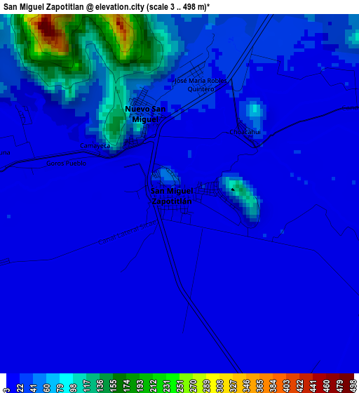
Below is the Elevation map of San Miguel Zapotitlan, which displays elevation range with different colors. Scale of the first map is from 3 to 498 m (10 to 1634 ft) with average elevation of 33 meters (=108 ft) [note 1]
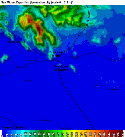
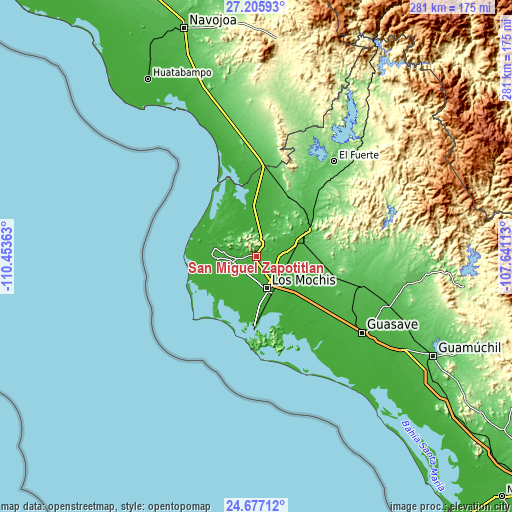
These maps also provides idea of topography and contour of this city, they are displayed at different zoom levels. More info about maps, scale and edge coordinates you can find below images.
| \ | Map #1 | Map #2 | Topo.Map |
| Scale [m] | 3..498 m | 0..614 m | × |
| Scale [ft] | 10..1634 ft | 0..2014 ft | × |
| Average | 33 m = 108 ft | 52.6 m = 173 ft | × |
| Width | 8.79 km = 5.5 mi | 17.57 km = 10.9 mi | 281.2 km = 174.7 mi |
| Height | 8.79 km = 5.5 mi | 17.57 km = 10.9 mi | 281.2 km = 174.7 mi |
| ↑Max Latitude | 25.987819° | 26.027314° | 27.20593° |
| Latitude at center | 25.94831° | 25.94831° | 25.94831° |
| ↓Min Latitude | 25.908788° | 25.869253° | 24.67712° |
| ← Min Longitude | -109.091325° | -109.135271° | -110.45363° |
| Longitude center | -109.04738° | -109.04738° | -109.04738° |
| →Max Longitude | -109.003435° | -108.959489° | -107.64113° |
Nearby cities:
Cities around San Miguel Zapotitlan sort by population:
• Bagojo Colectivo elevation 9 m
10.8 km,  220°
220°
• Nuevo San Miguel 18 m
1.8 km,  337°
337°
• El Guayabo 15 m
9.2 km,  265°
265°
• Heriberto Valdez Romero (El Guayabo) 19 m
9 km,  264°
264°
• Goros Número Dos 21 m
7.9 km,  177°
177°
• Gabriel Leyva Solano (Zapotillo Dos) 22 m
8.2 km,  152°
152°
• Flor Azul 18 m
9.6 km,  155°
155°
• Felipe Angeles 17 m
9 km, 175°
• Higueras de los Natoches 19 m
7.1 km,  82°
82°
• Ejido Tosalibampo 12 m
7.5 km,  299°
299°
• CERESO Nuevo 17 m
6.3 km, 175°
• Vallejo (Porvenir Vallejo) 16 m
7.7 km,  199°
199°
Multilingual:
 En español:
San Miguel Zapotitlan elevación 19 m.
 En France:
San Miguel Zapotitlan élévation 19 m.
 Auf Deutsch:
San Miguel Zapotitlan höhe über dem Meeresspiegel ist 19 m.
 На русском:
San Miguel Zapotitlan высота над уровнем моря 19 м
Sources and notes:
- [note 1] Map square and city borders are not equal. Map elevation data is calculated only from area inside that square.
- [src 1] Elevation data from geonames database provided with same terms of usage.
- [src 2] The elevation map of San Miguel Zapotitlan is generated using elevation data from NASA's 3 arcsec (90m) resolution SRTM data.
- [src 3] Base (background) map © OpenStreetMap contributors tiles are generated by Geofabrik and OpenTopoMap.
Copyright & License:
This San Miguel Zapotitlan Elevation Map is licensed under CC BY-SA. You may reuse any part from this page, if you give a proper credit by linking to this URL:
 More info on terms of use page.