Nazareno elevation
Nazareno (Durango, Lerdo), Mexico elevation is 1176 meters and Nazareno elevation in feet is 3858 ft above sea level [src 1]. Nazareno is a populated place (feature code) with elevation that is 138 meters (453 ft) smaller than average city elevation in Mexico.
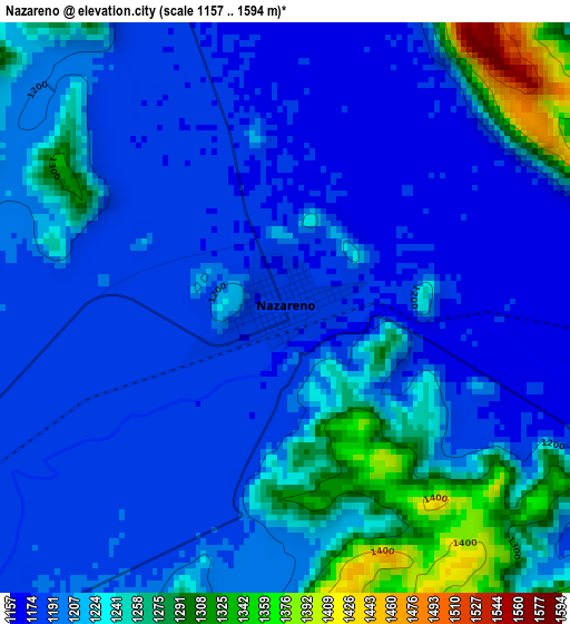
Below is the Elevation map of Nazareno, which displays elevation range with different colors. Scale of the first map is from 1157 to 1594 m (3796 to 5230 ft) with average elevation of 1213.2 meters (=3980 ft) [note 1]
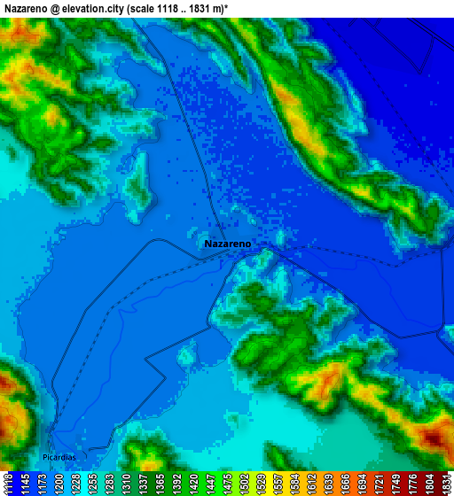
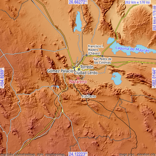
These maps also provides idea of topography and contour of this city, they are displayed at different zoom levels. More info about maps, scale and edge coordinates you can find below images.
| \ | Map #1 | Map #2 | Topo.Map |
| Scale [m] | 1157..1594 m | 1118..1831 m | × |
| Scale [ft] | 3796..5230 ft | 3668..6007 ft | × |
| Average | 1213.2 m = 3980 ft | 1250.6 m = 4103 ft | × |
| Width | 8.83 km = 5.5 mi | 17.66 km = 11 mi | 282.5 km = 175.5 mi |
| Height | 8.83 km = 5.5 mi | 17.66 km = 11 mi | 282.5 km = 175.5 mi |
| ↑Max Latitude | 25.438851° | 25.478529° | 26.66272° |
| Latitude at center | 25.39916° | 25.39916° | 25.39916° |
| ↓Min Latitude | 25.359456° | 25.319739° | 24.12223° |
| ← Min Longitude | -103.464595° | -103.508541° | -104.8269° |
| Longitude center | -103.42065° | -103.42065° | -103.42065° |
| →Max Longitude | -103.376705° | -103.332759° | -102.0144° |
Nearby cities:
Cities around Nazareno sort by population:
• Torreón elevation 1124 m
16.1 km,  0°
0°
• El Huarache (El Guarache) 1148 m
15 km,  333°
333°
• Villa de Guadalupe 1145 m
14.5 km, 331°
• Santo Niño Aguanaval 1141 m
14.7 km,  75°
75°
• Ventana 1201 m
9.9 km,  215°
215°
• Boquilla de las Perlas 1155 m
15.4 km,  120°
120°
• La Perla 1124 m
12.9 km,  32°
32°
• Álvaro Obregón 1139 m
15.3 km, 326°
• Rancho Alegre 1122 m
14.8 km,  39°
39°
• Picardías 1199 m
10.6 km, 218°
• Las Cuevas 1145 m
17 km,  310°
310°
• Las Mieleras 1143 m
15.4 km,  89°
89°
Multilingual:
 En español:
Nazareno elevación 1176 m.
 En France:
Nazareno élévation 1176 m.
 Auf Deutsch:
Nazareno höhe über dem Meeresspiegel ist 1176 m.

Sources and notes:
- [note 1] Map square and city borders are not equal. Map elevation data is calculated only from area inside that square.
- [src 1] Elevation data from geonames database provided with same terms of usage.
- [src 2] The elevation map of Nazareno is generated using elevation data from NASA's 3 arcsec (90m) resolution SRTM data.
- [src 3] Base (background) map © OpenStreetMap contributors tiles are generated by Geofabrik and OpenTopoMap.
Copyright & License:
This Nazareno Elevation Map is licensed under CC BY-SA. You may reuse any part from this page, if you give a proper credit by linking to this URL:
 More info on terms of use page.