San Andrés Ixtlán elevation
San Andrés Ixtlán (Jalisco, Gómez Farías), Mexico elevation is 1546 meters and San Andrés Ixtlán elevation in feet is 5072 ft above sea level [src 1]. San Andrés Ixtlán is a populated place (feature code) with elevation that is 232 meters (761 ft) bigger than average city elevation in Mexico.
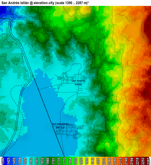
Below is the Elevation map of San Andrés Ixtlán, which displays elevation range with different colors. Scale of the first map is from 1390 to 2287 m (4560 to 7503 ft) with average elevation of 1716.8 meters (=5633 ft) [note 1]
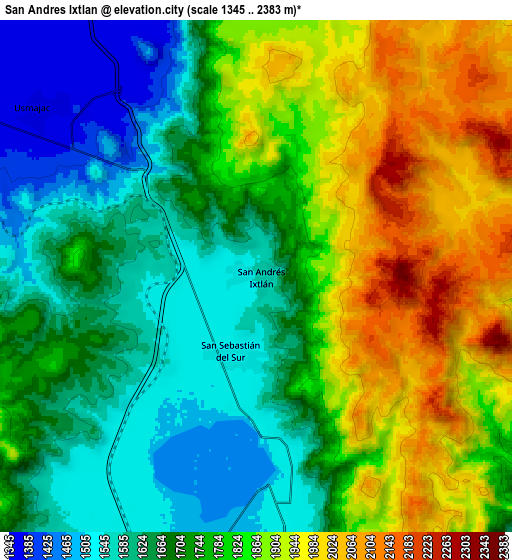
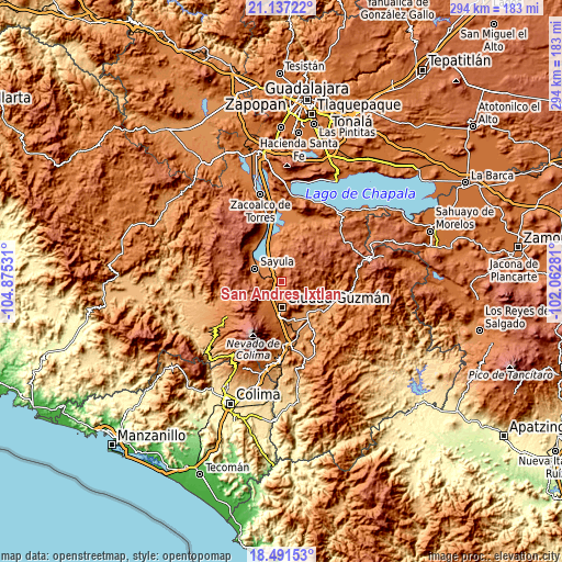
These maps also provides idea of topography and contour of this city, they are displayed at different zoom levels. More info about maps, scale and edge coordinates you can find below images.
| \ | Map #1 | Map #2 | Topo.Map |
| Scale [m] | 1390..2287 m | 1345..2383 m | × |
| Scale [ft] | 4560..7503 ft | 4413..7818 ft | × |
| Average | 1716.8 m = 5633 ft | 1760.6 m = 5776 ft | × |
| Width | 9.19 km = 5.7 mi | 18.39 km = 11.4 mi | 294.2 km = 182.8 mi |
| Height | 9.19 km = 5.7 mi | 18.39 km = 11.4 mi | 294.2 km = 182.8 mi |
| ↑Max Latitude | 19.861217° | 19.902543° | 21.13722° |
| Latitude at center | 19.81988° | 19.81988° | 19.81988° |
| ↓Min Latitude | 19.778532° | 19.737174° | 18.49153° |
| ← Min Longitude | -103.513005° | -103.556951° | -104.87531° |
| Longitude center | -103.46906° | -103.46906° | -103.46906° |
| →Max Longitude | -103.425115° | -103.381169° | -102.06281° |
Nearby cities:
Cities around San Andrés Ixtlán sort by population:
• Ciudad Guzmán elevation 1535 m
12.8 km,  176°
176°
• Sayula 1373 m
15.4 km,  296°
296°
• Zapotiltic 1318 m
22.1 km,  165°
165°
• Usmajac 1364 m
9.7 km,  309°
309°
• San Sebastián del Sur 1522 m
2.9 km,  188°
188°
• Atoyac 1356 m
21.7 km,  346°
346°
• Vista Hermosa 1177 m
19.5 km,  135°
135°
• Amacueca 1433 m
25.2 km,  327°
327°
• El Rincón 1250 m
18.3 km,  157°
157°
• Soyatlán de Afuera 1133 m
24.2 km,  126°
126°
• Ciudad Guzmán [CERESO] 1587 m
19 km, 189°
• Gómez Farías 1516 m
3 km, 194°
Multilingual:
 En español:
San Andrés Ixtlán elevación 1546 m.
 En France:
San Andrés Ixtlán élévation 1546 m.
 Auf Deutsch:
San Andrés Ixtlán höhe über dem Meeresspiegel ist 1546 m.
 На русском:
San Andrés Ixtlán высота над уровнем моря 1546 м
Sources and notes:
- [note 1] Map square and city borders are not equal. Map elevation data is calculated only from area inside that square.
- [src 1] Elevation data from geonames database provided with same terms of usage.
- [src 2] The elevation map of San Andrés Ixtlán is generated using elevation data from NASA's 3 arcsec (90m) resolution SRTM data.
- [src 3] Base (background) map © OpenStreetMap contributors tiles are generated by Geofabrik and OpenTopoMap.
Copyright & License:
This San Andrés Ixtlán Elevation Map is licensed under CC BY-SA. You may reuse any part from this page, if you give a proper credit by linking to this URL:
 More info on terms of use page.