Tepezalá elevation
Tepezalá (Aguascalientes), Mexico elevation is 2121 meters and Tepezalá elevation in feet is 6959 ft above sea level [src 1]. Tepezalá is a seat of a second-order administrative division (feature code) with elevation that is 807 meters (2648 ft) bigger than average city elevation in Mexico.
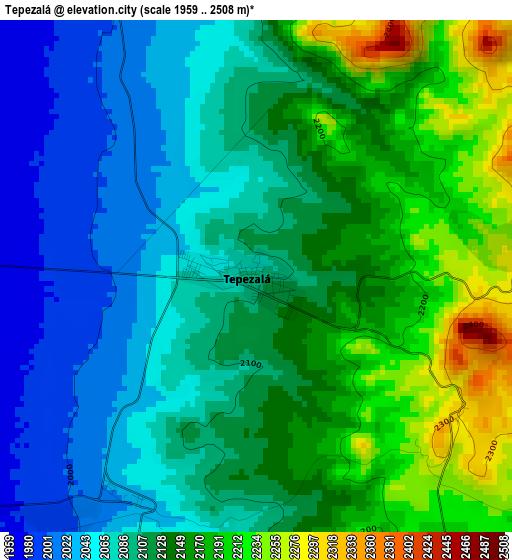
Below is the Elevation map of Tepezalá, which displays elevation range with different colors. Scale of the first map is from 1959 to 2508 m (6427 to 8228 ft) with average elevation of 2118.1 meters (=6949 ft) [note 1]
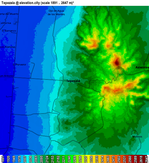
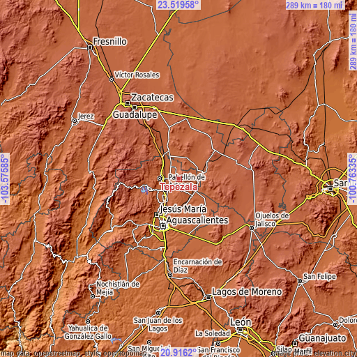
These maps also provides idea of topography and contour of this city, they are displayed at different zoom levels. More info about maps, scale and edge coordinates you can find below images.
| \ | Map #1 | Map #2 | Topo.Map |
| Scale [m] | 1959..2508 m | 1891..2647 m | × |
| Scale [ft] | 6427..8228 ft | 6204..8684 ft | × |
| Average | 2118.1 m = 6949 ft | 2081 m = 6827 ft | × |
| Width | 9.05 km = 5.6 mi | 18.09 km = 11.2 mi | 289.5 km = 179.9 mi |
| Height | 9.05 km = 5.6 mi | 18.09 km = 11.2 mi | 289.5 km = 179.9 mi |
| ↑Max Latitude | 22.264605° | 22.305268° | 23.51958° |
| Latitude at center | 22.22393° | 22.22393° | 22.22393° |
| ↓Min Latitude | 22.183243° | 22.142545° | 20.9162° |
| ← Min Longitude | -102.213545° | -102.257491° | -103.57585° |
| Longitude center | -102.1696° | -102.1696° | -102.1696° |
| →Max Longitude | -102.125655° | -102.081709° | -100.76335° |
Nearby cities:
Cities around Tepezalá sort by population:
• Pabellón de Arteaga elevation 1910 m
14 km,  232°
232°
• Asientos 2160 m
8.4 km,  79°
79°
• San Antonio 1918 m
8.3 km,  273°
273°
• San Jacinto 1949 m
15.3 km,  334°
334°
• Guadalupe de Atlas 2023 m
15 km,  71°
71°
• El Chayote 1928 m
10 km,  314°
314°
• El Bajío 1944 m
14.5 km,  279°
279°
• Carboneras 1911 m
9.1 km,  240°
240°
• Bimbaletes Aguascalientes (El Álamo) 2018 m
15.5 km,  85°
85°
• Molinos 2091 m
10.3 km,  131°
131°
• Noria del Borrego (Norias) 2032 m
14.9 km,  61°
61°
• Jarillas 2047 m
13.6 km,  53°
53°
Multilingual:
 En español:
Tepezala elevación 2121 m.
 En France:
Tepezalá élévation 2121 m.
 Auf Deutsch:
Tepezalá höhe über dem Meeresspiegel ist 2121 m.

Sources and notes:
- [note 1] Map square and city borders are not equal. Map elevation data is calculated only from area inside that square.
- [src 1] Elevation data from geonames database provided with same terms of usage.
- [src 2] The elevation map of Tepezalá is generated using elevation data from NASA's 3 arcsec (90m) resolution SRTM data.
- [src 3] Base (background) map © OpenStreetMap contributors tiles are generated by Geofabrik and OpenTopoMap.
Copyright & License:
This Tepezalá Elevation Map is licensed under CC BY-SA. You may reuse any part from this page, if you give a proper credit by linking to this URL:
 More info on terms of use page.