Yago elevation
Yago (Nayarit, Santiago Ixcuintla), Mexico elevation is 32 meters and Yago elevation in feet is 105 ft above sea level [src 1]. Yago is a populated place (feature code) with elevation that is 1282 meters (4206 ft) smaller than average city elevation in Mexico.
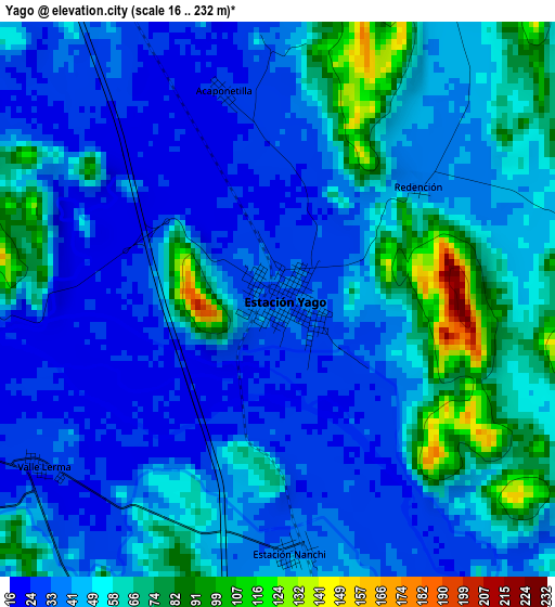
Below is the Elevation map of Yago, which displays elevation range with different colors. Scale of the first map is from 16 to 232 m (52 to 761 ft) with average elevation of 47.8 meters (=157 ft) [note 1]
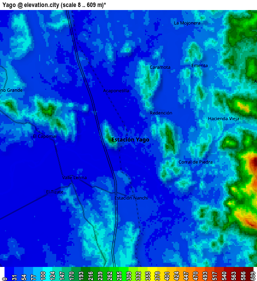
These maps also provides idea of topography and contour of this city, they are displayed at different zoom levels. More info about maps, scale and edge coordinates you can find below images.
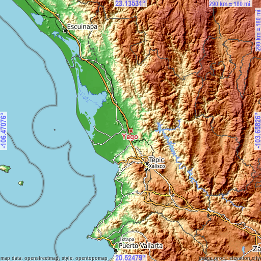
| \ | Map #1 | Map #2 | Topo.Map |
| Scale [m] | 16..232 m | 8..609 m | × |
| Scale [ft] | 52..761 ft | 26..1998 ft | × |
| Average | 47.8 m = 157 ft | 72.5 m = 238 ft | × |
| Width | 9.07 km = 5.6 mi | 18.14 km = 11.3 mi | 290.3 km = 180.4 mi |
| Height | 9.07 km = 5.6 mi | 18.14 km = 11.3 mi | 290.3 km = 180.4 mi |
| ↑Max Latitude | 21.876797° | 21.917571° | 23.13531° |
| Latitude at center | 21.83601° | 21.83601° | 21.83601° |
| ↓Min Latitude | 21.795212° | 21.754402° | 20.52479° |
| ← Min Longitude | -105.108455° | -105.152401° | -106.47076° |
| Longitude center | -105.06451° | -105.06451° | -105.06451° |
| →Max Longitude | -105.020565° | -104.976619° | -103.65826° |
Nearby cities:
Cities around Yago sort by population:
• Santiago Ixcuintla elevation 18 m
15.1 km,  260°
260°
• Ruíz 33 m
15.2 km,  327°
327°
• Villa Hidalgo 13 m
20.1 km,  238°
238°
• La Presa 18 m
14.7 km,  254°
254°
• Amapa 17 m
20.5 km, 253°
• Sauta 40 m
15.1 km,  212°
212°
• El Jicote 198 m
12.3 km,  176°
176°
• Colonia Emiliano Zapata 15 m
16 km,  267°
267°
• El Capomal 35 m
5.9 km, 273°
• El Tizate 24 m
6.6 km,  234°
234°
• El Venado 60 m
13.7 km,  28°
28°
• El Vado de San Pedro 24 m
17.2 km,  316°
316°
Multilingual:
 En español:
Yago elevación 32 m.
 En France:
Yago élévation 32 m.


Sources and notes:
- [note 1] Map square and city borders are not equal. Map elevation data is calculated only from area inside that square.
- [src 1] Elevation data from geonames database provided with same terms of usage.
- [src 2] The elevation map of Yago is generated using elevation data from NASA's 3 arcsec (90m) resolution SRTM data.
- [src 3] Base (background) map © OpenStreetMap contributors tiles are generated by Geofabrik and OpenTopoMap.
Copyright & License:
This Yago Elevation Map is licensed under CC BY-SA. You may reuse any part from this page, if you give a proper credit by linking to this URL:
 More info on terms of use page.