San Miguel Hila elevation
San Miguel Hila (State of Mexico, Nicolás Romero), Mexico elevation is 2418 meters and San Miguel Hila elevation in feet is 7933 ft above sea level [src 1]. San Miguel Hila is a populated place (feature code) with elevation that is 1104 meters (3622 ft) bigger than average city elevation in Mexico.
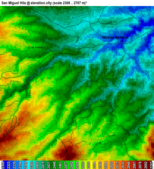
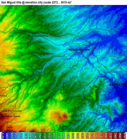
Below is the Elevation map of San Miguel Hila, which displays elevation range with different colors. Scale of the first map is from 2308 to 2707 m (7572 to 8881 ft) with average elevation of 2467.1 meters (=8094 ft) [note 1]
These maps also provides idea of topography and contour of this city, they are displayed at different zoom levels. More info about maps, scale and edge coordinates you can find below images.
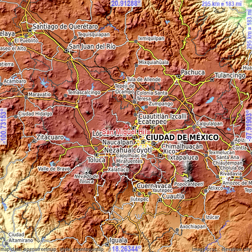
| \ | Map #1 | Map #2 | Topo.Map |
| Scale [m] | 2308..2707 m | 2272..3019 m | × |
| Scale [ft] | 7572..8881 ft | 7454..9905 ft | × |
| Average | 2467.1 m = 8094 ft | 2502.1 m = 8209 ft | × |
| Width | 9.21 km = 5.7 mi | 18.41 km = 11.4 mi | 294.6 km = 183.1 mi |
| Height | 9.21 km = 5.7 mi | 18.41 km = 11.4 mi | 294.6 km = 183.1 mi |
| ↑Max Latitude | 19.635005° | 19.67639° | 20.91288° |
| Latitude at center | 19.59361° | 19.59361° | 19.59361° |
| ↓Min Latitude | 19.552204° | 19.510787° | 18.26344° |
| ← Min Longitude | -99.369225° | -99.413171° | -100.73153° |
| Longitude center | -99.32528° | -99.32528° | -99.32528° |
| →Max Longitude | -99.281335° | -99.237389° | -97.91903° |
Nearby cities:
Cities around San Miguel Hila sort by population:
• Ciudad López Mateos elevation 2345 m
8.2 km,  118°
118°
• Nicolás Romero 2404 m
5.7 km,  19°
19°
• Veintidós de Febrero 2469 m
3 km,  311°
311°
• Progreso Industrial 2451 m
5.8 km,  325°
325°
• Loma Larga 2418 m
4.4 km, 329°
• Colonia Morelos 2511 m
5.1 km,  343°
343°
• Loma de San José 2476 m
5.4 km,  357°
357°
• Caja de Agua 2594 m
6.9 km,  323°
323°
• Ejido de Guadalupe 2360 m
7.4 km,  48°
48°
• Loma del Río 2469 m
2.8 km,  286°
286°
• Loma de Guadalupe (La Biznaga) 2591 m
7.9 km, 325°
• Ejido Miraflores 2679 m
8 km,  250°
250°
Multilingual:
 En español:
San Miguel Hila elevación 2418 m.
 En France:
San Miguel Hila élévation 2418 m.
 Auf Deutsch:
San Miguel Hila höhe über dem Meeresspiegel ist 2418 m.

Sources and notes:
- [note 1] Map square and city borders are not equal. Map elevation data is calculated only from area inside that square.
- [src 1] Elevation data from geonames database provided with same terms of usage.
- [src 2] The elevation map of San Miguel Hila is generated using elevation data from NASA's 3 arcsec (90m) resolution SRTM data.
- [src 3] Base (background) map © OpenStreetMap contributors tiles are generated by Geofabrik and OpenTopoMap.
Copyright & License:
This San Miguel Hila Elevation Map is licensed under CC BY-SA. You may reuse any part from this page, if you give a proper credit by linking to this URL:
 More info on terms of use page.