Mina México elevation
Mina México (State of Mexico, Almoloya de Juárez), Mexico elevation is 2610 meters and Mina México elevation in feet is 8563 ft above sea level [src 1]. Mina México is a populated place (feature code) with elevation that is 1296 meters (4252 ft) bigger than average city elevation in Mexico.
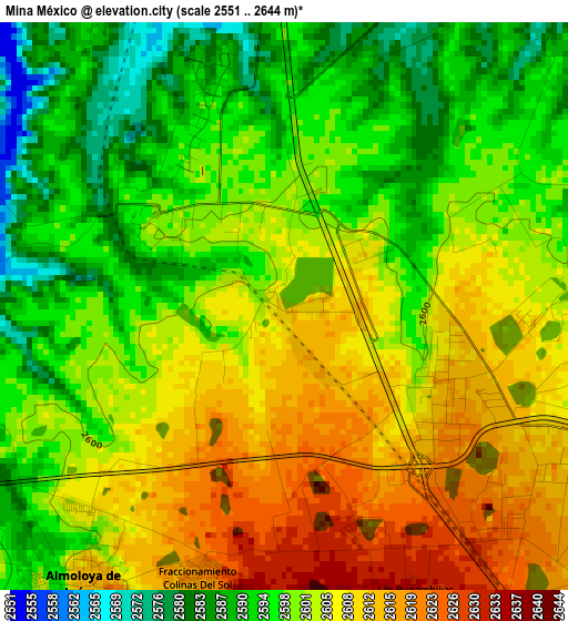
Below is the Elevation map of Mina México, which displays elevation range with different colors. Scale of the first map is from 2551 to 2644 m (8369 to 8675 ft) with average elevation of 2601.3 meters (=8534 ft) [note 1]
These maps also provides idea of topography and contour of this city, they are displayed at different zoom levels. More info about maps, scale and edge coordinates you can find below images.
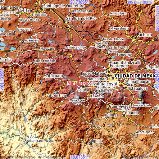
| \ | Map #1 | Topo.Map |
| Scale [m] | 2551..2644 m | × |
| Scale [ft] | 8369..8675 ft | × |
| Average | 2601.3 m = 8534 ft | × |
| Width | 9.22 km = 5.7 mi | 294.9 km = 183.2 mi |
| Height | 9.22 km = 5.7 mi | 294.9 km = 183.2 mi |
| ↑Max Latitude | 19.451582° | 20.73095° |
| Latitude at center | 19.41014° | 19.41014° |
| ↓Min Latitude | 19.368687° | 18.07851° |
| ← Min Longitude | -99.771655° | -101.13396° |
| Longitude center | -99.72771° | -99.72771° |
| →Max Longitude | -99.683765° | -98.32146° |
Nearby cities:
Cities around Mina México sort by population:
• Fraccionamiento Colinas del Sol elevation 2622 m
4.4 km,  197°
197°
• La Cabecera 2632 m
6.4 km, 199°
• Mayorazgo de León 2594 m
6.7 km,  345°
345°
• Villa de Almoloya de Juárez 2615 m
5.6 km,  215°
215°
• San Martín Toltepec 2685 m
6.9 km,  160°
160°
• Barrio de Jesús Fracción Primera 2619 m
6.4 km,  137°
137°
• Santa Juana Centro 2596 m
2.9 km,  302°
302°
• Santa Juana Primera Sección 2603 m
3.4 km,  228°
228°
• Barrio Bordo Nuevo 2606 m
6.7 km,  121°
121°
• Sebastián Lerdo de Tejada 2623 m
2.3 km,  173°
173°
• Colonia Aviación Autopan 2622 m
5 km,  133°
133°
• San Carlos Autopan 2614 m
5 km, 122°
Multilingual:
 En español:
Mina México elevación 2610 m.
 En France:
Mina México élévation 2610 m.
 Auf Deutsch:
Mina México höhe über dem Meeresspiegel ist 2610 m.

Sources and notes:
- [note 1] Map square and city borders are not equal. Map elevation data is calculated only from area inside that square.
- [src 1] Elevation data from geonames database provided with same terms of usage.
- [src 2] The elevation map of Mina México is generated using elevation data from NASA's 3 arcsec (90m) resolution SRTM data.
- [src 3] Base (background) map © OpenStreetMap contributors tiles are generated by Geofabrik and OpenTopoMap.
Copyright & License:
This Mina México Elevation Map is licensed under CC BY-SA. You may reuse any part from this page, if you give a proper credit by linking to this URL:
 More info on terms of use page.