La Huanica elevation
La Huanica (Morelos), Mexico elevation is 2811 meters and La Huanica elevation in feet is 9222 ft above sea level [src 1]. La Huanica is a populated place (feature code) with elevation that is 1497 meters (4911 ft) bigger than average city elevation in Mexico.
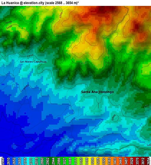
Below is the Elevation map of La Huanica, which displays elevation range with different colors. Scale of the first map is from 2568 to 3654 m (8425 to 11988 ft) with average elevation of 2900.2 meters (=9515 ft) [note 1]
These maps also provides idea of topography and contour of this city, they are displayed at different zoom levels. More info about maps, scale and edge coordinates you can find below images.
| \ | Map #1 | Topo.Map |
| Scale [m] | 2568..3654 m | × |
| Scale [ft] | 8425..11988 ft | × |
| Average | 2900.2 m = 9515 ft | × |
| Width | 9.21 km = 5.7 mi | 294.8 km = 183.2 mi |
| Height | 9.21 km = 5.7 mi | 294.9 km = 183.2 mi |
| ↑Max Latitude | 19.50099° | 20.77996° |
| Latitude at center | 19.45956° | 19.45956° |
| ↓Min Latitude | 19.41812° | 18.12832° |
| ← Min Longitude | -99.544735° | -100.90704° |
| Longitude center | -99.50079° | -99.50079° |
| →Max Longitude | -99.456845° | -98.09454° |
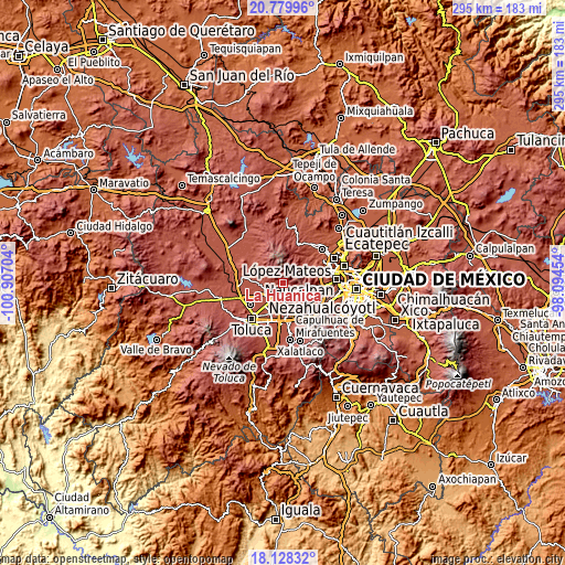
Nearby cities:
Cities around La Huanica sort by population:
• Santa María Zolotepec elevation 2636 m
4.8 km,  170°
170°
• Santa Ana Jilotzingo 2841 m
1.4 km,  106°
106°
• San Miguel Mimlapan 2897 m
4.1 km, 107°
• San Mateo Mozoquilpan 2607 m
6.3 km,  243°
243°
• San Agustín Mimbres 2630 m
5.9 km,  260°
260°
• Santa Ana Mayorazgo 2604 m
3.6 km,  200°
200°
• San Mateo Capulhuac 2777 m
2.9 km,  294°
294°
• Ejido de Mozoquilpan 2615 m
4.9 km,  216°
216°
• Santiago Tejocotillos 2908 m
5.9 km,  119°
119°
• La Concepción de Hidalgo 2657 m
3.4 km,  252°
252°
• Barrio de San Juan 2581 m
6.3 km, 217°
• San Agustín Huitzizilapan 2832 m
5.9 km,  138°
138°
Multilingual:
 En español:
La Huanica elevación 2811 m.
 En France:
La Huanica élévation 2811 m.
 Auf Deutsch:
La Huanica höhe über dem Meeresspiegel ist 2811 m.

Sources and notes:
- [note 1] Map square and city borders are not equal. Map elevation data is calculated only from area inside that square.
- [src 1] Elevation data from geonames database provided with same terms of usage.
- [src 2] The elevation map of La Huanica is generated using elevation data from NASA's 3 arcsec (90m) resolution SRTM data.
- [src 3] Base (background) map © OpenStreetMap contributors tiles are generated by Geofabrik and OpenTopoMap.
Copyright & License:
This La Huanica Elevation Map is licensed under CC BY-SA. You may reuse any part from this page, if you give a proper credit by linking to this URL:
 More info on terms of use page.