Santiago Tejocotillos elevation
Santiago Tejocotillos (State of Mexico, Xonacatlan), Mexico elevation is 2908 meters and Santiago Tejocotillos elevation in feet is 9541 ft above sea level [src 1]. Santiago Tejocotillos is a populated place (feature code) with elevation that is 1594 meters (5230 ft) bigger than average city elevation in Mexico.
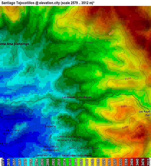
Below is the Elevation map of Santiago Tejocotillos, which displays elevation range with different colors. Scale of the first map is from 2579 to 3512 m (8461 to 11522 ft) with average elevation of 2966.9 meters (=9734 ft) [note 1]
These maps also provides idea of topography and contour of this city, they are displayed at different zoom levels. More info about maps, scale and edge coordinates you can find below images.
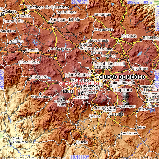
| \ | Map #1 | Topo.Map |
| Scale [m] | 2579..3512 m | × |
| Scale [ft] | 8461..11522 ft | × |
| Average | 2966.9 m = 9734 ft | × |
| Width | 9.22 km = 5.7 mi | 294.9 km = 183.2 mi |
| Height | 9.22 km = 5.7 mi | 294.9 km = 183.2 mi |
| ↑Max Latitude | 19.474516° | 20.7537° |
| Latitude at center | 19.43308° | 19.43308° |
| ↓Min Latitude | 19.391633° | 18.10163° |
| ← Min Longitude | -99.495495° | -100.8578° |
| Longitude center | -99.45155° | -99.45155° |
| →Max Longitude | -99.407605° | -98.0453° |
Nearby cities:
Cities around Santiago Tejocotillos sort by population:
• Santa María Zolotepec elevation 2636 m
4.7 km,  248°
248°
• Santa Ana Jilotzingo 2841 m
4.6 km,  303°
303°
• San Miguel Mimlapan 2897 m
2.1 km,  323°
323°
• San Pedro Huitzizilapan 2620 m
4.1 km,  222°
222°
• Santa María Tlalmimilolpan 2740 m
5.1 km,  203°
203°
• Colonia Guadalupe Victoria (La Capilla) 2860 m
3.4 km,  184°
184°
• La Concepción Xochicuautla 2890 m
5.8 km,  168°
168°
• Colonia Adolfo López Mateos 2815 m
3.7 km,  192°
192°
• Zacamulpa Tlalmimilolpan 2805 m
4.9 km, 173°
• Santa Cruz Huitzizilapan 2842 m
4 km, 174°
• San Agustín Huitzizilapan 2832 m
1.9 km, 220°
• La Unidad Huitzizilapan 3087 m
5.8 km,  102°
102°
Multilingual:
 En español:
Santiago Tejocotillos, Tejocotillos elevación 2908 m.
 En France:
Santiago Tejocotillos élévation 2908 m.
 Auf Deutsch:
Santiago Tejocotillos höhe über dem Meeresspiegel ist 2908 m.
 На русском:
Santiago Tejocotillos высота над уровнем моря 2908 м
Sources and notes:
- [note 1] Map square and city borders are not equal. Map elevation data is calculated only from area inside that square.
- [src 1] Elevation data from geonames database provided with same terms of usage.
- [src 2] The elevation map of Santiago Tejocotillos is generated using elevation data from NASA's 3 arcsec (90m) resolution SRTM data.
- [src 3] Base (background) map © OpenStreetMap contributors tiles are generated by Geofabrik and OpenTopoMap.
Copyright & License:
This Santiago Tejocotillos Elevation Map is licensed under CC BY-SA. You may reuse any part from this page, if you give a proper credit by linking to this URL:
 More info on terms of use page.