Emilio Portes Gil elevation
Emilio Portes Gil (State of Mexico, San Felipe del Progreso), Mexico elevation is 2560 meters and Emilio Portes Gil elevation in feet is 8399 ft above sea level [src 1]. Emilio Portes Gil is a populated place (feature code) with elevation that is 1246 meters (4088 ft) bigger than average city elevation in Mexico.
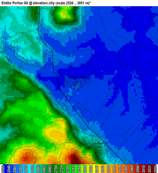
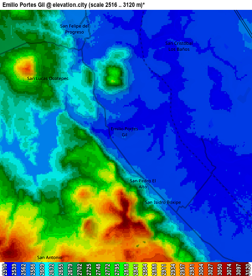
Below is the Elevation map of Emilio Portes Gil, which displays elevation range with different colors. Scale of the first map is from 2520 to 3051 m (8268 to 10010 ft) with average elevation of 2615.5 meters (=8581 ft) [note 1]
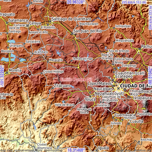
These maps also provides idea of topography and contour of this city, they are displayed at different zoom levels. More info about maps, scale and edge coordinates you can find below images.
| \ | Map #1 | Map #2 | Topo.Map |
| Scale [m] | 2520..3051 m | 2516..3120 m | × |
| Scale [ft] | 8268..10010 ft | 8255..10236 ft | × |
| Average | 2615.5 m = 8581 ft | 2648.5 m = 8689 ft | × |
| Width | 9.2 km = 5.7 mi | 18.41 km = 11.4 mi | 294.5 km = 183 mi |
| Height | 9.2 km = 5.7 mi | 18.41 km = 11.4 mi | 294.5 km = 183 mi |
| ↑Max Latitude | 19.685822° | 19.727194° | 20.96328° |
| Latitude at center | 19.64444° | 19.64444° | 19.64444° |
| ↓Min Latitude | 19.603047° | 19.561644° | 18.31468° |
| ← Min Longitude | -99.960615° | -100.004561° | -101.32292° |
| Longitude center | -99.91667° | -99.91667° | -99.91667° |
| →Max Longitude | -99.872725° | -99.828779° | -98.51042° |
Nearby cities:
Cities around Emilio Portes Gil sort by population:
• San Agustín Mextepec elevation 2587 m
1.6 km,  218°
218°
• Dolores Hidalgo 2556 m
1.6 km,  319°
319°
• San Lucas Ocotepec 2722 m
6.9 km,  303°
303°
• Jalpa de los Baños 2549 m
5.9 km,  49°
49°
• San Juan Jalpa Centro 2582 m
6.1 km,  346°
346°
• San Jerónimo Bonchete 2769 m
3.7 km,  246°
246°
• San Isidro Boxipe 2579 m
5.5 km,  150°
150°
• Palmillas 2561 m
6.5 km,  327°
327°
• Santa Cruz Mextepec 2577 m
4.2 km,  294°
294°
• La Cabecera Concepción 2564 m
7.1 km,  338°
338°
• San Juan Cote Ejido 2765 m
6.2 km,  225°
225°
• Barrio Tepetitlán Emilio Portes Gil 2536 m
3.3 km,  73°
73°
Multilingual:
 En español:
Emilio Portes Gil elevación 2560 m.
 En France:
Emilio Portes Gil élévation 2560 m.
 Auf Deutsch:
Emilio Portes Gil höhe über dem Meeresspiegel ist 2560 m.
 На русском:
Emilio Portes Gil высота над уровнем моря 2560 м
Sources and notes:
- [note 1] Map square and city borders are not equal. Map elevation data is calculated only from area inside that square.
- [src 1] Elevation data from geonames database provided with same terms of usage.
- [src 2] The elevation map of Emilio Portes Gil is generated using elevation data from NASA's 3 arcsec (90m) resolution SRTM data.
- [src 3] Base (background) map © OpenStreetMap contributors tiles are generated by Geofabrik and OpenTopoMap.
Copyright & License:
This Emilio Portes Gil Elevation Map is licensed under CC BY-SA. You may reuse any part from this page, if you give a proper credit by linking to this URL:
 More info on terms of use page.