Las Vigas elevation
Las Vigas (Guerrero, San Marcos), Mexico elevation is 34 meters and Las Vigas elevation in feet is 112 ft above sea level [src 1]. Las Vigas is a populated place (feature code) with elevation that is 1280 meters (4199 ft) smaller than average city elevation in Mexico.
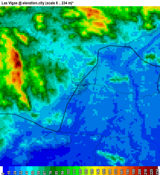
Below is the Elevation map of Las Vigas, which displays elevation range with different colors. Scale of the first map is from 6 to 234 m (20 to 768 ft) with average elevation of 52.4 meters (=172 ft) [note 1]
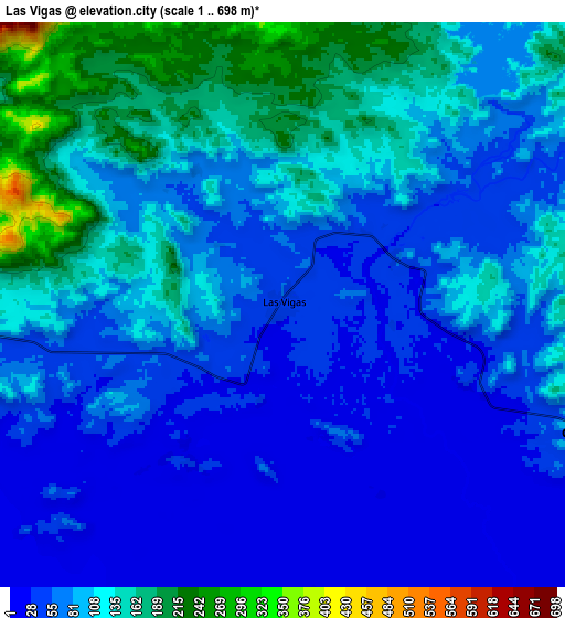
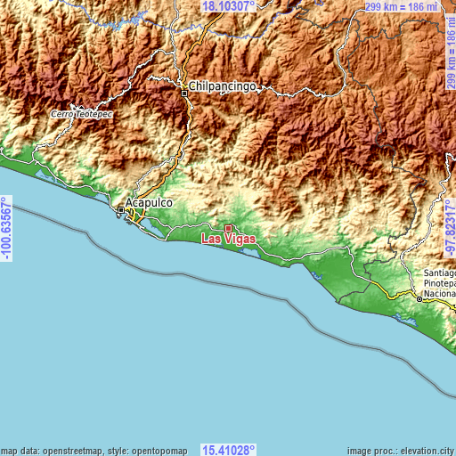
These maps also provides idea of topography and contour of this city, they are displayed at different zoom levels. More info about maps, scale and edge coordinates you can find below images.
| \ | Map #1 | Map #2 | Topo.Map |
| Scale [m] | 6..234 m | 1..698 m | × |
| Scale [ft] | 20..768 ft | 3..2290 ft | × |
| Average | 52.4 m = 172 ft | 86.9 m = 285 ft | × |
| Width | 9.36 km = 5.8 mi | 18.71 km = 11.6 mi | 299.4 km = 186 mi |
| Height | 9.36 km = 5.8 mi | 18.71 km = 11.6 mi | 299.4 km = 186 mi |
| ↑Max Latitude | 16.803514° | 16.845578° | 18.10307° |
| Latitude at center | 16.76144° | 16.76144° | 16.76144° |
| ↓Min Latitude | 16.719357° | 16.677265° | 15.41028° |
| ← Min Longitude | -99.273365° | -99.317311° | -100.63567° |
| Longitude center | -99.22942° | -99.22942° | -99.22942° |
| →Max Longitude | -99.185475° | -99.141529° | -97.82317° |
Nearby cities:
Cities around Las Vigas sort by population:
• San Marcos elevation 90 m
17.5 km,  283°
283°
• Cruz Grande 52 m
12.1 km,  111°
111°
• Cuautepec 200 m
24.2 km,  93°
93°
• Huamuchapa 727 m
22.4 km,  334°
334°
• Tonalá 327 m
21.7 km,  59°
59°
• La Azozuca 219 m
21 km,  71°
71°
• Jalapa 45 m
19.3 km, 106°
• Villa Hermosa 762 m
22.4 km, 331°
• La Dicha 336 m
23.3 km, 88°
• Rancho Viejo 378 m
13.2 km, 330°
• Tutepec 196 m
19.4 km,  23°
23°
• El Mesón 262 m
20.4 km, 62°
Multilingual:
 En español:
Las Vigas elevación 34 m.
 En France:
Las Vigas élévation 34 m.
 Auf Deutsch:
Las Vigas höhe über dem Meeresspiegel ist 34 m.

Sources and notes:
- [note 1] Map square and city borders are not equal. Map elevation data is calculated only from area inside that square.
- [src 1] Elevation data from geonames database provided with same terms of usage.
- [src 2] The elevation map of Las Vigas is generated using elevation data from NASA's 3 arcsec (90m) resolution SRTM data.
- [src 3] Base (background) map © OpenStreetMap contributors tiles are generated by Geofabrik and OpenTopoMap.
Copyright & License:
This Las Vigas Elevation Map is licensed under CC BY-SA. You may reuse any part from this page, if you give a proper credit by linking to this URL:
 More info on terms of use page.