Tehuitzingo elevation
Tehuitzingo (Puebla), Mexico elevation is 1074 meters and Tehuitzingo elevation in feet is 3524 ft above sea level [src 1]. Tehuitzingo is a populated place (feature code) with elevation that is 240 meters (787 ft) smaller than average city elevation in Mexico.
Below is the Elevation map of Tehuitzingo, which displays elevation range with different colors. Scale of the first map is from 992 to 1324 m (3255 to 4344 ft) with average elevation of 1109.9 meters (=3641 ft) [note 1]
These maps also provides idea of topography and contour of this city, they are displayed at different zoom levels. More info about maps, scale and edge coordinates you can find below images.
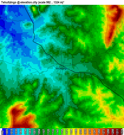
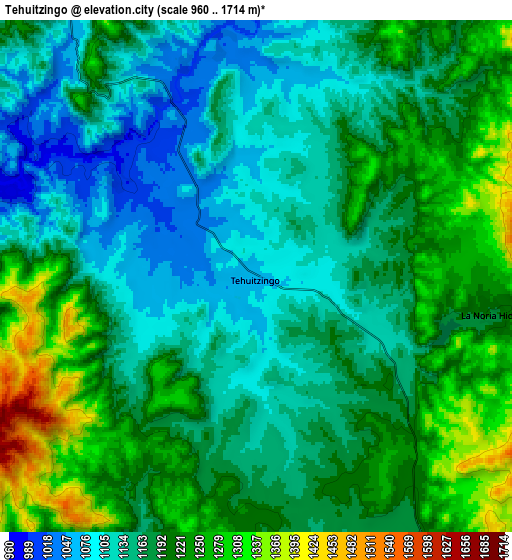
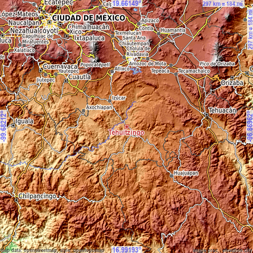
| \ | Map #1 | Map #2 | Topo.Map |
| Scale [m] | 992..1324 m | 960..1714 m | × |
| Scale [ft] | 3255..4344 ft | 3150..5623 ft | × |
| Average | 1109.9 m = 3641 ft | 1181.6 m = 3877 ft | × |
| Width | 9.28 km = 5.8 mi | 18.55 km = 11.5 mi | 296.8 km = 184.4 mi |
| Height | 9.28 km = 5.8 mi | 18.55 km = 11.5 mi | 296.8 km = 184.4 mi |
| ↑Max Latitude | 18.37357° | 18.41527° | 19.66149° |
| Latitude at center | 18.33186° | 18.33186° | 18.33186° |
| ↓Min Latitude | 18.29014° | 18.24841° | 16.99193° |
| ← Min Longitude | -98.319815° | -98.363761° | -99.68212° |
| Longitude center | -98.27587° | -98.27587° | -98.27587° |
| →Max Longitude | -98.231925° | -98.187979° | -96.86962° |
Nearby cities:
Cities around Tehuitzingo sort by population:
• Acatlán de Osorio elevation 1185 m
28 km,  120°
120°
• San Vicente Boquerón 1286 m
24 km,  103°
103°
• Tecomatlán 922 m
25 km,  189°
189°
• Amatitlán de Azueta 1165 m
27.3 km,  129°
129°
• Chinantla 1110 m
14.6 km,  175°
175°
• Piaxtla 1112 m
14.9 km,  171°
171°
• San Pedro Cuayuca 1226 m
19.4 km,  30°
30°
• Ahuehuetitla 1201 m
14.5 km,  155°
155°
• Hermenegildo Galeana 1382 m
20.1 km,  114°
114°
• Tetelcingo 1208 m
28.3 km, 111°
• Ahuatlán 1286 m
26.9 km,  4°
4°
• Axutla 888 m
19.9 km,  217°
217°
Multilingual:
 En español:
Tehuitzingo elevación 1074 m.
 En France:
Tehuitzingo élévation 1074 m.
 Auf Deutsch:
Tehuitzingo höhe über dem Meeresspiegel ist 1074 m.

Sources and notes:
- [note 1] Map square and city borders are not equal. Map elevation data is calculated only from area inside that square.
- [src 1] Elevation data from geonames database provided with same terms of usage.
- [src 2] The elevation map of Tehuitzingo is generated using elevation data from NASA's 3 arcsec (90m) resolution SRTM data.
- [src 3] Base (background) map © OpenStreetMap contributors tiles are generated by Geofabrik and OpenTopoMap.
Copyright & License:
This Tehuitzingo Elevation Map is licensed under CC BY-SA. You may reuse any part from this page, if you give a proper credit by linking to this URL:
 More info on terms of use page.