San Bartolomé elevation
San Bartolomé (Puebla, Quecholac), Mexico elevation is 2202 meters and San Bartolomé elevation in feet is 7224 ft above sea level [src 1]. San Bartolomé is a populated place (feature code) with elevation that is 888 meters (2913 ft) bigger than average city elevation in Mexico.
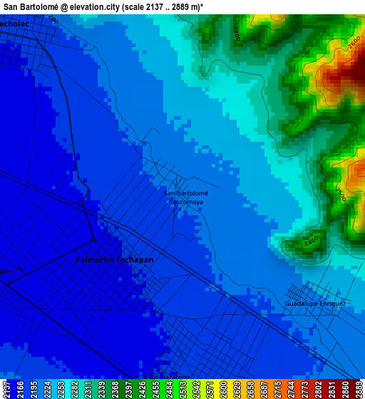
Below is the Elevation map of San Bartolomé, which displays elevation range with different colors. Scale of the first map is from 2137 to 2889 m (7011 to 9478 ft) with average elevation of 2236.2 meters (=7337 ft) [note 1]
These maps also provides idea of topography and contour of this city, they are displayed at different zoom levels. More info about maps, scale and edge coordinates you can find below images.
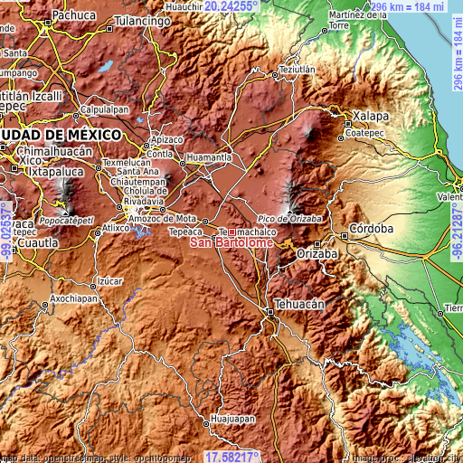
| \ | Map #1 | Topo.Map |
| Scale [m] | 2137..2889 m | × |
| Scale [ft] | 7011..9478 ft | × |
| Average | 2236.2 m = 7337 ft | × |
| Width | 9.24 km = 5.7 mi | 295.8 km = 183.8 mi |
| Height | 9.24 km = 5.7 mi | 295.8 km = 183.8 mi |
| ↑Max Latitude | 18.959216° | 20.24255° |
| Latitude at center | 18.91765° | 18.91765° |
| ↓Min Latitude | 18.876073° | 17.58217° |
| ← Min Longitude | -97.663065° | -99.02537° |
| Longitude center | -97.61912° | -97.61912° |
| →Max Longitude | -97.575175° | -96.21287° |
Nearby cities:
Cities around San Bartolomé sort by population:
• Palmarito Tochapan elevation 2157 m
2.7 km,  228°
228°
• Quecholac 2173 m
5.8 km,  314°
314°
• Xaltepec 2176 m
4.2 km,  164°
164°
• Santiago Tenango 2292 m
9.9 km,  344°
344°
• Tuzuapan 2140 m
5.4 km,  249°
249°
• La Purísima 2203 m
10.9 km,  153°
153°
• Jesús Nazareno 2169 m
4.6 km,  185°
185°
• Bellavista de Victoria (San José Bellavista) 2239 m
9.1 km,  120°
120°
• Santa Catarina Villanueva 2359 m
9.1 km,  2°
2°
• Guadalupe Enríquez 2218 m
4.3 km,  128°
128°
• San Isidro Monterrosas 2193 m
8.2 km, 145°
• Lomas de Romero 2164 m
10.3 km,  268°
268°
Multilingual:
 En español:
San Bartolomé, San Bartolomé Coscomaya elevación 2202 m.
 En France:
San Bartolomé élévation 2202 m.
 Auf Deutsch:
San Bartolomé höhe über dem Meeresspiegel ist 2202 m.

Sources and notes:
- [note 1] Map square and city borders are not equal. Map elevation data is calculated only from area inside that square.
- [src 1] Elevation data from geonames database provided with same terms of usage.
- [src 2] The elevation map of San Bartolomé is generated using elevation data from NASA's 3 arcsec (90m) resolution SRTM data.
- [src 3] Base (background) map © OpenStreetMap contributors tiles are generated by Geofabrik and OpenTopoMap.
Copyright & License:
This San Bartolomé Elevation Map is licensed under CC BY-SA. You may reuse any part from this page, if you give a proper credit by linking to this URL:
 More info on terms of use page.