Chichicuautla elevation
Chichicuautla (Puebla, Tepeyahualco), Mexico elevation is 2344 meters and Chichicuautla elevation in feet is 7690 ft above sea level [src 1]. Chichicuautla is a populated place (feature code) with elevation that is 1030 meters (3379 ft) bigger than average city elevation in Mexico.
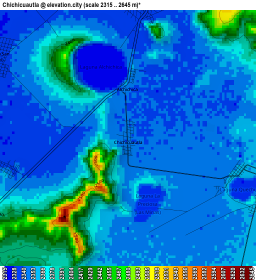
Below is the Elevation map of Chichicuautla, which displays elevation range with different colors. Scale of the first map is from 2315 to 2645 m (7595 to 8678 ft) with average elevation of 2361.9 meters (=7749 ft) [note 1]
These maps also provides idea of topography and contour of this city, they are displayed at different zoom levels. More info about maps, scale and edge coordinates you can find below images.
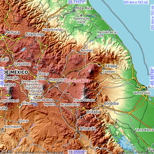
| \ | Map #1 | Topo.Map |
| Scale [m] | 2315..2645 m | × |
| Scale [ft] | 7595..8678 ft | × |
| Average | 2361.9 m = 7749 ft | × |
| Width | 9.22 km = 5.7 mi | 295 km = 183.3 mi |
| Height | 9.22 km = 5.7 mi | 295 km = 183.3 mi |
| ↑Max Latitude | 19.432177° | 20.71171° |
| Latitude at center | 19.39073° | 19.39073° |
| ↓Min Latitude | 19.349272° | 18.05895° |
| ← Min Longitude | -97.437885° | -98.80019° |
| Longitude center | -97.39394° | -97.39394° |
| →Max Longitude | -97.349995° | -95.98769° |
Nearby cities:
Cities around Chichicuautla sort by population:
• Guadalupe Victoria elevation 2445 m
12.3 km,  154°
154°
• Emilio Portes Gil 2396 m
15.3 km,  232°
232°
• San José Alchichica 2335 m
4.9 km,  4°
4°
• La Gloria 2459 m
11.7 km,  87°
87°
• González Ortega 2847 m
14 km,  112°
112°
• Quechulac 2368 m
5.2 km, 112°
• Guadalupe Sarabia 2437 m
16 km,  347°
347°
• Tlalconteno 2724 m
16.8 km,  67°
67°
• Tepeyehualco de Hidalgo 2327 m
15 km,  316°
316°
• Itzoteno 2334 m
5.4 km,  302°
302°
• Miravalles 2392 m
16.1 km,  250°
250°
• Saltillo 2858 m
14.6 km,  135°
135°
Multilingual:
 En español:
Chichicuautla elevación 2344 m.
 En France:
Chichicuautla élévation 2344 m.
 Auf Deutsch:
Chichicuautla höhe über dem Meeresspiegel ist 2344 m.

Sources and notes:
- [note 1] Map square and city borders are not equal. Map elevation data is calculated only from area inside that square.
- [src 1] Elevation data from geonames database provided with same terms of usage.
- [src 2] The elevation map of Chichicuautla is generated using elevation data from NASA's 3 arcsec (90m) resolution SRTM data.
- [src 3] Base (background) map © OpenStreetMap contributors tiles are generated by Geofabrik and OpenTopoMap.
Copyright & License:
This Chichicuautla Elevation Map is licensed under CC BY-SA. You may reuse any part from this page, if you give a proper credit by linking to this URL:
 More info on terms of use page.