Santiago Cuautlalpan elevation
Santiago Cuautlalpan (State of Mexico, Texcoco), Mexico elevation is 2254 meters and Santiago Cuautlalpan elevation in feet is 7395 ft above sea level [src 1]. Santiago Cuautlalpan is a populated place (feature code) with elevation that is 940 meters (3084 ft) bigger than average city elevation in Mexico.
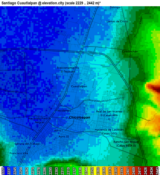
Below is the Elevation map of Santiago Cuautlalpan, which displays elevation range with different colors. Scale of the first map is from 2229 to 2442 m (7313 to 8012 ft) with average elevation of 2266 meters (=7434 ft) [note 1]
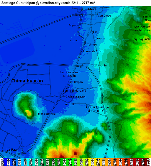
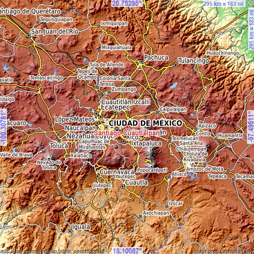
These maps also provides idea of topography and contour of this city, they are displayed at different zoom levels. More info about maps, scale and edge coordinates you can find below images.
| \ | Map #1 | Map #2 | Topo.Map |
| Scale [m] | 2229..2442 m | 2211..2717 m | × |
| Scale [ft] | 7313..8012 ft | 7254..8914 ft | × |
| Average | 2266 m = 7434 ft | 2318.4 m = 7606 ft | × |
| Width | 9.22 km = 5.7 mi | 18.43 km = 11.5 mi | 294.9 km = 183.2 mi |
| Height | 9.22 km = 5.7 mi | 18.43 km = 11.5 mi | 294.9 km = 183.2 mi |
| ↑Max Latitude | 19.473757° | 19.515183° | 20.75295° |
| Latitude at center | 19.43232° | 19.43232° | 19.43232° |
| ↓Min Latitude | 19.390873° | 19.349415° | 18.10087° |
| ← Min Longitude | -98.945305° | -98.989251° | -100.30761° |
| Longitude center | -98.90136° | -98.90136° | -98.90136° |
| →Max Longitude | -98.857415° | -98.813469° | -97.49511° |
Nearby cities:
Cities around Santiago Cuautlalpan sort by population:
• Santa María Chimalhuacán elevation 2249 m
5.3 km,  256°
256°
• Chicoloapan 2250 m
1.7 km,  182°
182°
• San Miguel Coatlinchán 2313 m
3.6 km,  56°
56°
• Lomas de San Sebastián 2308 m
6.5 km,  210°
210°
• Profesor Carlos Hank González 2283 m
7.8 km, 210°
• Coatepec 2420 m
7.9 km,  131°
131°
• Montecillo 2245 m
2.9 km,  345°
345°
• Arenal 2256 m
7.2 km,  217°
217°
• San Bernardino 2247 m
5 km,  6°
6°
• Santa Martha 2237 m
1.7 km,  266°
266°
• Colonia Guadalupe Victoria 2240 m
7.7 km, 345°
• Colonia Lázaro Cárdenas 2255 m
1.6 km, 347°
Multilingual:
 En español:
Santiago Cuautlalpan elevación 2254 m.
 En France:
Santiago Cuautlalpan élévation 2254 m.
 Auf Deutsch:
Santiago Cuautlalpan höhe über dem Meeresspiegel ist 2254 m.
 На русском:
Santiago Cuautlalpan высота над уровнем моря 2254 м
Sources and notes:
- [note 1] Map square and city borders are not equal. Map elevation data is calculated only from area inside that square.
- [src 1] Elevation data from geonames database provided with same terms of usage.
- [src 2] The elevation map of Santiago Cuautlalpan is generated using elevation data from NASA's 3 arcsec (90m) resolution SRTM data.
- [src 3] Base (background) map © OpenStreetMap contributors tiles are generated by Geofabrik and OpenTopoMap.
Copyright & License:
This Santiago Cuautlalpan Elevation Map is licensed under CC BY-SA. You may reuse any part from this page, if you give a proper credit by linking to this URL:
 More info on terms of use page.