Altamirano elevation
Altamirano (Chiapas), Mexico elevation is 1250 meters and Altamirano elevation in feet is 4101 ft above sea level [src 1]. Altamirano is a seat of a second-order administrative division (feature code) with elevation that is 64 meters (210 ft) smaller than average city elevation in Mexico.
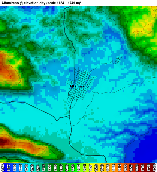
Below is the Elevation map of Altamirano, which displays elevation range with different colors. Scale of the first map is from 1154 to 1749 m (3786 to 5738 ft) with average elevation of 1292 meters (=4239 ft) [note 1]
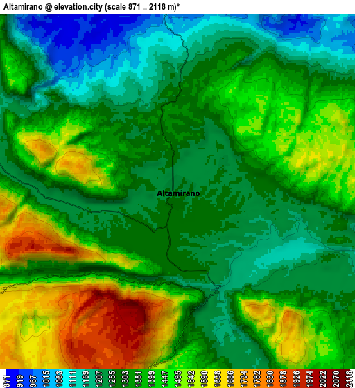
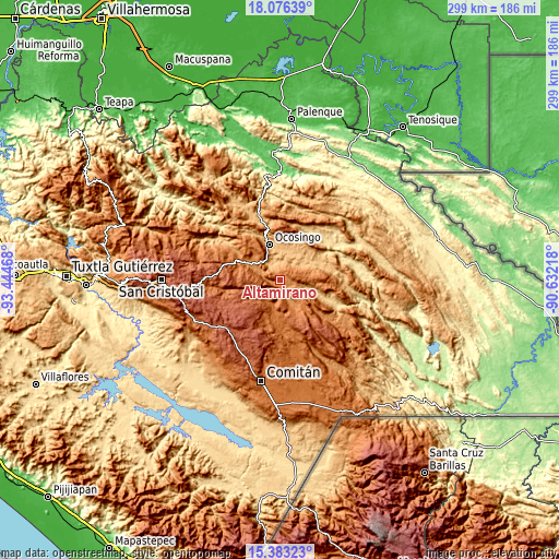
These maps also provides idea of topography and contour of this city, they are displayed at different zoom levels. More info about maps, scale and edge coordinates you can find below images.
| \ | Map #1 | Map #2 | Topo.Map |
| Scale [m] | 1154..1749 m | 871..2118 m | × |
| Scale [ft] | 3786..5738 ft | 2858..6949 ft | × |
| Average | 1292 m = 4239 ft | 1357.7 m = 4454 ft | × |
| Width | 9.36 km = 5.8 mi | 18.72 km = 11.6 mi | 299.5 km = 186.1 mi |
| Height | 9.36 km = 5.8 mi | 18.72 km = 11.6 mi | 299.5 km = 186.1 mi |
| ↑Max Latitude | 16.77665° | 16.81872° | 18.07639° |
| Latitude at center | 16.73457° | 16.73457° | 16.73457° |
| ↓Min Latitude | 16.692481° | 16.650383° | 15.38323° |
| ← Min Longitude | -92.082375° | -92.126321° | -93.44468° |
| Longitude center | -92.03843° | -92.03843° | -92.03843° |
| →Max Longitude | -91.994485° | -91.950539° | -90.63218° |
Nearby cities:
Cities around Altamirano sort by population:
• Ocosingo elevation 882 m
20 km,  342°
342°
• Chanal 2084 m
24.9 km,  249°
249°
• Altamirano 1736 m
20.4 km,  324°
324°
• Abasolo 1283 m
21.2 km,  297°
297°
• Veinte de Noviembre 1565 m
13.6 km,  199°
199°
• Justo Sierra 1593 m
21.5 km,  185°
185°
• Sibacá 1026 m
24.4 km,  333°
333°
• Patria Nueva (San José el Contento) 887 m
22.9 km, 339°
• La Laguna 1226 m
10.5 km,  115°
115°
• El Vergel 1581 m
17.8 km, 194°
• Morelia (Victórico Rodolfo Grajales) 1258 m
7.6 km,  99°
99°
• Los Pinos 923 m
22 km, 340°
Multilingual:
 En español:
Altamirano elevación 1250 m.
 En France:
Altamirano élévation 1250 m.
 Auf Deutsch:
Altamirano höhe über dem Meeresspiegel ist 1250 m.

Sources and notes:
- [note 1] Map square and city borders are not equal. Map elevation data is calculated only from area inside that square.
- [src 1] Elevation data from geonames database provided with same terms of usage.
- [src 2] The elevation map of Altamirano is generated using elevation data from NASA's 3 arcsec (90m) resolution SRTM data.
- [src 3] Base (background) map © OpenStreetMap contributors tiles are generated by Geofabrik and OpenTopoMap.
Copyright & License:
This Altamirano Elevation Map is licensed under CC BY-SA. You may reuse any part from this page, if you give a proper credit by linking to this URL:
 More info on terms of use page.