Santa Ana Nopalucan elevation
Santa Ana Nopalucan (Tlaxcala), Mexico elevation is 2228 meters and Santa Ana Nopalucan elevation in feet is 7310 ft above sea level [src 1]. Santa Ana Nopalucan is a seat of a second-order administrative division (feature code) with elevation that is 914 meters (2999 ft) bigger than average city elevation in Mexico.
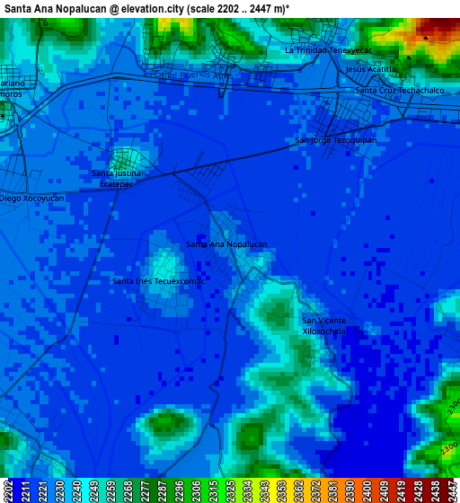
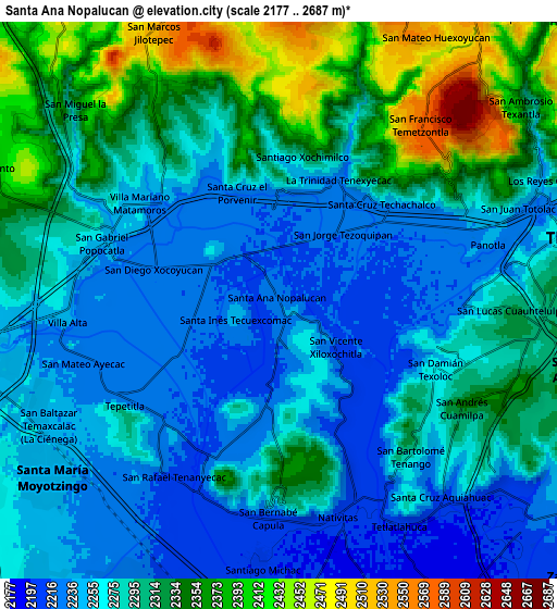
Below is the Elevation map of Santa Ana Nopalucan, which displays elevation range with different colors. Scale of the first map is from 2202 to 2447 m (7224 to 8028 ft) with average elevation of 2229.8 meters (=7316 ft) [note 1]
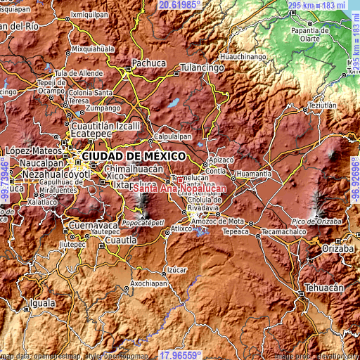
These maps also provides idea of topography and contour of this city, they are displayed at different zoom levels. More info about maps, scale and edge coordinates you can find below images.
| \ | Map #1 | Map #2 | Topo.Map |
| Scale [m] | 2202..2447 m | 2177..2687 m | × |
| Scale [ft] | 7224..8028 ft | 7142..8816 ft | × |
| Average | 2229.8 m = 7316 ft | 2291.1 m = 7517 ft | × |
| Width | 9.22 km = 5.7 mi | 18.45 km = 11.5 mi | 295.1 km = 183.4 mi |
| Height | 9.22 km = 5.7 mi | 18.45 km = 11.5 mi | 295.1 km = 183.4 mi |
| ↑Max Latitude | 19.339571° | 19.381031° | 20.61985° |
| Latitude at center | 19.2981° | 19.2981° | 19.2981° |
| ↓Min Latitude | 19.256619° | 19.215127° | 17.96559° |
| ← Min Longitude | -98.377155° | -98.421101° | -99.73946° |
| Longitude center | -98.33321° | -98.33321° | -98.33321° |
| →Max Longitude | -98.289265° | -98.245319° | -96.92696° |
Nearby cities:
Cities around Santa Ana Nopalucan sort by population:
• Tepetitla elevation 2234 m
5.8 km,  231°
231°
• Villa Mariano Matamoros 2241 m
5.7 km,  303°
303°
• San Damián Texoloc 2262 m
5.5 km,  113°
113°
• Santa Justina Ecatepec 2252 m
2.7 km, 301°
• San Jorge Tezoquipan 2221 m
3.3 km,  39°
39°
• Xocoyucan 2227 m
4.5 km,  285°
285°
• Santa Inés Tecuexcomac 2244 m
1.5 km,  252°
252°
• La Trinidad Tenexyecac 2236 m
4.6 km,  24°
24°
• San Bartolomé Tenango 2294 m
6.7 km,  139°
139°
• San José Atoyatenco 2217 m
5.7 km,  203°
203°
• Santa Cruz el Porvenir 2264 m
4.1 km,  337°
337°
• San Miguel del Milagro 2299 m
6.3 km,  180°
180°
Multilingual:
 En español:
Santa Ana Nopalucan elevación 2228 m.
 En France:
Santa Ana Nopalucan élévation 2228 m.
 Auf Deutsch:
Santa Ana Nopalucan höhe über dem Meeresspiegel ist 2228 m.
 На русском:
Santa Ana Nopalucan высота над уровнем моря 2228 м
Sources and notes:
- [note 1] Map square and city borders are not equal. Map elevation data is calculated only from area inside that square.
- [src 1] Elevation data from geonames database provided with same terms of usage.
- [src 2] The elevation map of Santa Ana Nopalucan is generated using elevation data from NASA's 3 arcsec (90m) resolution SRTM data.
- [src 3] Base (background) map © OpenStreetMap contributors tiles are generated by Geofabrik and OpenTopoMap.
Copyright & License:
This Santa Ana Nopalucan Elevation Map is licensed under CC BY-SA. You may reuse any part from this page, if you give a proper credit by linking to this URL:
 More info on terms of use page.