Muñoz elevation
Muñoz (Tlaxcala, Muñoz de Domingo Arenas), Mexico elevation is 2488 meters and Muñoz elevation in feet is 8163 ft above sea level [src 1]. Muñoz is a seat of a second-order administrative division (feature code) with elevation that is 1174 meters (3852 ft) bigger than average city elevation in Mexico.
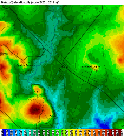
Below is the Elevation map of Muñoz, which displays elevation range with different colors. Scale of the first map is from 2420 to 2611 m (7940 to 8566 ft) with average elevation of 2498.1 meters (=8196 ft) [note 1]
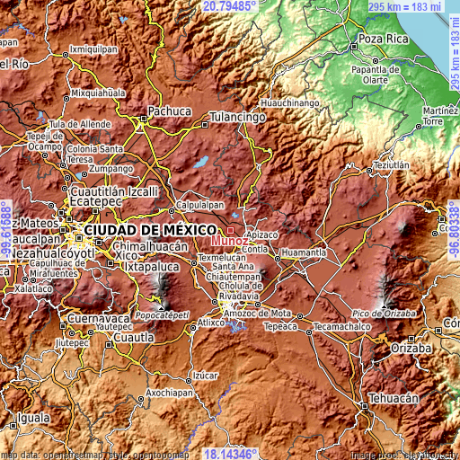
These maps also provides idea of topography and contour of this city, they are displayed at different zoom levels. More info about maps, scale and edge coordinates you can find below images.
| \ | Map #1 | Topo.Map |
| Scale [m] | 2420..2611 m | × |
| Scale [ft] | 7940..8566 ft | × |
| Average | 2498.1 m = 8196 ft | × |
| Width | 9.21 km = 5.7 mi | 294.8 km = 183.2 mi |
| Height | 9.21 km = 5.7 mi | 294.8 km = 183.2 mi |
| ↑Max Latitude | 19.516006° | 20.79485° |
| Latitude at center | 19.47458° | 19.47458° |
| ↓Min Latitude | 19.433144° | 18.14346° |
| ← Min Longitude | -98.253575° | -99.61588° |
| Longitude center | -98.20963° | -98.20963° |
| →Max Longitude | -98.165685° | -96.80338° |
Nearby cities:
Cities around Muñoz sort by population:
• Zimatepec elevation 2448 m
7.6 km,  141°
141°
• San José Tetel 2487 m
7 km,  131°
131°
• Atexcatzingo 2509 m
6.6 km,  95°
95°
• Yauhquemehcan 2434 m
8 km,  159°
159°
• San Lucas Tecopilco 2588 m
5 km,  284°
284°
• Topilco de Juárez 2449 m
6 km,  170°
170°
• San Francisco Tlacuilohcan 2436 m
8.3 km, 167°
• San Pedro Ecatepec 2590 m
7.8 km,  47°
47°
• San José Cuamantzingo 2498 m
6.5 km,  314°
314°
• José María Morelos 2511 m
5.4 km, 100°
• Xaltocan 2445 m
5.6 km,  180°
180°
• Atlangatepec 2507 m
6.4 km,  0°
0°
Multilingual:
 En español:
Muñoz elevación 2488 m.
 En France:
Muñoz élévation 2488 m.


Sources and notes:
- [note 1] Map square and city borders are not equal. Map elevation data is calculated only from area inside that square.
- [src 1] Elevation data from geonames database provided with same terms of usage.
- [src 2] The elevation map of Muñoz is generated using elevation data from NASA's 3 arcsec (90m) resolution SRTM data.
- [src 3] Base (background) map © OpenStreetMap contributors tiles are generated by Geofabrik and OpenTopoMap.
Copyright & License:
This Muñoz Elevation Map is licensed under CC BY-SA. You may reuse any part from this page, if you give a proper credit by linking to this URL:
 More info on terms of use page.